

Miner/Ioca Park dressed in early fall aster blooms – pic taken 8/27/2026
Thursday – 27 Aug 2026 – 7:55pm
A deep partial lunar eclipse will be visible across Southern Colorado on Thursday. At its peak, more than 90% of the Moon will slip into Earth’s shadow, giving much of the Moon a reddish or coppery appearance. Clouds are clearing out now – looks good!
The Moon will rise around 7:36 pm Thursday, with the partial eclipse set to begin at ~ 8:40 pm.
The eclipse will reach its maximum at approximately 10:15 pm, when about 93% of the Moon will be covered by Earth’s umbral shadow. The partial eclipse will end around 11:55 pm.
The past…
Stevens Field Observations
Tuesday: High: 84, Low: 50, Peak wind: 30mph
Wednesday: High: 85, Low: 47, Peak wind: 29mph
Thursday: High: 82, Low: 47, Peak wind: 31mph
| Average High | Record High / Year | Average Low | Record Low / Year |
| 79 | 89 / 1985 | 43 | 29 / 1956 |
Precipitation summary… Tuesday’s rain lottery winner, Udgar, only got 0.03”. Wednesday’s rain lottery winner, Rich, reported .13″ of rain.


Current satellite and radar…

Water vapor satellite Thursdays evening – High is over Arizona/New Mexico border. Front will slide in from the northwest over next 72 hours. High pressure will move east.

Forecast highlights…
*** Recent storms have been spotty, so fire danger remains high. The San Juan National Forest and Archuleta County are under stage 1 fire restrictions. ***
*** Scattered afternoon and evening storms Friday & Saturday. Uptick for Sunday!***
Rest of Thursday through Saturday… The Subtropical high is centered on the Arizona/NewMexico border giving us northwest flow – not favorable for widespread shower activity. The High will gradually shift on Saturday to the Texas panhandle putting us under favorable southwest flow.
Moisture and instability will remain marginal leading to spotty showers and thunderstorms each afternoon and evening.
Temps… Highs: low-80s to upper 80s. Lows: mid 40s to low 50s.
Winds…Afternoon gusts will be 20mph to 25mph. As always, isolated stronger gusts are likely near showers and thunderstorms.
Sunday and Monday… The first fall frontal system pushes in from the northwest bringing moisture into our area with southwest flow and cold air aloft – which decreases stability. We’ll see numerous thunderstorms and rainshowers each afternoon with possibility of small hail and gusty winds.
Temps… Cooler. Highs: mid-70s to neat 80. Lows:
Winds… Afternoon gusts will be 20mph to 25mph. As always, isolated stronger gusts are likely near showers and thunderstorms.

Tuesday through Thursday… Dry air will move in and stabilize our atmosphere while the subtropical ridge weakens. We’ll be back to playing thunderstorm lottery.
Temps… Highs: upper-70s to mid 80s. Lows: low 40s to mid 40s.
Winds… Afternoon gusts will be 22mph to 28mph. As always, isolated stronger gusts are likely near showers and thunderstorms.
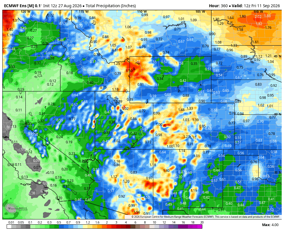
3 Sep to 11 Sep… The forecast models are all over the place for this period. This is typical when we transition from summer to fall.
Note: There is the possibility of seeing subtropical storm moisture being pulled into our southwest flow as the end of next week. We’ll be watching this closely.
The next post will be Saturday afternoon.
– Arleen


2 Responses
Hi there…where is Miner/loca park? Did you hike there? Looks awesome!
Michele – sorry, I just saw your comment. Take Piedra past Williams Creek Reservoir – take a left at the fork to PoisonPark Trail head. Hike down 700 feet and 2.5 miles. It is one of my favorite spots!
– Arleen