

Lots of clouds over the mountains. Let’s hope those clouds drop some rain! – pic taken 8/30/2026
Sunday – 30 Aug 2026 – 6:15pm
The past…
Stevens Field Observations
Friday: High: 86, Low: 48, Peak wind: 26mph, Afternoon humidity: 18-23%
Saturday: High: 79, Low: 53, Peak wind: 33mph, Afternoon humidity: 29-34%
| Average High | Record High / Year | Average Low | Record Low / Year |
| 79 | 91 / 1990 | 42 | 25 / 1956 |
Precipitation summary… A few lucky folks got just enough rain to wet the ground yesterday, but most of the country stayed dry.
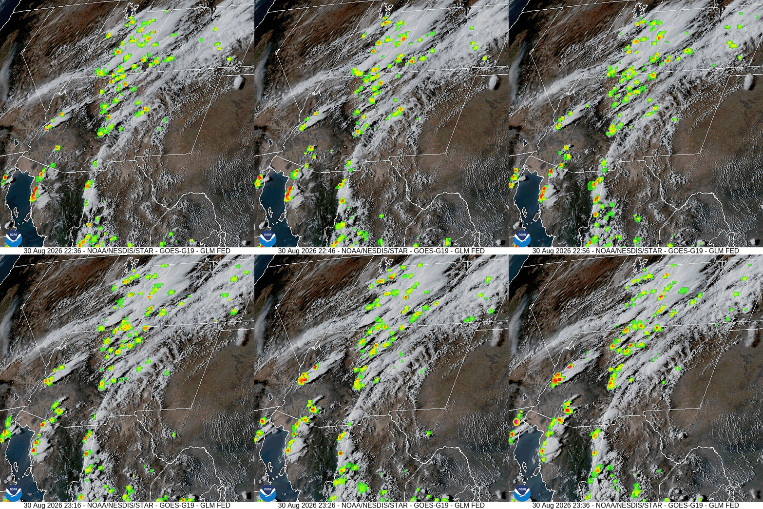
Current satellite and radar…

Forecast highlights…
*** It’s been dry, warm, and breezy. Fire danger remains high. The San Juan National Forest and Archuleta County are under stage 1 fire restrictions. ***
*** Scattered storms into early Tuesday morning. Mostly dry with breezy afternoons Tuesday through Friday. Scattered storms next weekend. ***
Rest of Sunday into early Tuesday morning… Monsoon moisture and instability are moving into the area from the southwest.
As of dinnertime Sunday, most of the activity is to our west, but it will slowly move east. Our best chance for showers and thunderstorms is Monday afternoon into late Monday evening.
Storms will be capable of producing short periods of heavy rain, small hail, gusty winds, and lightning over small areas.
Tuesday through Friday… A low-pressure system impacting the Pacific NW will push the monsoon moisture plume to our east. We will be mostly dry and sunny with breezy afternoons.
Next weekend… The high will strengthen over the central plains and help push some monsoon moisture and instability back into our area. It’s a coin toss for you to get rain on your head each afternoon and evening.
Temps…
Sunday night lows will be in the high 40s to the mid 50s.
Monday highs will be near 70 to the high 70s and lows will be in the low to high 40s.
Tuesday through Friday highs will be in the mid 70s to the low 80s and lows will be near 40 to the high 40s.
Next weekend highs will be in the high 70s to the mid 80s and lows will be in the low to high 40s.
Winds…
Monday afternoon gusts will be around 20mph.
Tuesday and Wednesday, each afternoon gusts will be around 25mph.
Thursday through next weekend, each afternoon gusts will be around 20mph.
*** As always, isolated stronger gusts are likely near showers and thunderstorms. ***
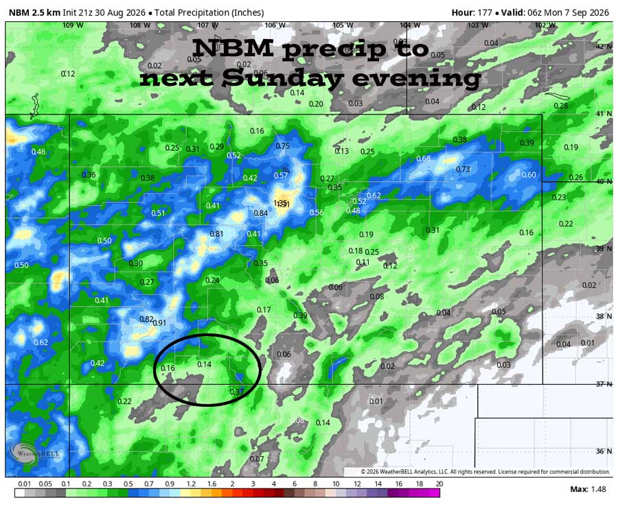
6 Sep to 14 Sep… The subtropical high is expected to stay to our east through 9 Sep and will bring us a weak monsoon pattern. After that, the forecast models are all over the place. The models indicate moisture and instability sticking with us, but I’m skeptical.


It indicates scattered showers into early Tuesday morning and then dry Tuesday through Friday. The rest of the period wants to be active.
The next post will be Tuesday afternoon.
– Shawn


