

Tommy relaxed in his favorite spot while the sun sets behind the mountains – pic taken 8/19/2026
Friday – 21 Aug 2026 – 4:50pm
The past…
Stevens Field Observations
Wednesday: High: 88, Low: 49, Peak wind: 24mph, Afternoon humidity: 17-22%
Thursday: High: 86, Low: 50, Peak wind: 35mph, Afternoon humidity: 19-25%
| Average High | Record High / Year | Average Low | Record Low / Year |
| 79 | 90 / 1910 | 44 | 28 / 1964 |
Precipitation summary… There have been spotty showers the last few days. Some folks get a good soaking while others hardly get anything.
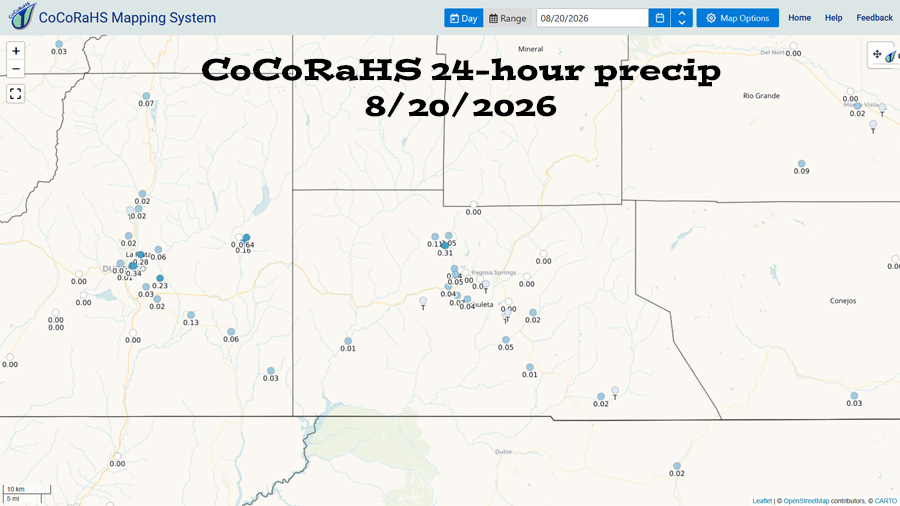
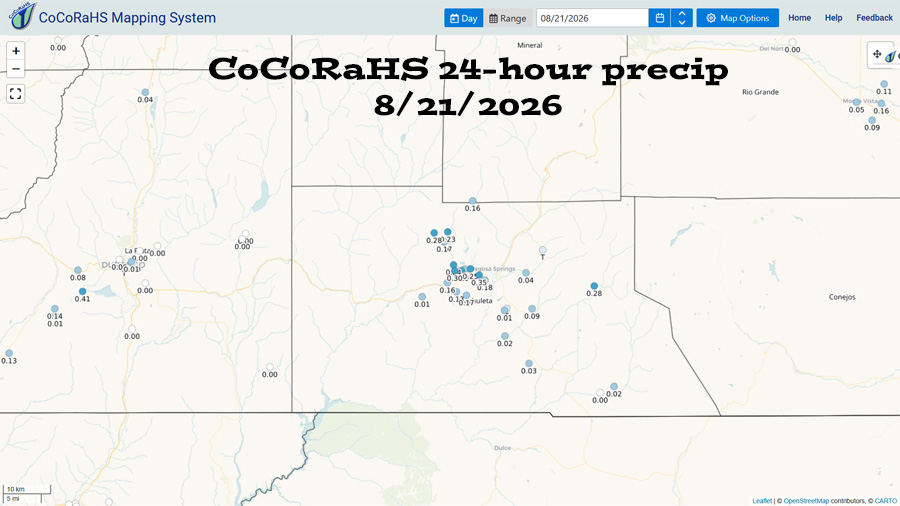
Current satellite and radar…


Forecast highlights…
*** Fire danger remains high. Warm, breezy afternoons have dried things out. The San Juan National Forest and Archuleta County are under stage 1 fire restrictions. ***
*** Scattered afternoon and evening storms each day through Wednesday. Less active the second half of the week, but there’s a still chance for a few spotty storms. We will continue to play rain lottery. ***
Rest of Friday through Wednesday… The high is currently over the Four Corners and will move slowly south towards southern NM. Moisture and instability are decent through Wednesday and then decrease.
This weekend some storms will be capable of producing short periods of heavy rain, small hail, gusty winds, and lightning.
Thursday through next Friday… The high will be over the AZ/NM/MX border. Moisture and instability will decrease leading to less storm activity. A few spotty storms are possible each afternoon, mostly over the mountains. Consider yourself lucky if you get a few raindrops.
Temps…
Friday night lows will be in the high 40s to the mid 50s.
Saturday through next Friday highs will be in the mid 80s to the low 90s and mid 40s to the low 50s.
Winds…
Each afternoon gusts will be around 20mph though isolated stronger gusts are likely near showers and thunderstorms.
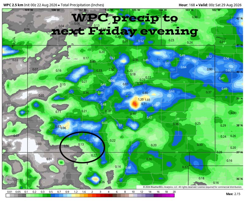
28 Aug to 5 Sep… The high is expected to be to our south while the first fall-like low pressure system moves through the Pacific NW. This weakens the sub-tropical ridge and cuts off monsoon moisture.
We will have marginal instability and marginal moisture for spotty afternoon and evening storms. Precip amounts are not impressive.
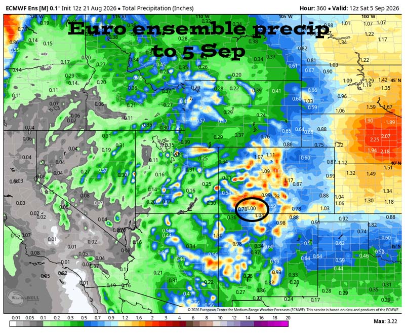
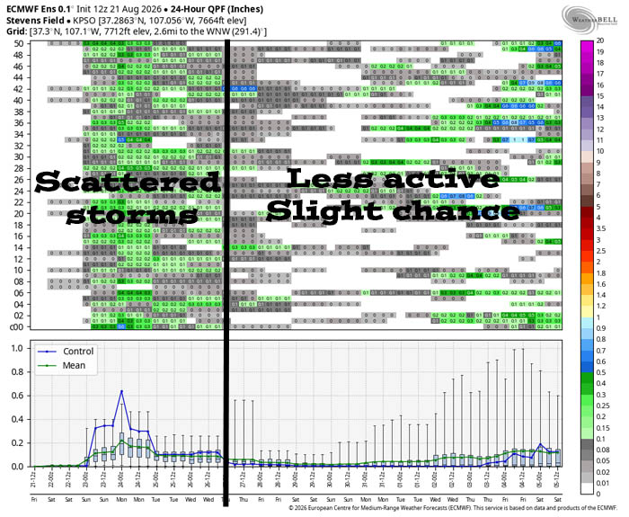
We will have scattered afternoon and evening showers through Wednesday with Saturday and Sunday being the most active. The rest of the period will be less active, but there’s still a chance for a few spotty showers every day. It’s better than nothing!
The next post will be Sunday afternoon.
– Shawn


