

Rainshower over Pagosa Peak Tuesday afternoon – pic taken 7/21/2026
Wednesday – 22 Jul 2026 – 2:15pm
The past…
Stevens Field Observations
Monday: High: 94*, Low: 49, Peak wind: 20mph, Afternoon humidity: 14-17%
Tuesday: High: 92, Low: 55, Peak wind: 25mph, Afternoon humidity: 15-20%
* Tied record high first set in 1910 *
| Average High | Record High / Year | Average Low | Record Low / Year |
| 82 | 91 / 1939 | 47 | 34 / 1993 |
Precipitation summary… There was no precip reported Tuesday morning. Late Tuesday afternoon and evening a few parts of the county got a decent soaking.

Current satellite and radar…
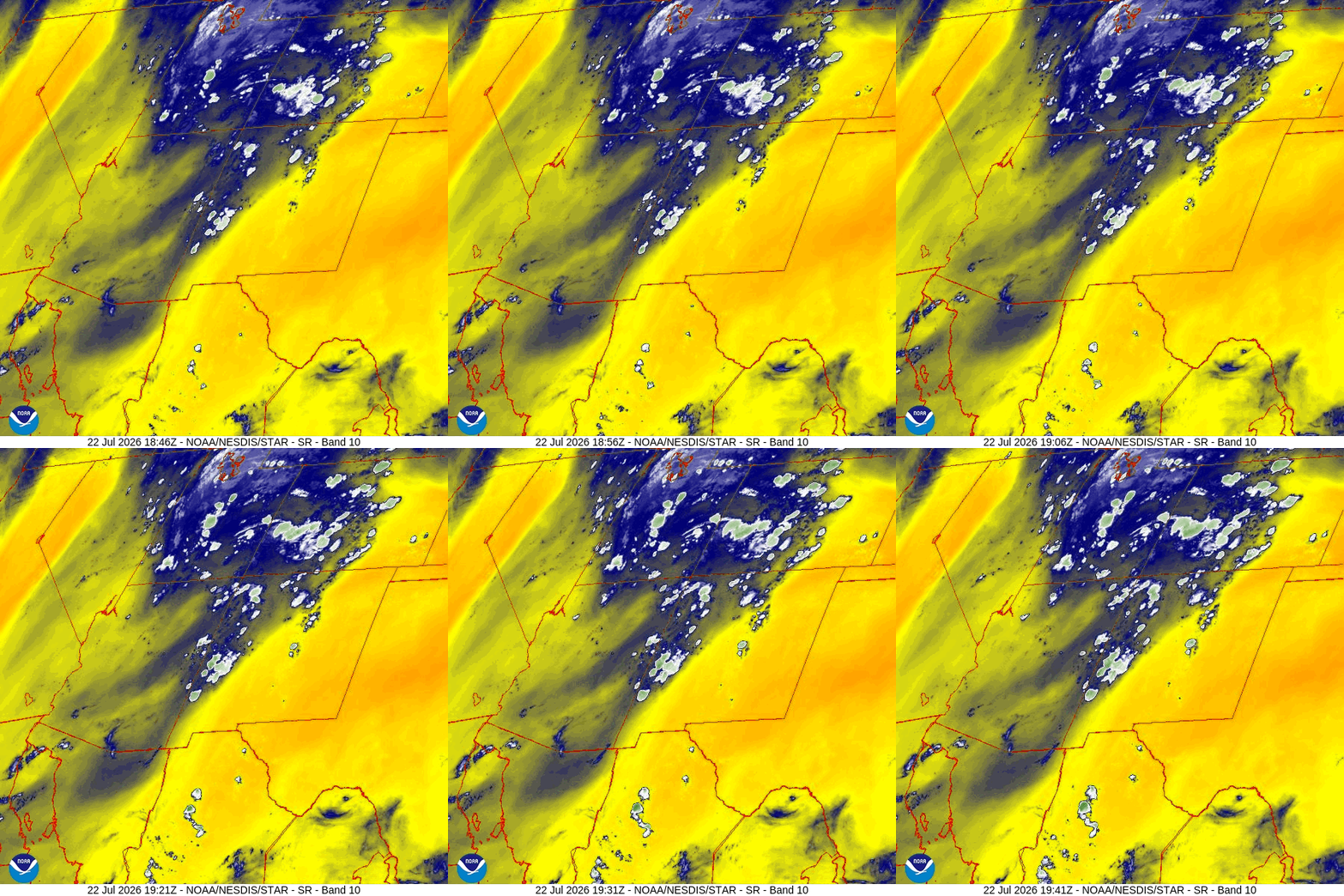
A weak low is spinning over southeast UT and giving us southerly flow – yay! And the heart of the monsoon plume is over us – yay!
Storms are developing just south of Archuleta County and moving north.

It will get more active later this afternoon and into the evening.
Forecast highlights…
*** Fire danger remains high. The entire San Juan National Forest and Archuleta County are under stage 2 fire restrictions. ***
*** MONSOON action is here for a while – yay! The rest of the week and next week will remain active. Our best surge of moisture is happening today. Let it rain! ***
*** A FLOOD WATCH is in effect until late Wednesday night. Ingredients are in place for low-lying areas, drainages, and streams to flood. “Turn around. Don’t drown!” ***
Late Wednesday afternoon through Thursday evening… Things line up well for us to get some soaking monsoon storms.
We will see an increase of afternoon and evening storms that could persist into the early morning hours each night. Storms will produce short periods of heavy rain, small hail, gusty winds, and lightning over small areas.
Friday and through the following week… Monsoon moisture and instability will stick with us. We will have scattered storms each afternoon and evening. Storms will be capable of producing short periods of heavy rain over small areas.
Reminder… “scattered” means that not everyone will get hit every day.
Temps…
Wednesday night lows will be in the low to high 50s.
Thursday highs will be in the mid 70s to low 80s and lows will be near 50 to the mid 50s.
Friday though next Wednesday highs will be in the mid 80s to low 90s and lows will be in the near 50 to the high 50s.
Winds…
Each afternoon gusts will be 15-20mph though isolated stronger gusts are likely near showers and thunderstorms.

22 Jul to 6 Aug… The subtropical high pressure will wobble around the Four Corners region. Some days will be more active than others, but it looks good!
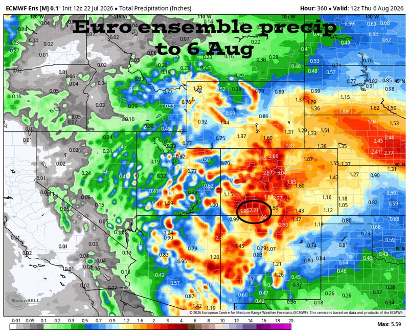

It’s active through the whole period. This is how our monsoon season should look!
The next post will be Friday afternoon.
– Shawn


