

I took this picture along Newt Jack in Turkey Springs. It clearly shows the patchwork of very dry vs drying out fast conditions. Our weather is dry, warm, and windy. FIRE DANGER IS VERY HIGH. – pic taken 6/16/2026
Thursday – 18 Jun 2026 – 4:00pm
The past…
Stevens Field Observations
Tuesday: High: 87, Low: 39, Peak wind: 26mph, Afternoon humidity: 8-12%
Wednesday: High: *89*, Low: 42, Peak wind: 32mph, Afternoon humidity: 9-12%
* Beat previous record high of 87 set in 1986*
| Average High | Record High / Year | Average Low | Record Low / Year |
| 79 | 93 / 1954 | 36 | 22 / 1950 |
Precipitation summary… There has been no recent measurable precip.
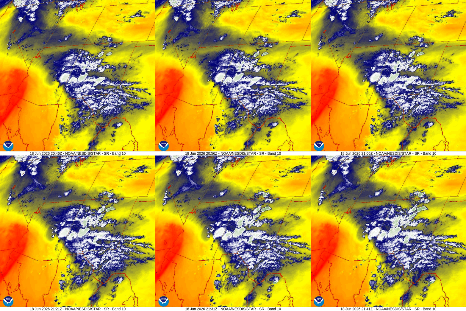
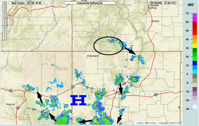
Current satellite and radar…
Forecast highlights…
*** FIRE WEATHER WATCH FOR SATURDAY. ***
*** Breezy afternoons, mostly dry, and warm for the next 10-14 days. FIRE DANGER WILL REMAIN HIGH. ***
*** I do not see the monsoon setting up for us in June. ***
Rest of Thursday… The upper-level ridge is just to our south. There is a little instability that will kick up a small shower or thunderstorm over the mountains.
Friday… The ridge will slowly move to our east and allow weak moisture and weak instability to move into our area. There will be a few isolated showers or thunderstorms mostly over the mountains. Consider yourself lucky if you get a few raindrops.
Keep an eye on out for new lightning fires.
Saturday through Wednesday morning… The ridge will set up to our southwest. Upper-level flow will be out of the west and northwest and will be stable and dry. It will remain sunny and warm with breezy afternoons.
Wednesday afternoon through the following weekend (24-28 Jun)… A little moisture and instability will kick up a few scattered showers and thunderstorms each afternoon. Precip amounts will be low and spotty. My expectations are low.
Fire danger will remain high and lightning fires are possible.
Temps…
Thursday night lows will be near 40 to the high 40s.
Friday, Saturday, and Sunday highs will be in the low to high 80s and lows will be near 40 to the high 40s.
Monday through next Thursday highs will be in the mid 80s to low 90s and lows will be near 40 to the high 40s.
Winds…
Friday afternoon gusts will be around 20mph.
Saturday afternoon gusts will be 30-35mph.
Sunday through next Thursday, each afternoon gusts will be 25-30mph.
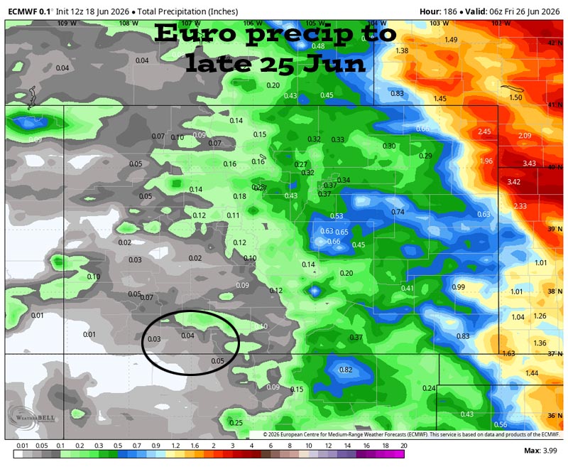
My expectations are low.
25 Jun to 3 Jul… The subtropical high will set up to our south. The first few days of this period we will have weak moisture and weak instability that will kick up an isolated afternoon shower or thunderstorm each day.
I’m not too sure about the last few days of this period. Some of the models show another dry period while some models hint at weak monsoon flow.
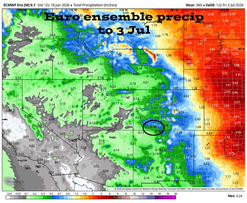
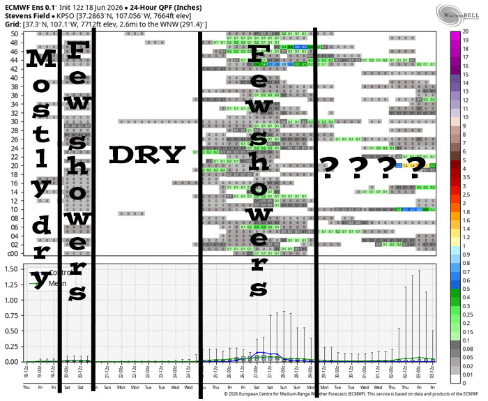
Friday there will be a few scattered showers and thunderstorms with light precip amounts. Then it’s dry Saturday through Wednesday morning. There’s a chance for scattered showers and thunderstorms 24 to 28 Jun. The forecast models are all over the place towards the end of this period.
The next post will be Saturday afternoon.
– Shawn


