
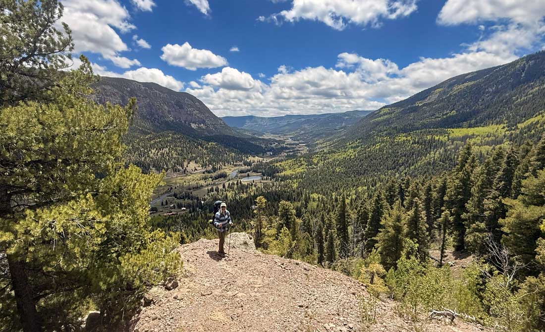
Had an excellent backpack adventure in our San Juan Mountains! – pic taken 5/19/2026
Monday – 25 May 2026 – 4:00pm
The past…
Stevens Field Observations
Saturday: High: 70, Low: 32, Peak wind: 32mph
Sunday: High: 76, Low: 35, Peak wind: 24mph
| Average High | Record High / Year | Average Low | Record Low / Year |
| 70 | 82 / 1984 | 31 | 19 / 1980 |
Precipitation summary… There has been no recent measurable precip.
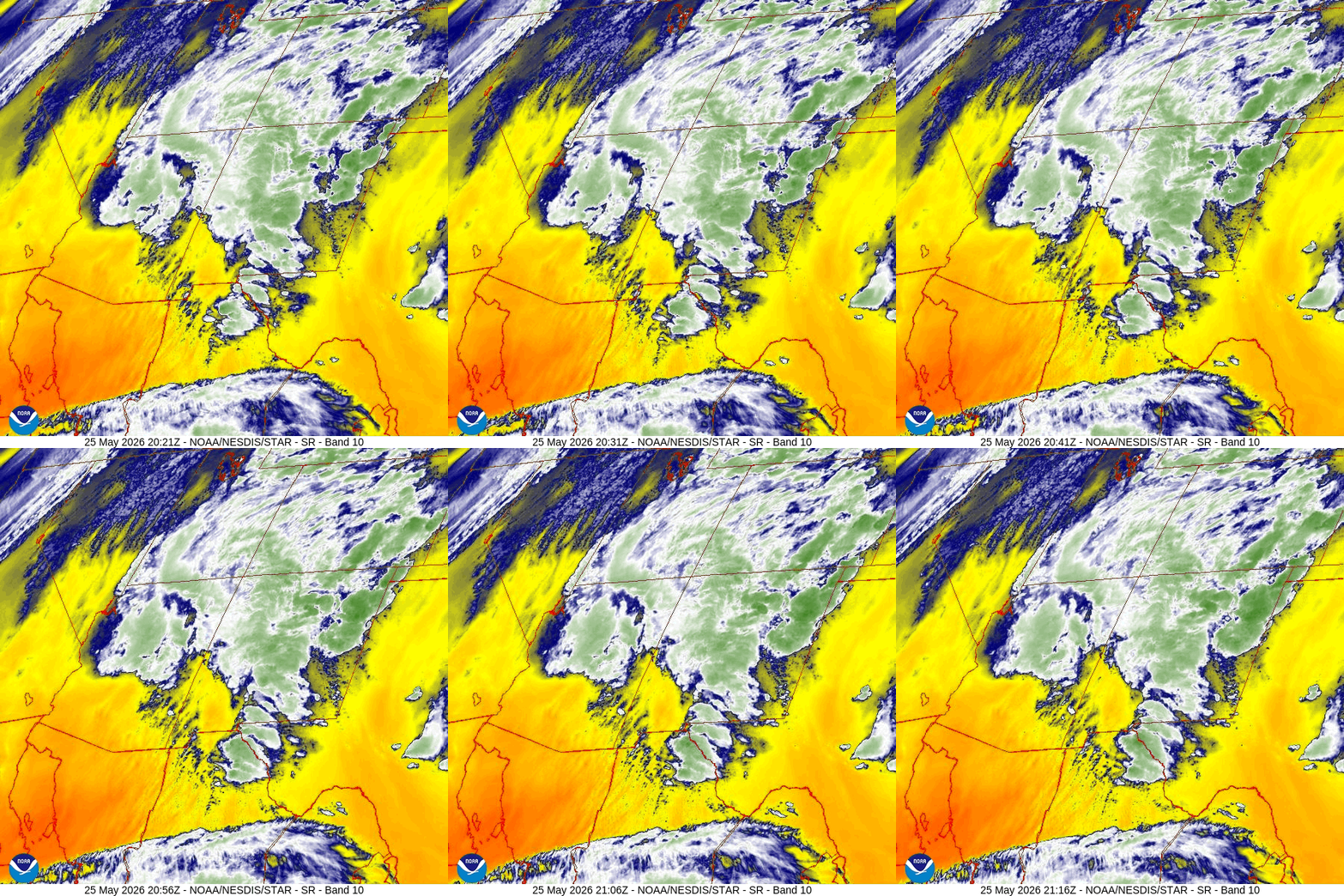
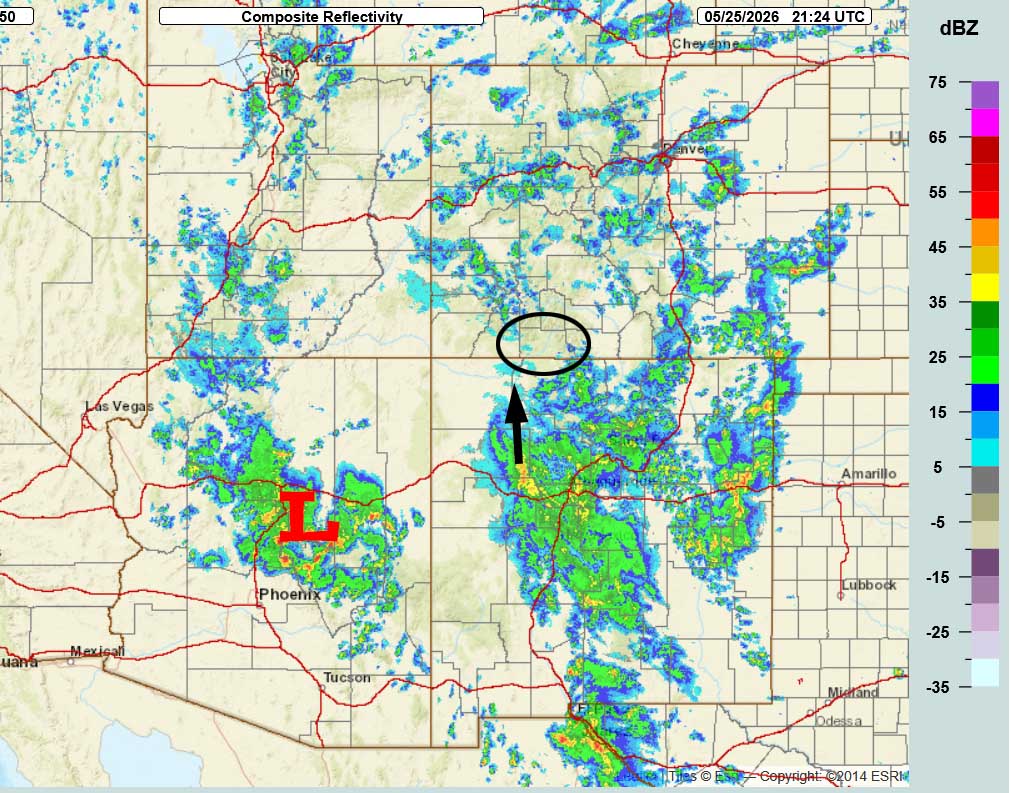
Current satellite and radar…
Forecast highlights…
*** Scattered showers and thunderstorms late Monday afternoon into Tuesday afternoon. ***
*** Dry Wednesday through Saturday with pleasant temps. ***
*** Chance for scattered afternoon showers and thunderstorms will slowly increase starting Sunday or next Monday. ***
Forecast details…
Monday evening into Tuesday afternoon… A low spinning over AZ is pushing moisture and instability into the Four Corners region. Hit and miss showers and thunderstorms are likely through Tuesday afternoon. Rain lottery winners could up to 0.25” of rain. The mountains above timberline could get 1-2” of snow.
Tuesday evening through Saturday… We will be between a low to the west and a ridge to the east. This would be an active pattern later in the summer, but right now there isn’t enough moisture and instability to bring us precip.
We’ll wake up each day to nearly clear skies and then clouds will increase with afternoon heating, but we’ll stay dry.
Starting Sunday or next Monday and going through next week… A “monsoon-like” pattern will gradually set up. Moisture and instability will increase a little each day leading to increasing chances for afternoon showers and thunderstorms.
Temps…
Monday night lows will be near 40 to the high 40s.
Tuesday highs will be in the low to high 60s and lows will be in the mid 30s to the low 40s.
Wednesday through next Monday highs will be near 70 to the high 70s and lows will be mid 30s to the low 40s.
Winds…
Monday and Tuesday, each afternoon gusts near a shower or thunderstorm will be 25-30mph.
Wednesday afternoon gusts will be around 20mph.
Thursday and Friday, each afternoon gusts will be 25-30mph.
Saturday, Sunday, and next Monday, each afternoon gusts will be 15-20mph.
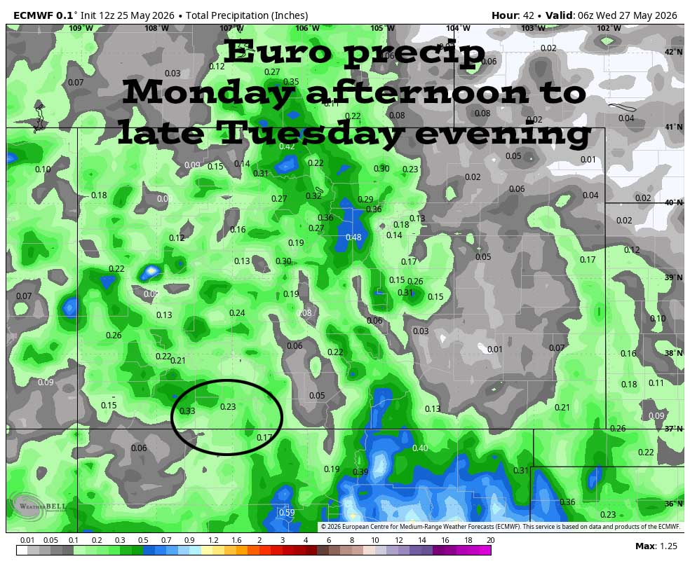
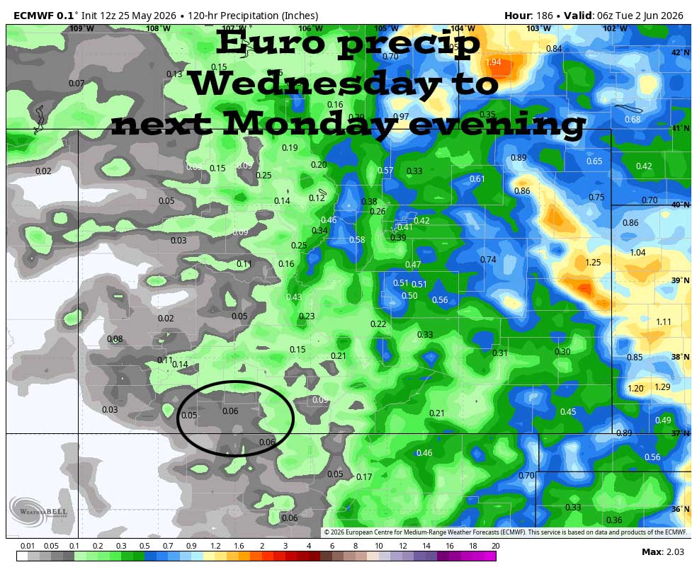
2 Jun to 9 Jun… A “monsoon-like” pattern will try to set up with a little more moisture and a little more instability so we will see hit and miss afternoon showers and thunderstorms.
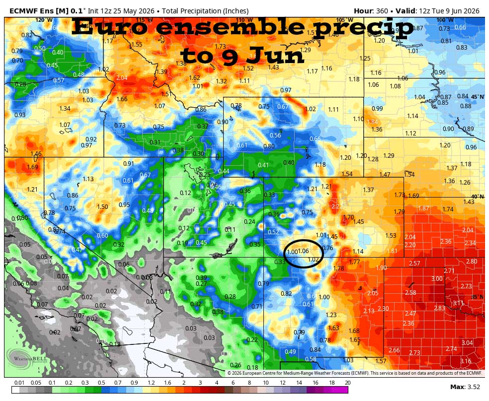
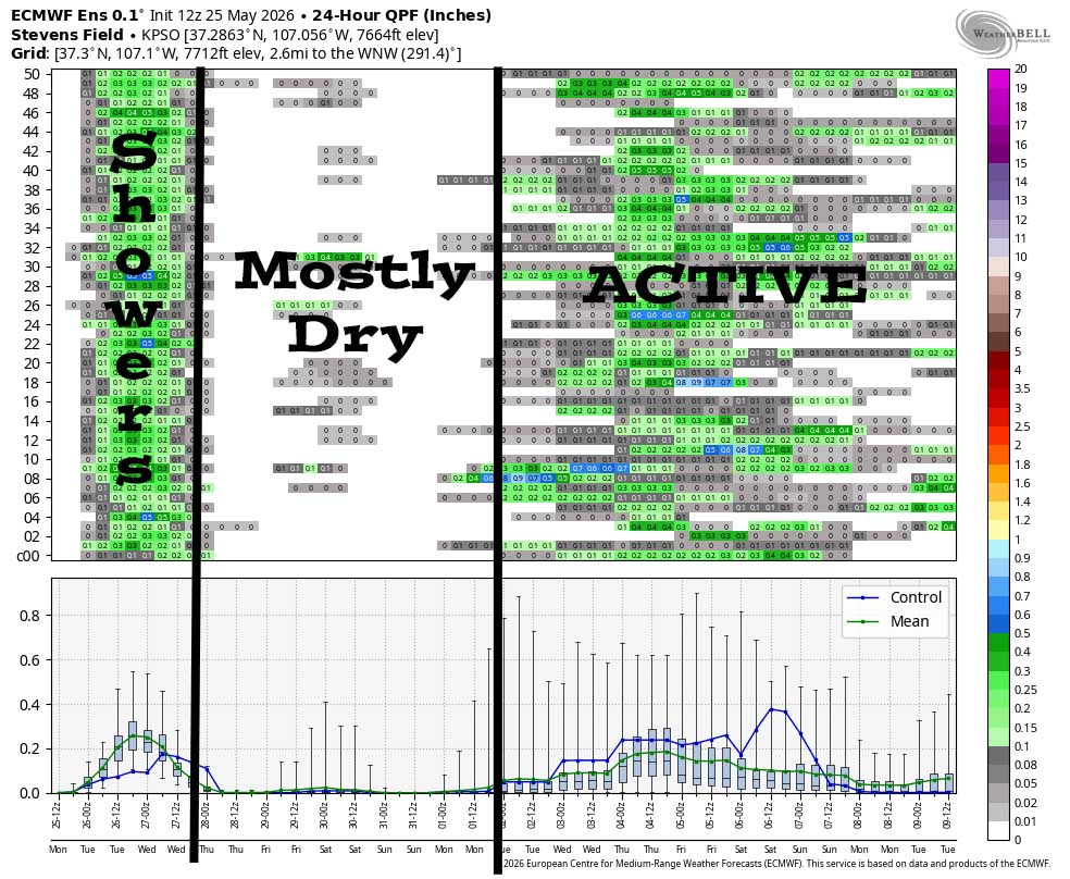
Scattered showers are likely through Tuesday afternoon. Wednesday through Sunday it’s mostly dry. Starting 1 or 2 June, the pattern will get more active with scattered afternoon convective showers.
The next post will be Wednesday afternoon.
– Shawn


