

May you have a wonderful reflective Memorial Day weekend. It is a time to reflect on those that made the ultimate sacrifice in securing our freedom to be able to travel & to be with family & friends.
Saturday – 23 May 2026 – 8:00pm
The past…
Stevens Field Observations
Thursday: High: 68, Low: 30, Peak wind: 29mph
Friday: High: 67, Low: 31, Peak wind: 29mph
Saturday: High: 70, Low: 32, Peak wind: 28mph
| Average High | Record High / Year | Average Low | Record Low / Year |
| 70 | 80 / 1961 | 32 | 12 / 1940 |
Precipitation summary… There has been no precipitation in our area in the last 72 hours.
Current satellite and radar…
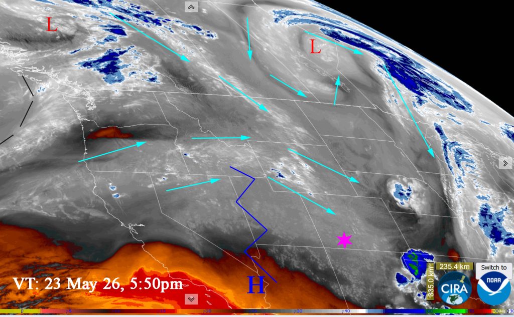
Satellite at 6:10pm on Saturday: Currently under the influence of a weak, dirty ridge. It is dirty in that moisture and clouds are able to stream over it and into our area.
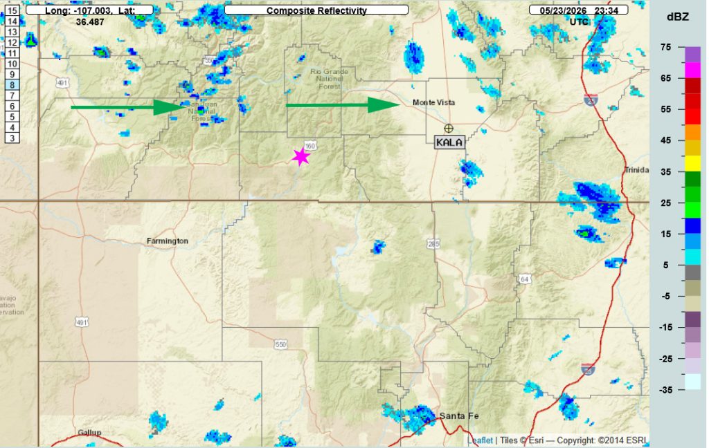
Radar at 5:34pm Saturday – Showers are moving west to east. The few in our area are downsloping and drying before they reach us.
Forecast highlights…
*** Unsettled weather for the weekend. ***
***Rain showers and thunderstorms starting Monday into Tuesday.***
Forecast details…
Rest of Saturday through Sunday…
A weak, minor ridge will give us “unsettled” weather. What is unsettled weather? You’ll see the cumulus growing throughout the day as temperatures warm. They’ll be nice, white build ups with darker underbellies. But this is a down sloping flow for us so the showers that form won’t amount to much. You’ll see dangly bits (scientific term) extending down from the clouds and get 5 rain drops, maybe twenty, on your windshield but not enough to really wet the ground.
The weather through tomorrow will be dry with partly cloudy skies and lots of sun, with a slight chance for a spotty afternoon/evening shower or thunderstorm over the weekend especially in the mountains.
Temps…
Highs will be upper 60s to mid 70s through Sunday. Lows will be in the low 30s to upper 30s.
Winds…
Breezy afternoons winds will persist. On Sunday, afternoon gusts will be around 15mph in the Pagosa area and around 15-25mph in the high country.
Monday and Tuesday
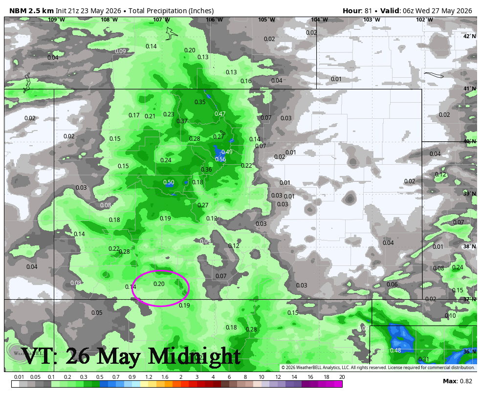
A strong area of low pressure in the Gulf of Alaska will sink off the coast of California allowing ideal southwest flow to set up in our area. This will give us showers accompanied by thunderstorms starting Monday afternoon into late on Tuesday.
Best chance of rainshowers/thunderstorms will be from Monday at 6pm till Tuesday at 6pm. The MJO will be moving into a favorable area for us at this time and be at a minor enhanced level.
Both days will be Mostly Cloudy to Cloudy.
Temps.. Monday highs will be upper 60s to mid 70s. Overnight lows will be upper 30s. Tuesday will be cooler with high temps in the 60s.
Winds… Afternoon gusts will be 20mph in the Pagosa area and 30 mph in the high country.
Wednesday through Friday
High pressure will be in control. There may be some fog in low lying areas early Wednesday morning and clouds will slowly move out Wednesday morning. Otherwise, it will be partly cloudy through Friday.
Temps.. Highs will be upper 60s to mid 70s. Wednesday will be the warmest days with warmer areas highs pushing into the upper 70s. Overnight lows will be in the mid 30s to upper 30s.
Winds… Afternoon gusts will be 20 to 25mph in the Pagosa area and 30 mph in the high country.
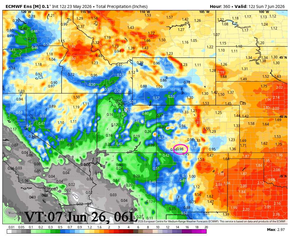
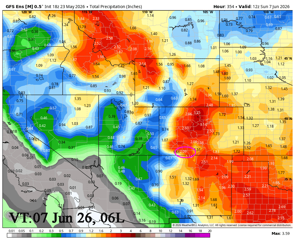
2 Week Outlook to 7 Jun… We can expect to see daily afternoon showers starting Sunday, May 31st as a series of low pressure areas and upper level disturbances move in from the Pacific and pass through our area.
It will feel like a monsoon pattern but these upper level disturbances are associated with the polar front jet. It is still active.
The Euro is showing .98″ to June 7th at 6am while the GFS is showing 2.09″. The Euro is in agreement with the NBM model and has been verifying better. The GFS is showing a notable jump!
My next post will be Monday.
– Arleen


