
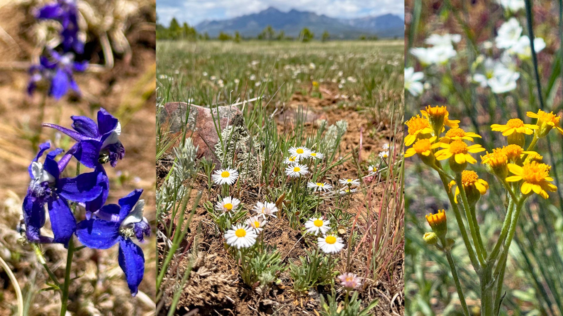
Wildflowers are popping up in Turkey Springs meadows. Pictures taken May 19th, 2026 (select title of post to see picture)
Tuesday – 19 May 2026 – 7:50pm
Thankfully, the worst of the winds are over for the near term.
The past…
Stevens Field Observations
Sunday: High: 67, Low: 37, Peak wind: 28mph
Monday: High: 57, Low: 43, Peak wind: 40mph
Tuesday: High: 63, Low: 32, Peak wind: 29mph
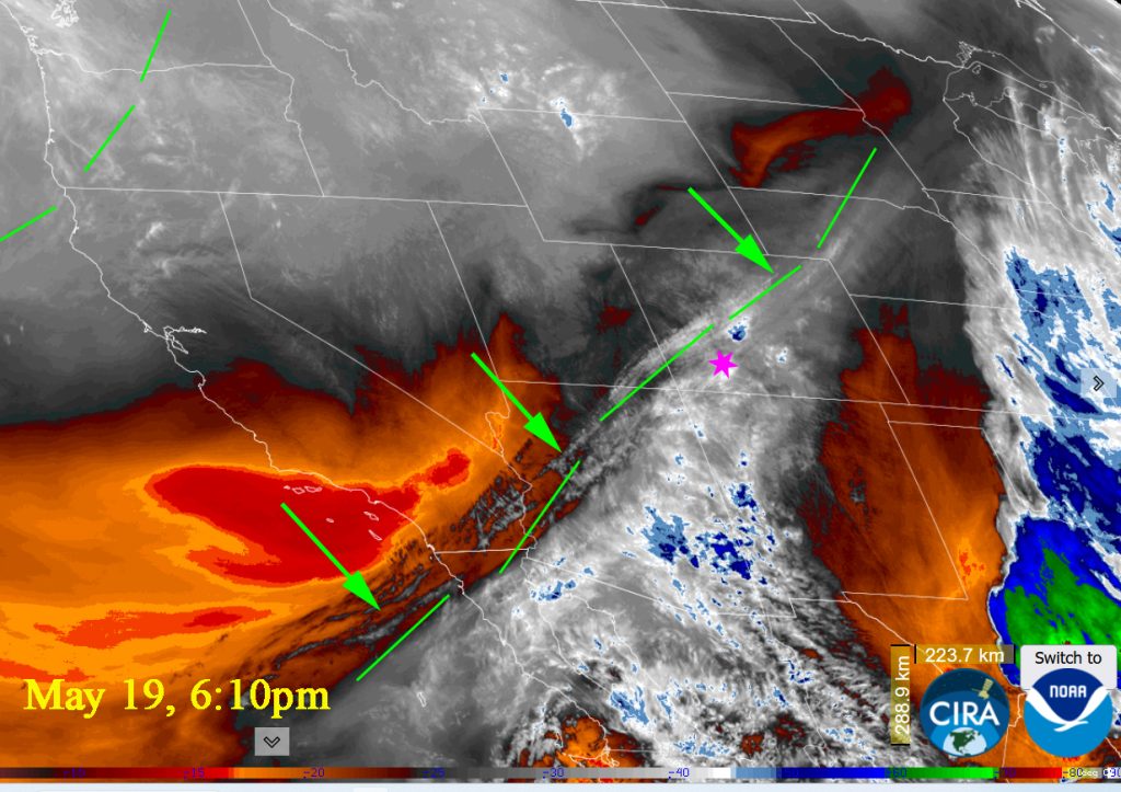
A front roared through Monday morning ~ 7:00am. We had threatening showers all day but the only result was lots of wind. The winds carried in dust and haze from the west of us.
| Average High | Record High / Year | Average Low | Record Low / Year |
| 70 | 80 / 1996 | 31 | 19 / 1943 |
Precipitation summary… Areas in LaPlata County saw up to .12″ yesterday. Archuleta county only had a few traces of rain. Wolf Creek had .10″ of rain or about 1″ of snow.
Current satellite and radar…

Forecast highlights…
*** Slight chance for a spotty morning shower or thunderstorm on Wednesday and next weekend, otherwise there will be lots of sun and breezy afternoons. ***
***Better chance of rain showers and thunderstorms starting Monday into Tuesday.***
Forecast details…
Rest of Tuesday… Mostly Cloudy becoming Partly Cloudy overnight. Overnight lows: mid 30s.
Wednesday through next weekend… Most of this period will be dry with lots of sun, but there is a slight chance for a spotty morning shower or thunderstorm Wednesday and next weekend especially in the mountains. Breezy afternoons will persist.
Temps…
Wednesday highs will be in the lo 60s to the upper 60s and lows overnight into Thursday morning will be upper 20s to low 30s.
Thursday and Friday highs will be mid 60s to mid 70s and lows will be in the low 30s to upper 30s.
Next weekend highs will increase into Sunday with a high of low to high 70s and lows will be in the lo 30s to the upper 30s.
Winds…
Wednesday afternoon gusts will be 25mph in the Pagosa area and 30-40mph in the high country.
Thursday and Friday, each afternoon gusts will be 20-25mph in the Pagosa area and 30-35mph in the high country.
Next weekend, each afternoon gusts will be around 15mph in the Pagosa area and around 15-25mph in the high country.
Monday into Tuesday the 26th
An area of low pressure will sink into our southwest ling up perfectly to start giving up showers accompanied by thunderstorms starting Monday afternoon into late on Tuesday.
Clouds will increase throughout the day on Monday. Tuesday will be Mostly Cloudy to Cloudy.
Temps.. Monday highs will be lo 70s to upper 70s. Overnight lows will be mid-30s. Tuesday high temps will be in the 60s.
Winds… Monday afternoon gusts will be 20mph in the Pagosa area and 30 mph in the high country.
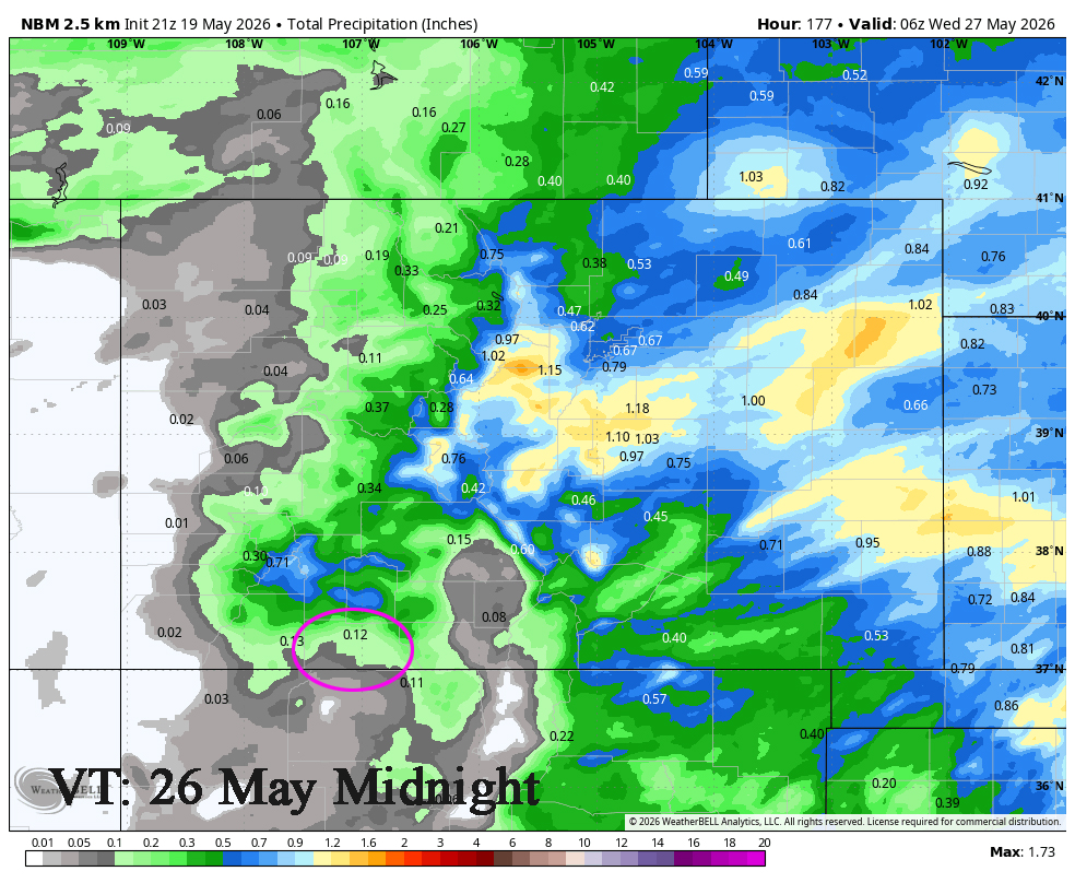
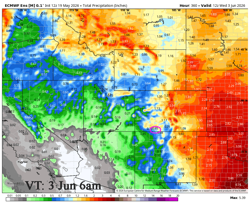
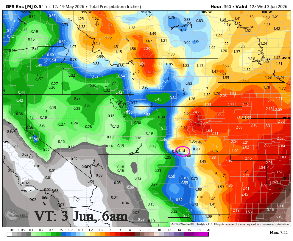
2 week outlook to 3 Jun… There will be a little more moisture and more instability so we will see hit and miss afternoon showers and thunderstorms. The MJO is moving into our area after the 25th and will enhance activity for the end of the month in the beginning of June before things dry out again.
The Euro is showing .95″ to June 3rd at 6am while the GFS is showing 1.14″. Both models have been overdoing it a bit.
My next post will be Wednesday, tomorrow evening.
– Arleen


