

We see very little snow on our mountains. Why are the rivers running high? From the Pagosa Springs area, we see the south and west sides of our mountains. Snow is nearly gone on those sides of the mountains, but on the north side there is still quite a bit of snow. I took the picture of the Upper San Juan snotel yesterday. There is zero snow near the snotel, but the north facing slope above the snotel still has snow. – pic taken 5/16/2026
Sunday – 17 May 2026 – 3:20pm
The past…
Stevens Field Observations
Friday: High: 76, Low: 32, Peak wind: 24mph
Saturday: High: 76, Low: 36, Peak wind: 32mph
| Average High | Record High / Year | Average Low | Record Low / Year |
| 68 | 82 / 1988 | 30 | 15 / 1916 |
Precipitation summary… There has been no recent measurable precip.
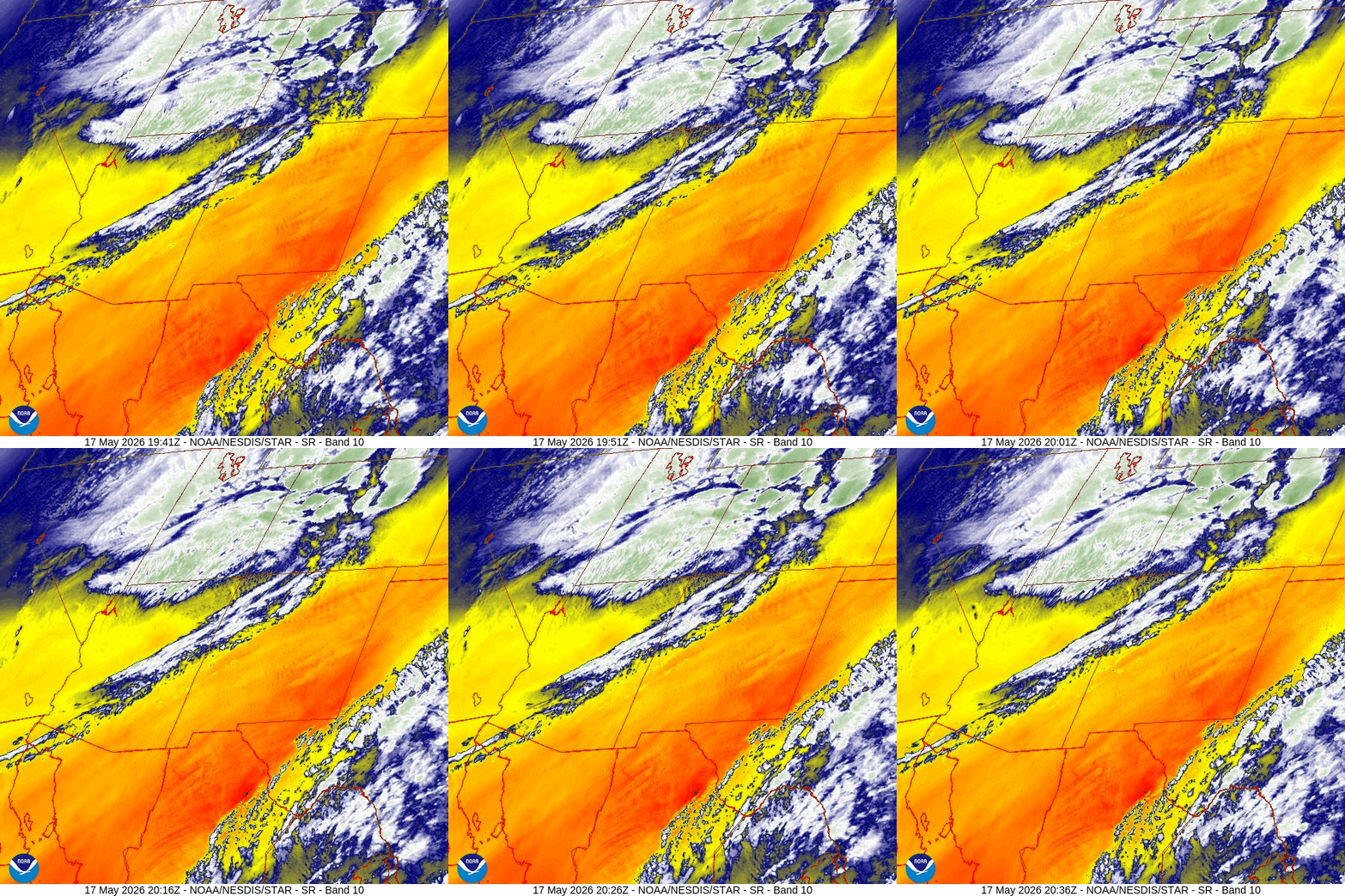
Current satellite and radar…

Forecast highlights…
*** Potential for blowing dust Sunday night through Monday morning. ***
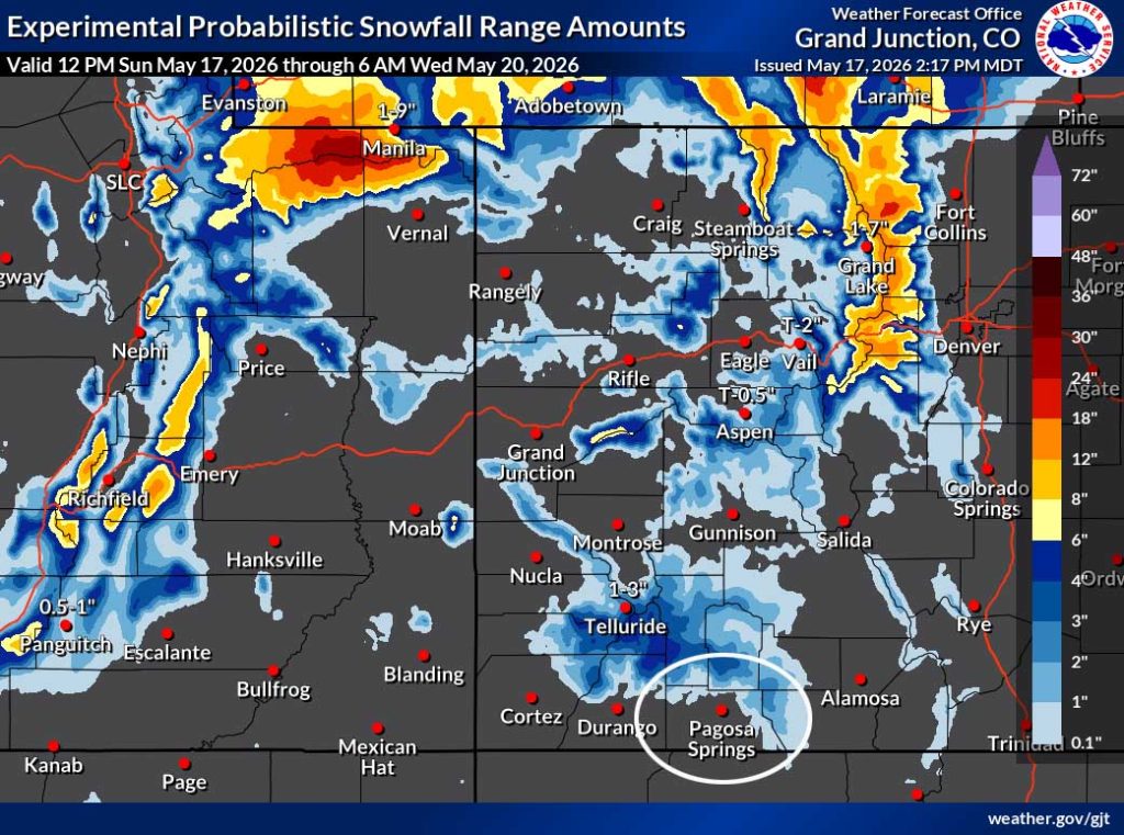
*** Scattered showers and a thunderstorm or two Monday morning. 1-3” of snow is possible on Wolf Creek Pass. ***
*** Wind gusts over 30mph Sunday, Monday, and Tuesday. ***
*** Slight chance for a spotty afternoon shower or thunderstorm Wednesday and next weekend, otherwise there will be lots of sun and breezy afternoons. ***
Forecast details…
Sunday night through Monday morning… A low will move through central UT Sunday night and then through northern CO Monday and cause gusty winds across the region. Monday morning between sunrise and noon we’ll catch the tail-end of the cold front and some scattered showers and an isolated thunderstorm or two.
Wind gusts will be 35-40mph, but more clouds, cooler temps, and higher humidity will ease fire danger a tiny bit.
Precip forecast…
Mountains above 9,000ft: 1-3” of snow
Pagosa Springs area: up to 0.10” of rain, graupel, or small hail
Monday afternoon through next weekend… Most of this period will be dry with lots of sun, but there is a slight chance for a spotty afternoon shower or thunderstorm Wednesday and next weekend. Breezy afternoons will persist.
Temps…
Sunday night lows will be in the low 30s to low 40s.
Monday highs will be in the mid 50s to the low 60s and lows will be in the mid 20s to the mid 30s.
Tuesday highs will be in the near 60 to near 70 and lows will be in the high 20s to the high 30s.
Wednesday highs will be in the mid 60s to the low 70s and lows will be near 30 to near 40.
Thursday and Friday highs will be near 70 to the high 70s and lows will be in the low 30s to low 40s.
Next weekend highs will be in the low to high 70s and lows will be in the mid 30s to the low 40s.
Winds…
Sunday evening gusts will be 30-35mph in the Pagosa area and 50-60mph in the high country.
Monday morning into the afternoon gusts will be 35-40mph in the Pagosa area and 55-65mph in the high country.
Tuesday afternoon gusts will be around 30mph in the Pagosa area and 35-45mph in the high country.
Wednesday afternoon gusts will be 25mph in the Pagosa area and 30-40mph in the high country.
Thursday and Friday, each afternoon gusts will be 20-25mph in the Pagosa area and 30-35mph in the high country.
Next weekend, each afternoon gusts will be around 20mph in the Pagosa area and around 30mph in the high country.

Most of this will fall after sunrise Monday to noon Monday.
24 May to 1 Jun… There will be a little more moisture and a little more instability so we will see hit and miss afternoon showers and thunderstorms.


We will get scattered showers Monday morning. It’s mostly dry Monday afternoon through next Friday. Starting 23 or 24 May, the pattern is trying to get more active with hit and miss afternoon convective showers.
The next post will be Tuesday afternoon.
– Shawn


