

A few big fat snowflakes fell briefly on Wolf Creek Pass but they didn’t amount to anything. – CDOT web cam 4/11/2026 around 1pm
Saturday – 11 Apr 2026 – 4:10pm
The past…
Stevens Field Observations
Thursday: High: 67, Low: 28, Peak wind: 26mph
Friday: High: 64, Low: 32, Peak wind: 32mph
| Average High | Record High / Year | Average Low | Record Low / Year |
| 57 | 77 / 1916 | 23 | 2 / 1951 |
Precipitation summary… Much of Archuletta County got a little precip last night. Wolf Creek Pass got around an inch of wet snow.

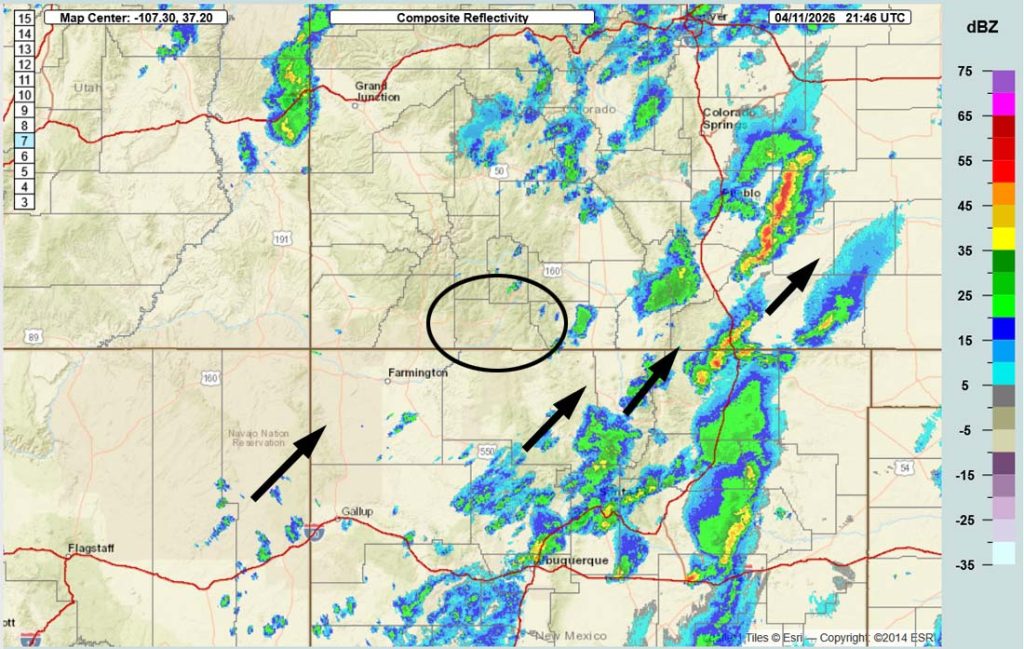
Current satellite and radar…

Forecast highlights…
*** Scattered showers and an isolated thunderstorm or two will end Saturday evening. ***
*** Round 2 of precip Monday evening through Tuesday afternoon. ***
*** Expect winter driving conditions on Wolf Creek Pass Monday night into Tuesday afternoon. ***
*** Hard freeze Monday, Tuesday, and Wednesday nights. ***
Forecast details…
Rest of Saturday… Scattered showers and an isolated thunderstorm or two will end Saturday after the trough moves through and the atmosphere dries out.
Saturday night through Monday morning… A quick moving transient ridge will keep us mostly dry. There’s a slight chance for a few isolated showers over the mountains.
Monday afternoon through Tuesday afternoon… System 2 will move through. This one will have better storm energy and moisture, so we’ll get more precip.
Timing… Scattered showers will start over the mountains Monday afternoon and then in the Pagosa area they’ll start Monday evening. The best chance for precip is late Monday evening through Tuesday morning. Hit and miss showers will gradually end by late Tuesday afternoon.
Snow levels…
Monday afternoon into early Tuesday morning: 8,500ft to 9,000ft
Sunrise to sunset Tuesday: 7,000ft to 7,500ft
Precip amounts:
Mountains above 9,000ft: 4-7”
Pagosa area above 8,000ft: up to 1” of snow and up to 0.30” of rain
Pagosa area below 8,000ft: a dusting of snow and up to 0.30” of rain
Tuesday night through Friday morning… A transient ridge with drier air will give us mostly sunny skies and temps slightly above average.
Friday afternoon through next Saturday… I’m unsure of this period. Some models show us going getting clipped by a fast moving low pressure system while others expect it to miss us.
Right now I see potential for a few scattered showers, mostly over the mountains, with light precip amounts.
Temps…
Saturday night lows will be in the high 20s to the mid 30s.
Sunday highs will be in the mid 50s to the low 60s and lows will be in the high 20s to the high 30s.
Monday highs will be in the near 50 to the high 50s and *** lows will be in the mid 20s to the low 30s ***.
Tuesday highs will be in the mid 40s to the low 50s and *** lows will be in the mid teens to the mid 20s ***.
Wednesday highs will be in the low 50s to high 50s and lows will be in the *** lows will be near 20 to the high 20s ***.
Thursday, Friday, and next Saturday highs will be in the mid 50s to the mid 60s and lows will be in the mid 20s to the mid 30s.
Winds…
Sunday and Monday, each afternoon gusts will be around 30mph in the Pagosa Springs area and 35-45mph in the high country.
Tuesday and Wednesday, each afternoon gusts will be 20-25mph in the Pagosa Springs area and 30-40mph in the high country.
Thursday and Friday, each afternoon gusts will be 25-30mph in the Pagosa Springs area and 35-45mph in the high country.
Next Saturday afternoon gusts will be around 20mph in the Pagosa Springs area and 30-35mph in the high country.


18 Apr to 26 Apr… Some forecast models show a weak system on the 18th. The rest of the period is trying to dry out, but there is a lot of uncertainty.
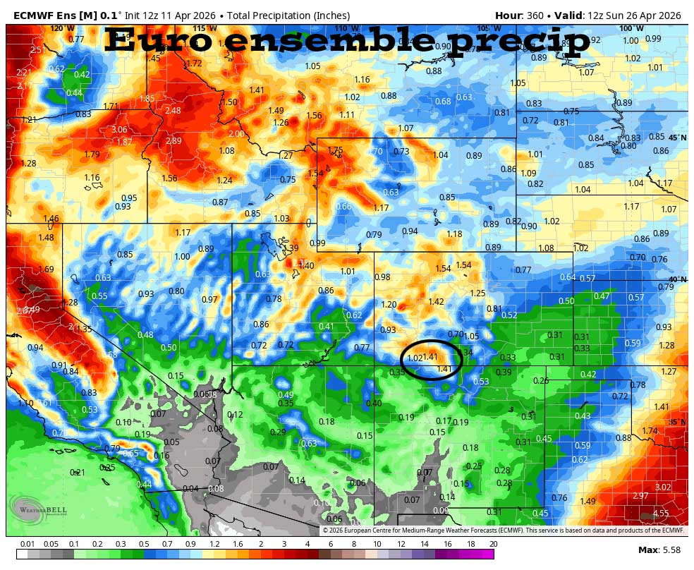

Round 1 is winding down Saturday evening. Round 2 is Monday evening into Tuesday afternoon. Then it’s dry through Friday morning. Friday night and Saturday this model shows scattered showers while other models have nothing. The rest of the period is drying out but there is a lot of uncertainty.
The next post will be on Monday afternoon.
– Shawn


