

17” of new snow up at Wolf Creek this morning and 44” in the last 3 days! – pic taken 2/20/2026 by Wolf Creek groomer Doug!
Friday – 20 Feb 2026 – 12:50pm
The past…
Stevens Field Observations
Thursday: High: 26, Low: 0, Peak wind: 24mph
Friday’s peak wind so far is 36mph at 10:10am
| Average High | Record High / Year | Average Low | Record Low / Year |
| 43 | 61 / 1995 | 9 | -20 / 1955 |
Precipitation summary… Wolf Creek reported 17” of snow in the last 24 hours bringing the storm total 44”.
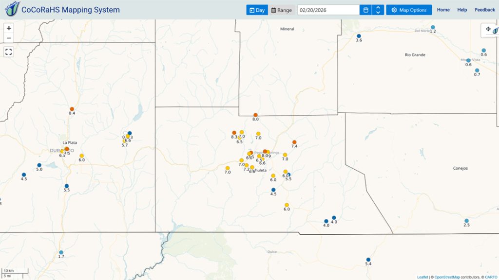
Snow that fell after these reports will be in tomorrow’s measurements. I’ll do a thorough storm wrap-up tomorrow.
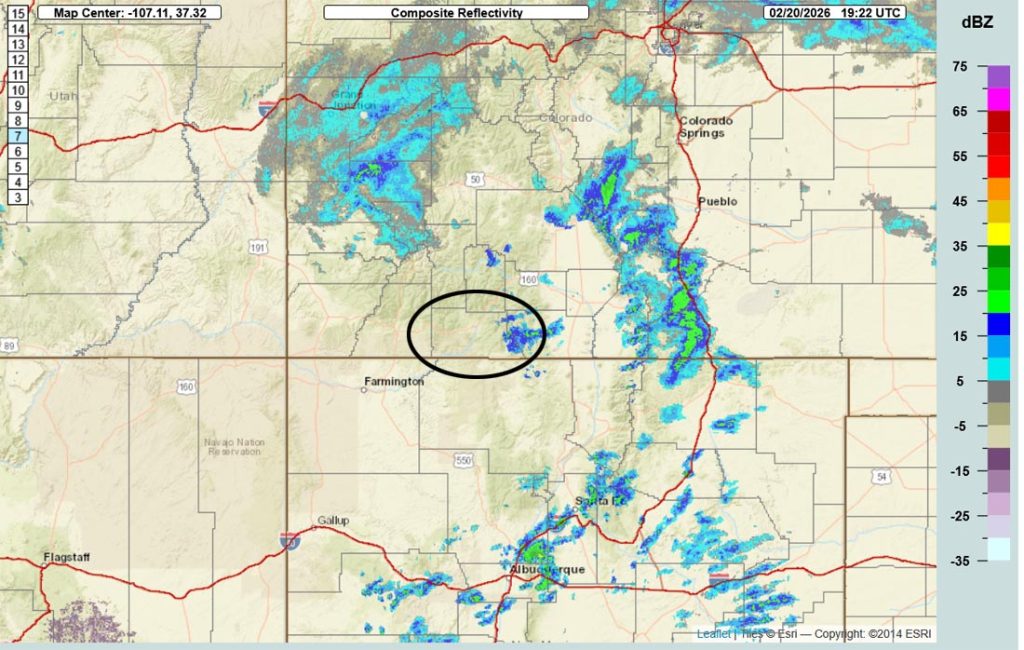
Current satellite and radar…

Forecast highlights…
*** WINTER WEATHER ADVISORY for the San Juan River Basin will expire at 11pm Friday. ***
*** WINTER WEATHER WARNING for the eastern San Juan Mountains above 10,000ft will expire at 11pm Friday. ***
*** AVALANCHE WARNING for the mountains valid through Friday. ***
*** Starting tomorrow, we’ll see more blue sky, a gradual warming trend, and will be dry for a while. ***

Forecast details…
Friday afternoon… The trough moved through around 11am. The low will slide just our north and will keep things unstable through Friday afternoon.
In the Pagosa area, we’ll go back and forth between patches of blue sky and snowshowers. Snowshowers will move through quickly and cause short periods of spotty snow. “If you don’t like the weather, just wait a few minutes!”
In the mountains, snowshowers will be more persistent and visibility will be poor most of the afternoon.
Additional snow amounts noon to midnight Friday…
Wolf Creek area: 2-4”
Pagosa area: a dusting to 2” – it will be spotty

Saturday through next Friday… A ridge will build over the region. We should see lots of sun and a warming trend.
Tuesday, Wednesday, and Thursday we might see a few more clouds as the jet stream dips south into northern Colorado.
Temps…
Friday highs will be in the mid-20s to low 30s. *** Friday night lows will be -10 to +5. ***
Saturday highs will be in the mid 30s to low 40s and lows will be near zero to the mid teens.
Sunday highs will be in the low to high 40s and lows will be near 10 to the high teens.
Monday, Tuesday, and Wednesday highs will be in the high 40s to the mid 50s. and lows will be in the mid teens to the mid 20s.
Thursday and next Friday highs will be near 50 to the mid 50s and lows will be in the high teens to mid 20s.
Winds…
Friday afternoon gusts will be 30-35mph in the Pagosa area and 45-55mph in the high country.
Saturday through Tuesday each afternoon, gusts will be around 10mph in the Pagosa area and 25-30mph in the high country.
Wednesday, Thursday, and next Friday, each afternoon gusts will be 15-20mph near Pagosa and 35-40mph in the high country.
27 Feb to 7 Mar… Our nemesis, the big evil ridge, will set up over the west coast. Weak systems might try to sneak through from the northwest (not favorable for us) towards the end of this period. I don’t see anything “fun” on the horizon.
I’ll do a thorough post Saturday that will include a storm wrap-up and mountain snowpack. Keep an eye out on Facebook for quick updates.
– Shawn


2 Responses
First class operation … thank you
Greetings, haven’t seen the “spotty” part yet…. Still pretty steady up at Oak Hill 8K
THANKS for all the reporting