

The mountains made a brief appearance between snowshowers around noon. – pic taken 2/17/2026
Tuesday – 17 Feb 2026 – 2:30pm
The past…
Stevens Field Observations
Monday: High: 50, Low: 30, Peak wind: 12mph
Peak winds Tuesday morning:
Stevens Field: 58mph at 8:35am
Durango airport: 58mph at 6:58am
Farmington: 58mph at 6:32am
Lobo Overlook/Wolf Creek: 71mph at 3:35am – the sensor didn’t report winds from roughly 5:30am to 10am
| Average High | Record High / Year | Average Low | Record Low / Year |
| 42 | 67 / 1943 | 8 | -30 / 1910 |
Precipitation summary…
Precip started this morning as CoCoRaHS observers were measuring. I estimate that much of the Pagosa area got 1-2” of snow. Of course, it’s difficult to accurately measure snow that’s being blown around by 40mph winds! I’ll post the “official” measurements tomorrow.
Wolf Creek Ski Area reported 5” of new snow at 2pm Tuesday.
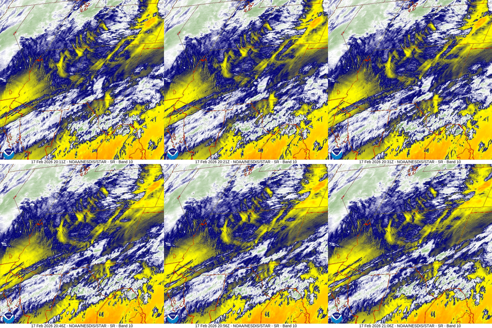
Current satellite and radar…

Forecast highlights…
*** WINTER WEATHER ADVISORY for the San Juan River Basin. This includes Pagosa Springs. 4-8” of snow and winds gusting to 40mph are expected until 5am Thursday. ***
*** WINTER WEATHER WARNING for the eastern San Juan Mountains above 10,000ft. This includes Wolf Creek and Cumbres Passes. Up to 24” of snow and winds gusting to 70mph are expected until 11pm Wednesday. ***
*** AVALANCHE WATCH for the mountains valid 9am Wednesday to 5pm Friday. ***
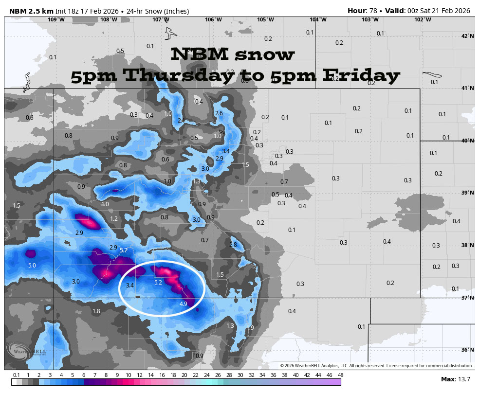
*** A 3rd round of snow is likely Thursday night into Friday evening. ***
*** Another storm is possible 24-26 Feb. ***

Forecast details…
Timing…
Tuesday afternoon through Tuesday evening: We’re between rounds 1 and 2. Strong, unstable flow will cause fast-moving, intense spotty snowshowers, especially over the mountains.
In the Pagosa area, there will be brief near white-out conditions as spotty snowshowers move quickly through – just wait 10 or 15 minutes and it will pass!
In the Wolf Creek area, conditions will bounce around between a little crappy to a lot crappy.
Round 2 – Early Wednesday morning through Wednesday afternoon: Bands of moderate to heavy snow will move through. There’s also a slight chance for an isolated thunderstorm or two.
Snow levels… Below 7,000ft for the whole period.
Snow totals Tuesday afternoon through Tuesday evening…
Wolf Creek area: 3-6”
Pagosa area: 1-2” – It will be spotty and get blown into the next county!
Round 2 Snow totals Early Wednesday morning through Wednesday evening…
Wolf Creek area: 12-18”
Pagosa area: 4-8”

Wednesday night through Thursday evening… There will be a lull as a transient ridge moves through. Scattered snowshowers are possible, mostly over the mountains. Snow amounts will be minimal.
Thursday night through Friday evening… Round 3. The final trough will move through. It’s digging a little farther south, so it looks better for us. The best chance for snowshowers is early Friday morning into Friday afternoon. There will be less wind!
Snow amounts…
Wolf Creek area: 6-10”
Pagosa area: 3-6”
Saturday, Sunday, and Monday… A ridge will build over the region. We should see lots of sun and a warming trend.
Temps…
Tuesday highs will be near 30 to the high 30s and lows will be near 20 to the mid 20s.
Wednesday highs will be near 30 to mid-30s and lows will be near zero to the low teens.
Thursday and Friday highs will be in the mid-20s to low 30s. Thursday night lows will be in the high single digits to the mid teens. Friday night lows will be in the mid negative single digits to the mid positive single digits.
Saturday highs will be in the mid 30s to low 40s and lows will be in the low single digits to the mid teens.
Sunday highs will be in the low to high 40s and lows will be near 10 to the high teens.
Monday highs will be in the high 40s to the mid 50s and lows will be in the mid teens to mid 20s.
Winds…
Tuesday afternoon wind gusts will be 30-40mph in the Pagosa area and 50-70mph in the mountains. *** Expect occasional white-out conditions on Wolf Creek Pass. ***
Wednesday afternoon gusts will be 40-50mph in the Pagosa area and 50-70mph in the high country. *** Expect white-out conditions on Wolf Creek Pass. ***
Thursday afternoon gusts will be around 20mph in the Pagosa area and 30-40mph in the high country.
Friday afternoon gusts will be 25-30mph in the Pagosa area and 40-50mph in the high country.
Saturday, Sunday, and Monday, each afternoon, gusts will be around 15mph in the Pagosa area and 25-30mph in the high country.
24 Feb to 4 Mar… 24 to 26 Feb a moderate system could move through. The rest of this period looks dry.
I’ll try to do a post each day through Thursday. Keep an eye out on Facebook for quick updates.
– Shawn


