

It was nice to wake up to 3” of snow this morning! – Pic taken 1/24/2026
Saturday – 24 Jan 2026 – 1:15pm
The past…
Stevens Field Observations
Friday: High: 40, Low: 24, Peak Wind: 20mph
| Average High | Record High / Year | Average Low | Record Low / Year |
| 38 | 53 / 1986 | 1 | -33 / 1917 |
Precipitation summary… We got some snow, but it was less than I expected.
Ski area snow totals from Saturday morning…
Wolf Creek: 5”
Purgatory: 12”
Silverton: 20”
Telluride: 7”
Flow over our mountains is one of the most important ingredients for snow. Wolf Creek does best when flow is out of the southwest. With this storm flow was more out of the west-southwest which favored Purgatory and Silverton.
Thanks so much for everyone’s snow reports, pictures, and videos on our Facebook page!

Current satellite and radar…


Forecast highlights…
*** A WINTER WEATHER ADVISORY for Pagosa Springs will expire 5am Sunday. ***
*** A WINTER STORM WARNING for the eastern San Juan Mountains above 10,000ft. will expire 5 am Sunday. ***
*** Expect winter driving conditions into Sunday morning. ***

*** Most of Sunday and next week will be dry. ***
Forecast details…
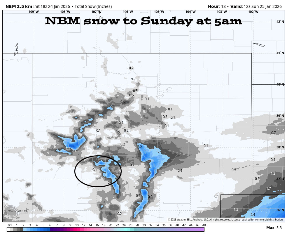
Saturday afternoon into early Sunday morning… The trough will move through our area around midnight tonight.
Snowshowers will be spotty in the Pagosa area and additional accumulations will be minimal. In the mountains, occasional heavy snowshowers will fall into Saturday evening.
Clouds will gradually clear overnight and temps will be chilly tomorrow morning.
Additional snow amounts…
Wolf Creek area: 3-6”
Pagosa area: a dusting to 1”
Most of Sunday and the rest of next week… A ridge will build over the region and dry us out.
Temps…
Saturday night lows will be near 0 to the low teens.
Sunday highs will be in the high 20s to mid-30s and lows will be -10 to 5.
Monday highs will be in the low to high 30s and lows will be -5 to 10.
Tuesday highs will be in the mid-30s to low 40s and lows will be in the low single digits to the mid-teens.
Wednesday, Thursday, and Friday highs will be near 40 to the high 40s and lows will be in the high single digits to high teens.
Next Saturday highs will be in the low 40s to low 50s and lows will be in the low teens to low 20s.
Winds…
Saturday and Sunday, afternoon gusts will be 15-20 in the Pagosa area and 30-35mph in the high country.
Monday through next Saturday, each afternoon peak winds will be around 10mph in the Pagosa area and around 20mph in the high country.
31 Jan to 8 Feb… I see no significant storms on the horizon. Sadly it looks mostly dry.
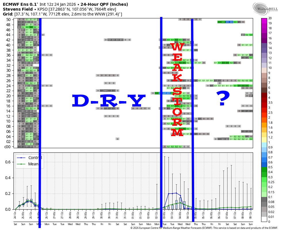
It begins with the outgoing storm and then it’s dry to 2 Feb.
It hints at a weak storm around 3 Feb and then it’s a mystery towards the end of the period.
Other forecast products lean more towards ridging and dry weather than the opposite.
The next post will be tomorrow.
– Shawn


