
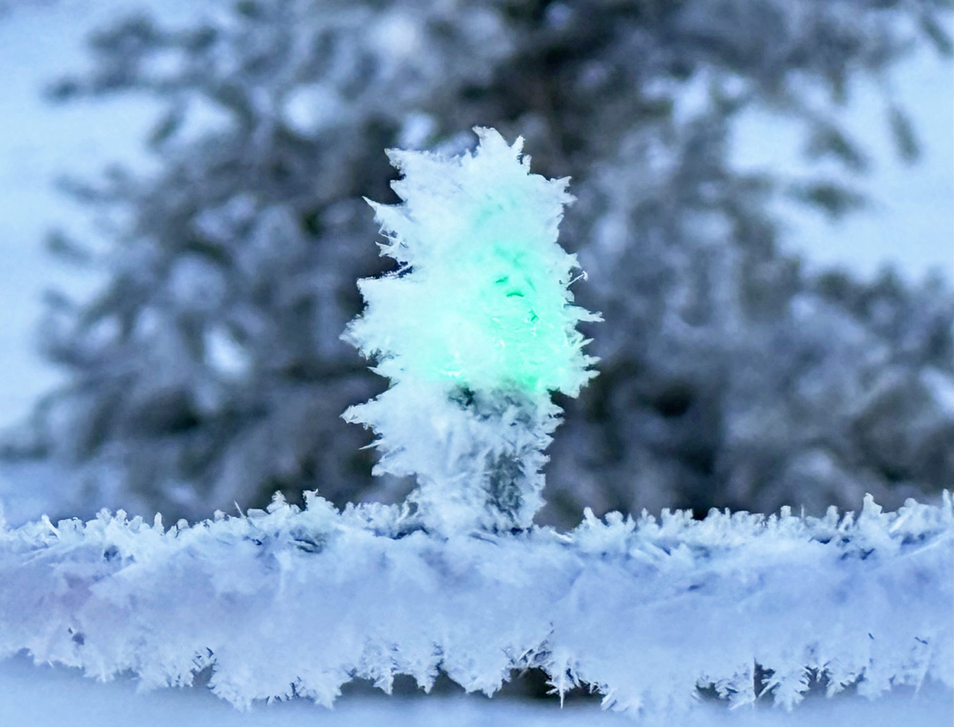
Single digit temps at night produce heavy frost. Moisture in the air deposits on trees, grass & other items. The process of deposition is process of H2O changing from gas state to frozen state. – Pic taken 12/7/2025
Monday – 8 Dec 2025 – 6:00pm
The past…
Stevens Field Observations
Saturday: High: 35, Low: 14, Peak Wind: 7mph
Sunday: High: 42, Low: 8, Peak Wind: 5mph
Monday: High: 45, Low: 10, Peak Wind: 6mph
| Average High | Record High / Year | Average Low | Record Low / Year |
| 42 | 56 / 1981 | 8 | -19 / 1909 |
Precipitation summary… There has been no measurable precip in the last 24 hours.
Current satellite and radar…

Water Vapor satellite loop Monday afternoon – Strong ridge over west coast will keep moisture well to our north. Only northern Colorado mountains are getting any snow. Pagosa is on the down-slope, dry side of the San Juan Mountains.
Radar – these is nothing in the state of Colorado
Forecast highlights…
*** Lots of sun, with a warming trend the next two weeks. ***
Forecast details…
Monday evening through the 15th of December….
A Rex block will set up off the southern West Coast and keep the dreaded, dry flow out of the northwest over us.
Temps will slowly warm above average. Still, cold inversions will set up overnight with the clear skies.
Tuesday & Wednesday will be partly cloudy with high tmps of low 40s to upper 40s.
Thursday through Sunday will be clear skies with high tmps of mid 40s to low 50s.
Monday will be partly cloudy with high tmps of low 40s to upper 40s.
Low tmps overnight will be mid teens to low 20s. Cold spots will be in single digits.
Winds…
Afternoon peak winds will be 10-15mph each day.

NBM snow to 15 Dec at 6pm – only a few spots in northern most Colorado will see any snow over the next week.
The 8-14 day period… Upper level flow will remain in a La Nina-like pattern. The storm track over our region will be out of the northwest which means northern CO is favored and we might get a few scraps.
There are signs that the pattern could get more active the 4th week of December as the ridge flattens out.

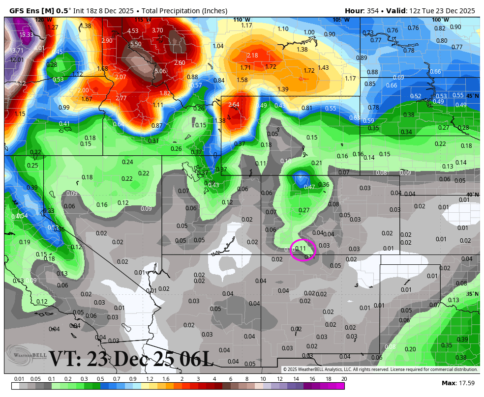
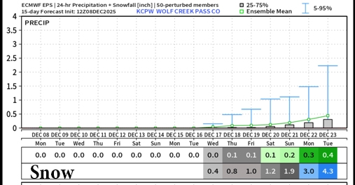
This is the 15-day ensemble precip totals: On top Euro ensemble shows 0.30”” in the Pagosa area. In the bottom, the GFS ensemble is looking for only .11”.
The next post will be on Wednesday.
– Arleen


