

Tommy at the lake on another fantastic fall day! – Photo taken on 11/14/2025
Friday – 14 Nov 2025 – 4:00pm
The past…
Stevens Field Observations
Wednesday: High: 62, Low: 25, Peak Wind: 16mph
Thursday: High: 62, Low: 26, Peak Wind: 12mph
| Average High | Record High / Year | Average Low | Record Low / Year |
| 50 | 65 / 1990 | 17 | -10 / 1950 |
Precipitation summary… There has been no recent measurable precip.
Current satellite and radar…
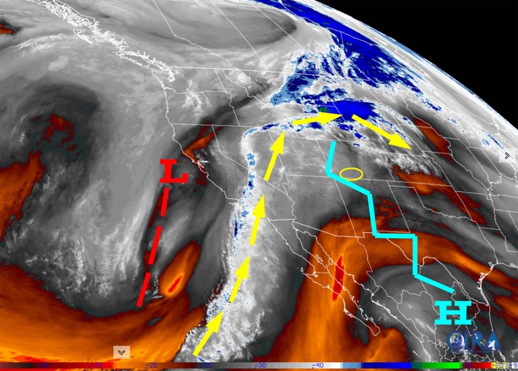
There is nothing on radar in the Pagosa Springs area Friday afternoon.
Forecast highlights…
*** Dry through Saturday night. ***
*** Early Sunday afternoon into early Monday morning there will be mountain snow and a few snowflakes in the valley. ***
*** Expect winter driving conditions on Wolf Creek Pass Sunday afternoon into Monday morning. ***
*** Another weak system Tuesday and Wednesday and then a few spotty showers through Friday. ***
Forecast details…
Rest of Friday through Saturday night… The ridge will weaken and slowly move to our east. We’ll continue to see patches of mid and high clouds, but we’ll stay dry. Temps will remain about 10 degrees warmer than average.
Sunday to sunrise Monday… A low pressure system will move through. Unfortunately it will move quickly and be a short-duration event. This means precip totals will be lower than I’ve been expecting.
Timing… Spotty showers will start over the mountains after sunrise on Sunday and then become more widespread early Sunday afternoon into early Monday morning. Hit and miss showers will persist over the mountains until around sunrise Monday.
Snow levels…
Sunday sunrise to late Sunday evening 10,000ft dropping to 8,500ft
Late Sunday evening to sunrise Monday 8,500ft dropping to 7,500ft
Snow forecast…
Mountains above 10,000ft: 5-9”
Valley above 7,500ft: a dusting to 1”
Valley below 7,500ft: none to a dusting
Late Monday morning through Tuesday morning… We will get a short break between systems. It will remain unsettled with mostly cloudy skies and a few spotty showers, mostly over the mountains. Precip amounts will be light.
Tuesday afternoon through Friday… The jet stream and storm track will remain active for us. One or two more low-pressure systems will move through the region. I am concerned that they will track too far south and we won’t get much precip.
The best chance for precip is Tuesday evening through Wednesday afternoon and then scattered showers are possible through Friday.
Snow levels will bounce around between 7,000ft and 8,000ft.
Snow forecast for this period – most of this will fall Tuesday night into Wednesday afternoon…
Mountains above 9,000ft: 4-8”
Valley above 7,600ft: 1-3”
Valley below 7,600ft: up to 1”
Temps…
Rest of Friday through Saturday highs will be in the high 50s to mid-60s. Friday lows will be in the low 20s to low 30s. Saturday night lows will be in the mid-20s to mid-30s.
Sunday highs will be in the high 40s to mid-50s and lows will be in the mid-20s to low 30s.
Monday and through the rest of next week highs will be near 40 to the mid-40s and lows will be in the high teens to high 20s.
Winds…
Afternoon gusts through Saturday will be 10-15mph.
Sunday late afternoon and evening gusts will be around 25mph in the valley and 35-45mph in the mountains.
Monday through next Friday afternoon gusts will be 10-15mph.


The 8-14 day period… We’ll be on the southern edge of the storm track. I see a few chances for light precip, but there is nothing big on the horizon.
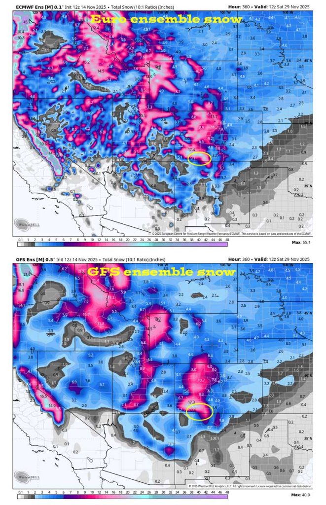
None of the storms are big, but the cumulative effect could be pretty good.

Unless there’s a significant change to my forecast, the next post will be on Sunday.
– Shawn


