

Dramatic sky – pic taken 9/13/2025
Sunday – 14 Sep 2025 – 5:50pm
The past…
Stevens Field Observations
Friday: High: 66, Low: 46, Minimum relative humidity: 52%, Peak Wind: 28mph
Saturday: High: 66, Low: 42, Minimum relative humidity: 32%, Peak Wind: 36mph
*** Sunday morning a few cold spots got down to 30 degrees. ***
| Average High | Record High / Year | Average Low | Record Low / Year |
| 74 | 92 / 1990 | 37 | 24 / 1950 |
Precipitation summary… Most of the county has exceeded the September average precip!
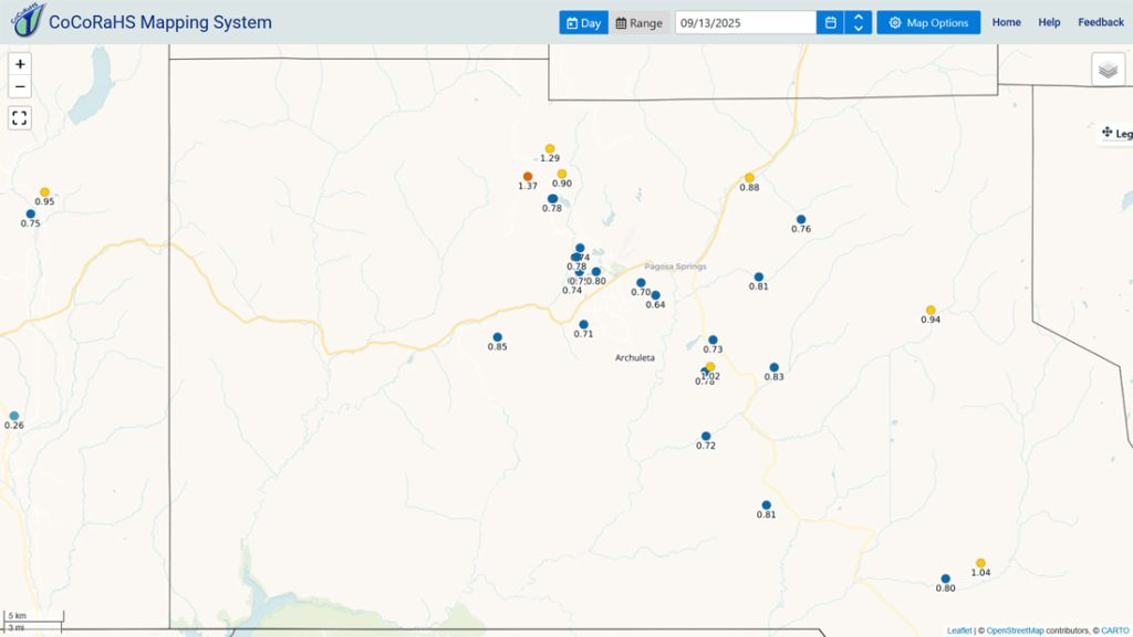
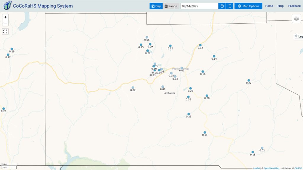
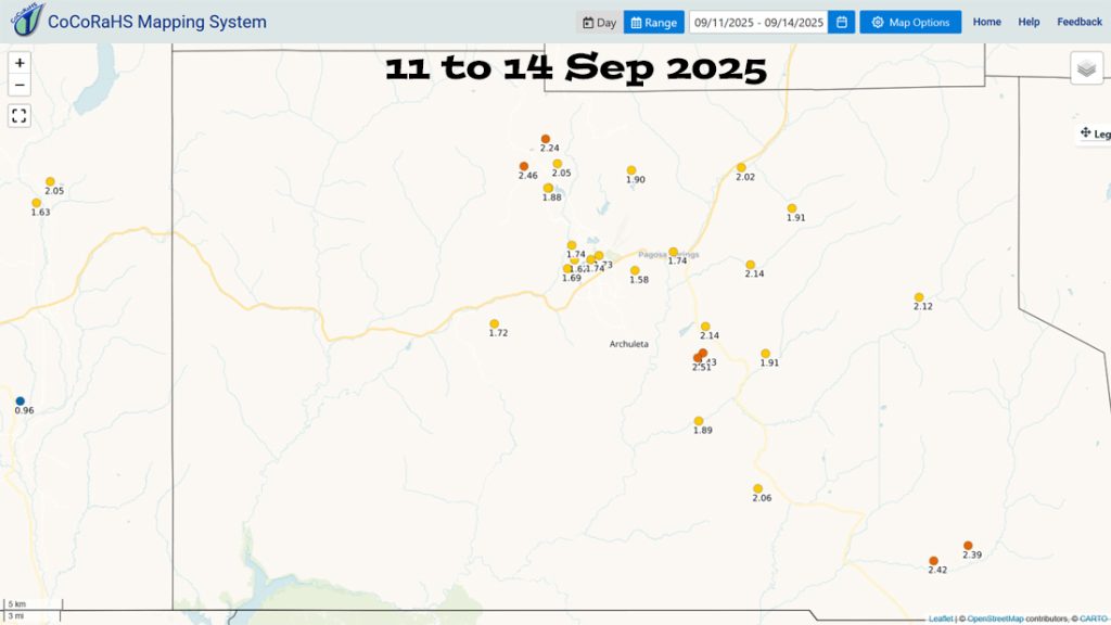
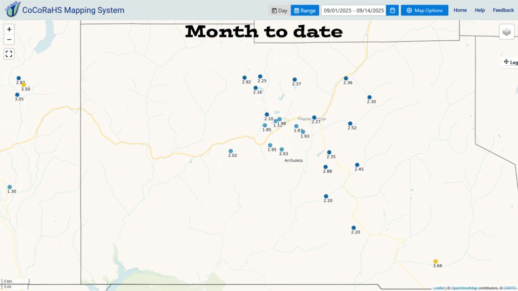
*** Much of the county has exceeded the September average of 2.00”. ***
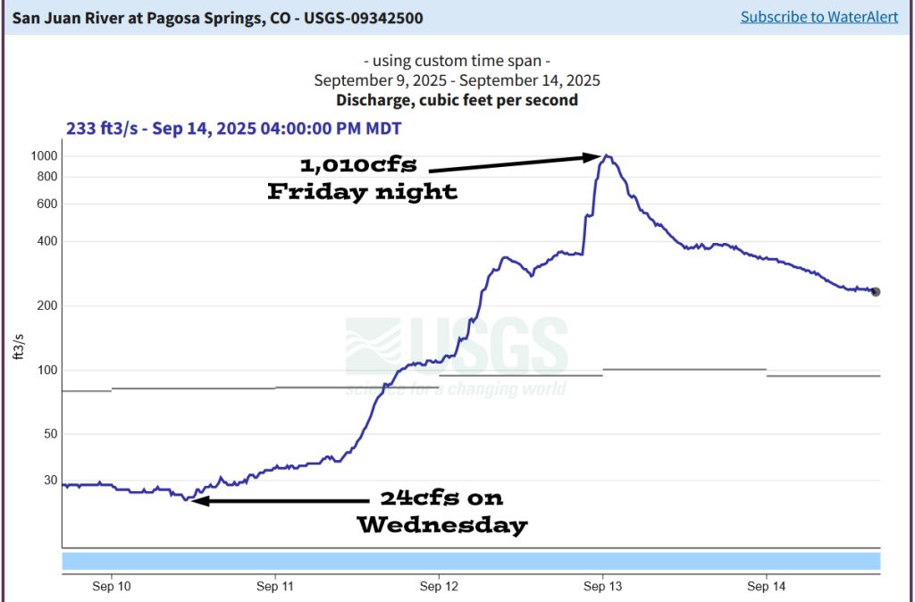
San Juan River levels…
Forecast discussion…
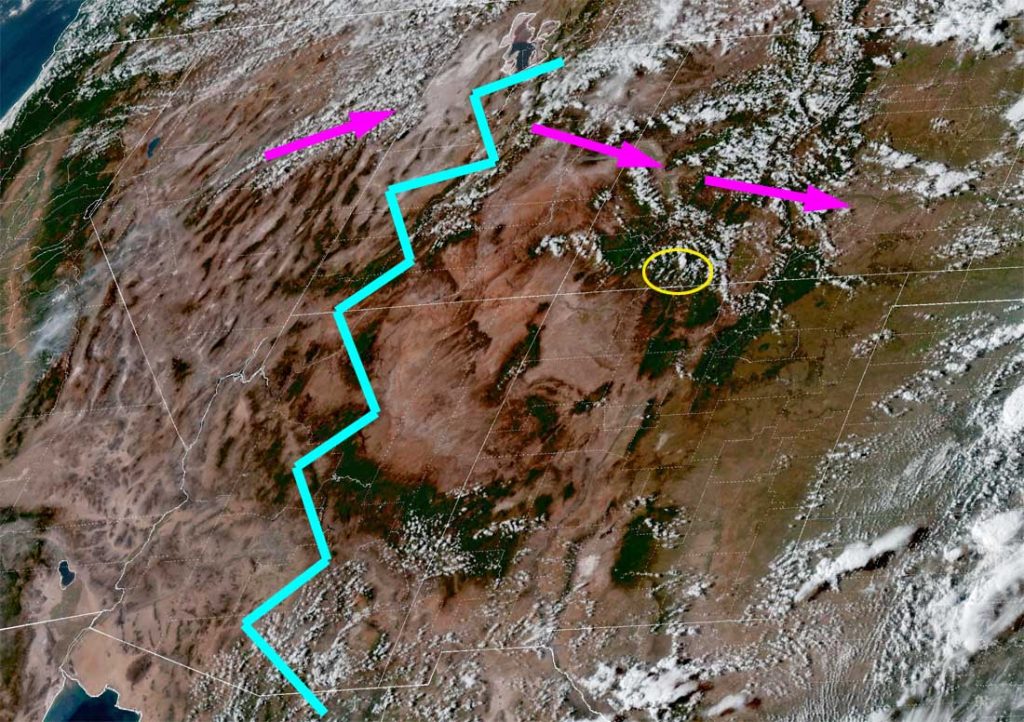
There is nothing on radar in our area Sunday afternoon.
Forecast highlights…
*** Sunday night the cold spots in the valley could dip below freezing. Protect your plants! ***
*** Today through Thursday there will be lots of blue sky and pleasant temps. ***
*** Tuesday afternoon there is a slight chance for an afternoon shower or thunderstorm, mostly over the mountains. ***
*** Friday, Saturday, and next Sunday hit and miss showers and thunderstorms are possible each afternoon. Precip amounts will be low. ***
Rest of Sunday through Thursday… A ridge will build over the region and give us nice weather with lots of blue sky and pleasant highs mostly in the 70s.
Tuesday afternoon there’s a slight chance for an isolated afternoon shower or thunderstorm as a trough skirts to our north.
Friday afternoon through next Sunday… A weak through will move the region. We’ll see more clouds and a few spotty afternoon showers and thunderstorms. Precip amounts will be low.
Temps…
Sunday night lows will be in the mid-30s to mid-40s.
Monday through Friday will be in the low 70s to low 80s and lows will be in the high 30s to mid-40s.
Saturday and next Sunday highs will be in the high 60s to mid-70s and low will be in the mid-30s to mid-40s.
*** The cold spots in the valley could dip below freezing tonight. ***
What is a “cold spot”? Cold spots are in low-lying areas where the coldest air sinks to. These areas can be 5 degrees colder than the slightly higher spots nearby. If your low temp is often just below my forecast low temperature range, then you live in a cold spot. *** It’s a good idea to protect your sensitive plants tonight! ***
Winds… Gusts each afternoon gusts will mostly be around 20mph. As always, stronger isolated gusts are likely near a shower or thunderstorm.
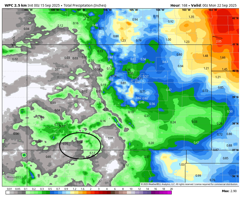
Most of this is expected Saturday and Sunday afternoons.
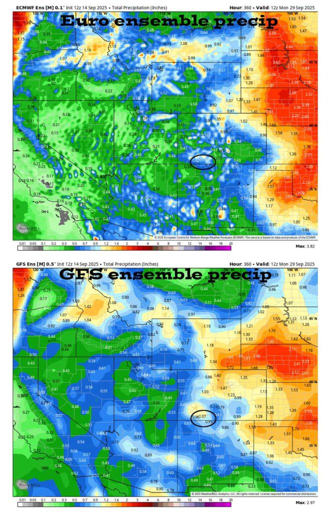
The 8-14 day period… The models are really flip-flopping for this period. We’re in the battleground between low pressure systems skirting to our north and the subtropical ridge trying to hang on to our south. It’s a typical transition season weather pattern. Stay tuned!
Unless something interesting pops up, the next post will be on Tuesday.
– Shawn


