
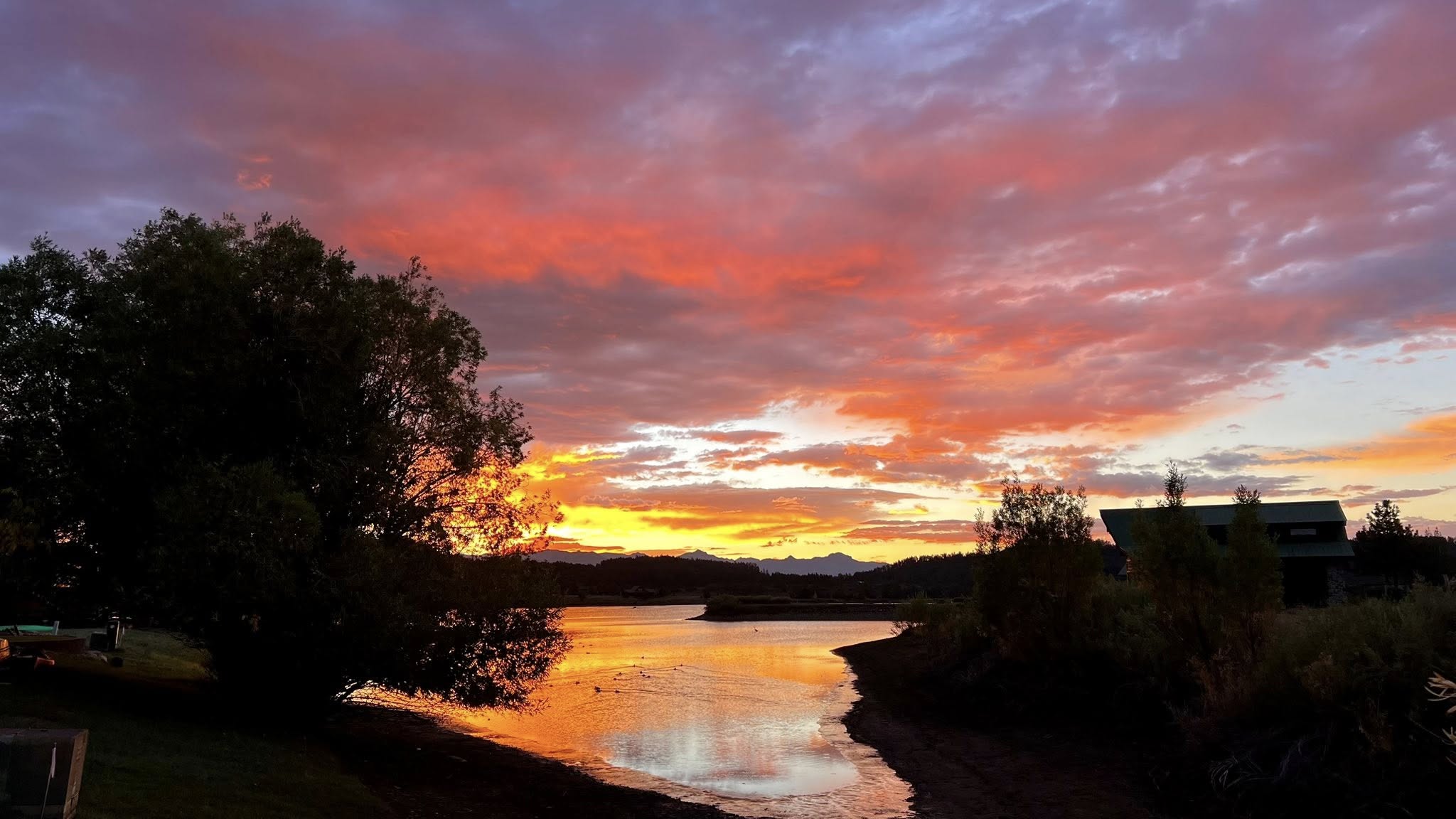
Thanks to Kathleen McFadden for getting up early this morning to capture this amazing sunrise to share with us! Picture taken on 9/16/2025
Tuesday – 16 Sep 2025 – 6:00pm
The past…
Stevens Field Observations
Monday: High: 73, Low: 36, Minimum relative humidity: 19%, Peak Wind: 20mph
Tuesday: High: 73 Low: 42, Minimum relative humidity: 20%, Peak Wind: 26mph
| Average High | Record High / Year | Average Low | Record Low / Year |
| 74 | 87 / 1956 | 35 | 25 / 1971 |
Precipitation summary… We had very isolated showers Sunday, Monday, and today, Tuesday. We only had a few reports of a trace to .02″ but mostly reports of zero.
Forecast discussion…

Water Vapor late Tuesday afternoon – Upper level low dipped into Colorado this morning and is exiting out of the northeast. The associated trough dipped into our area with a few very light rain showers this morning. Dry air is now moving in from the west.
There is nothing on radar in our area Tuesday afternoon. We had a few isolated showers in the early morning.
Forecast highlights…
*** Today through Friday there will be lots of blue sky and pleasant temps. ***
*** Saturday & Sunday: Isolated afternoon showers & thunderstorms with low precip amounts. ***
Rest of Tuesday through Friday… A ridge will slowly build over the region and give us pleasant weather with lots of blue sky!
There is some dry air advection going on and afternoon winds will be breezy, gusting to 25mph on Tuesday and Wednesday and 18mph on Thursday and Friday.
We’ll have pleasant highs in the low 70s to mid 70s. Low temperatures will be in the mid to upper 30s with those “cold-spot” low lying areas getting down toward freezing.
What is a “cold spot”? Cold spots are in low-lying areas where the coldest air sinks to. These areas can be 5 degrees colder than the slightly higher spots nearby. If your low temp is often just below my forecast low temperature range, then you live in a cold spot. It’s a good idea to protect your sensitive plants.
Saturday and Sunday… A weak trough will move through the region. We’ll see more clouds and a few spotty afternoon showers and thunderstorms. But, precipitation amounts will be low.
Winds in the afternoon will be breezy to 20mph. However, expect higher isolated gusts in the vicinity of any thunderstorms.
Highs will be in the high 60s to mid-70s and low will be in the mid-30s to mid-40s.
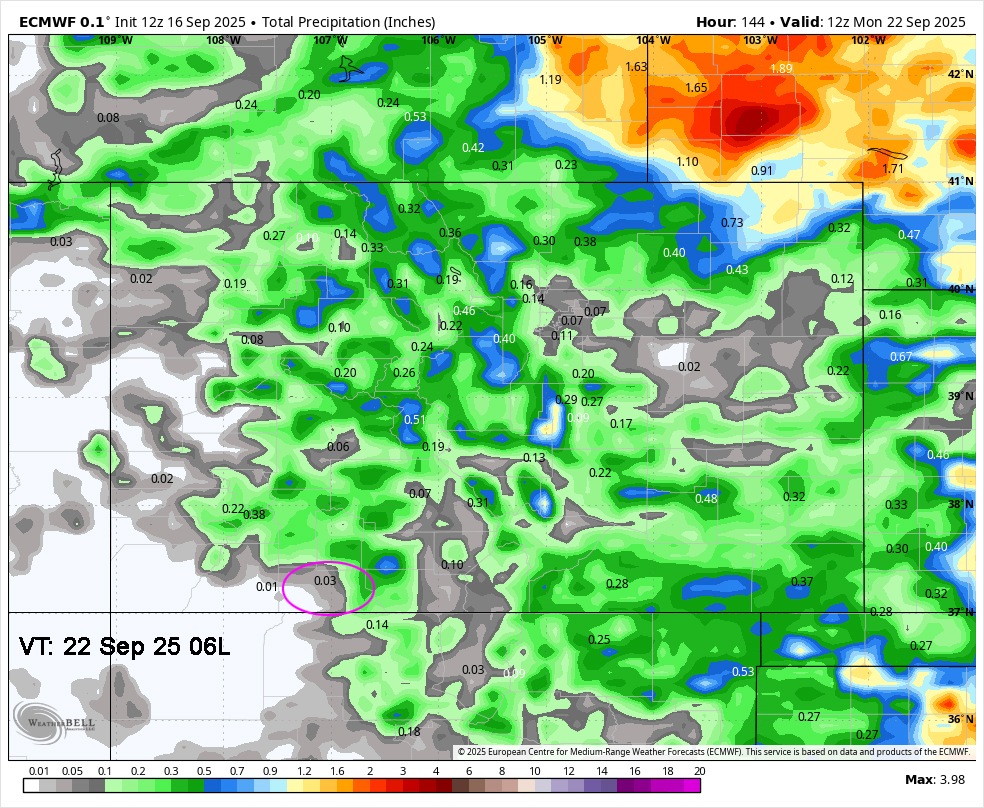
Euro precip to Monday morning shows 0.03”” near Pagosa and up to 0.7” in our mountains.
Most of this is expected Saturday and Sunday afternoons.
The 8-14 day period… The models are really flip-flopping for this period. We’re in the battleground between low pressure systems skirting to our north and the subtropical ridge trying to push in from the southwest. It’s a typical transition season weather pattern. Stay tuned!
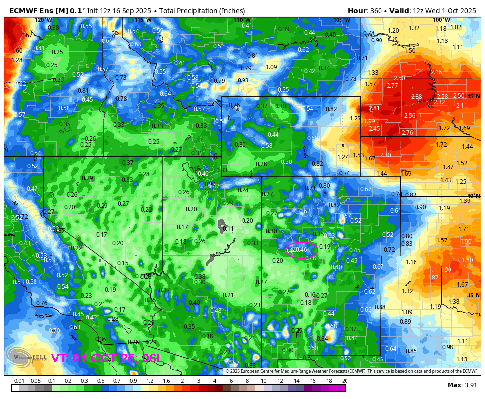
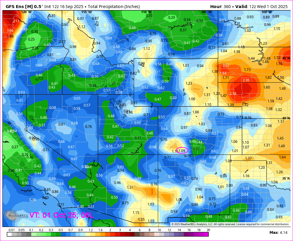
On the top, Euro ensemble precip to Oct 1st at 6am shows 0.46” in the Pagosa area. On the bottom, GFS ensemble precip shows 1.09”. That’s a big difference. I think the ridge will win so the Euro will be more accurate.
I’ll have a post out tomorrow with the detailed Colorfest forecast. Colorfest is this weekend! We’ll be briefing the pilots first thing Saturday and Sunday morning and then I’ll be going up with Rocky Mountain Balloon Adventures. I will share pictures with you!
I’ll have another full weather post out on Thursday.
– Arleen


