
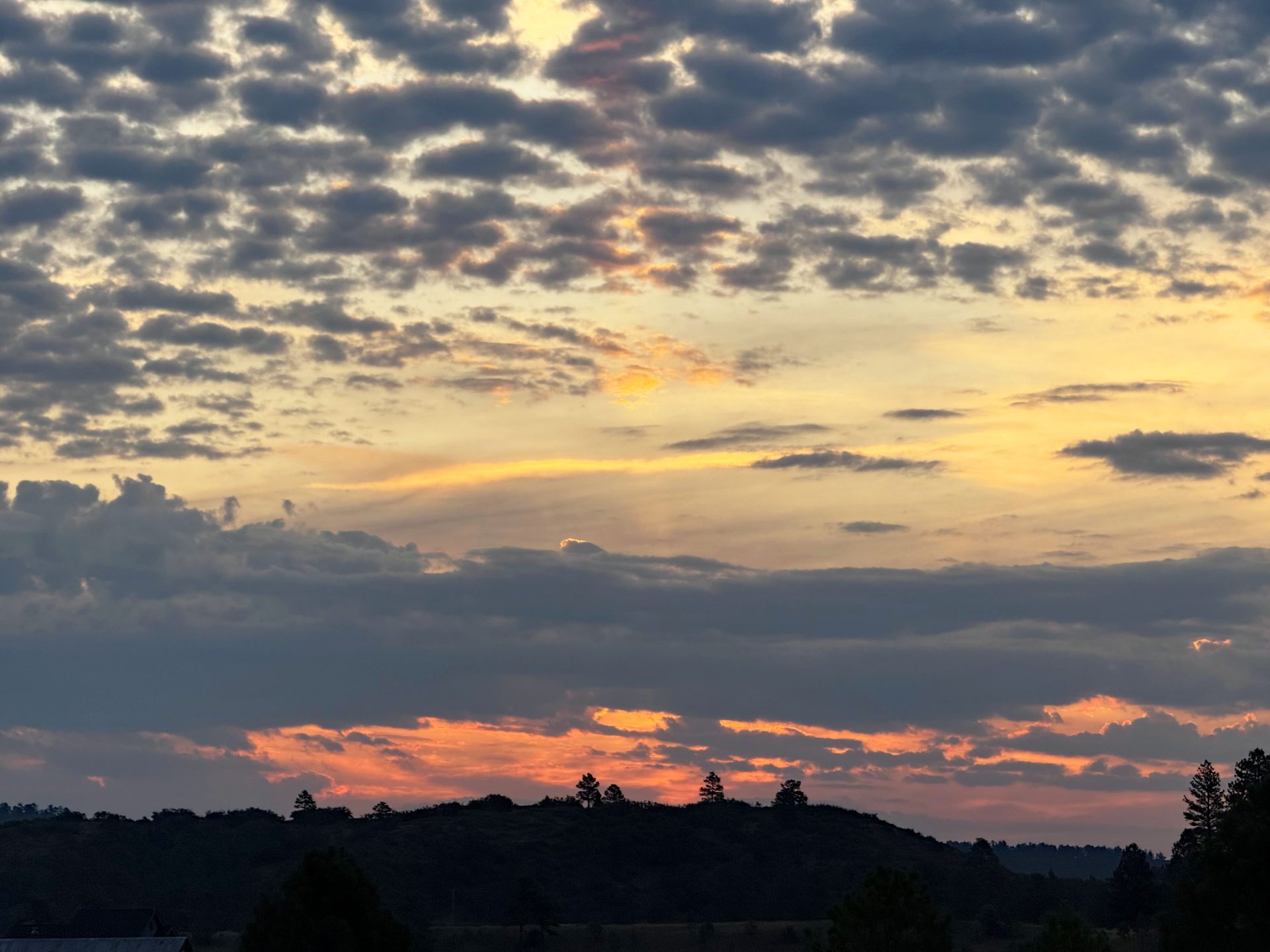
Sherbet sunrise this morning at 6:30am. All that beautiful altocumulus is moisture for afternoon storms. Pic taken 8/14/2025
Thursday – 14 Aug 2025 – 8:00pm
The past…
Steven Field Observations
Tuesday: Hi tmp: 84, Lo Tmp: 44, Min RH: 17%, DewPoint: 32, Peak Wind: 18mph
Wednesday: Hi tmp: 88, Lo Tmp: 47, Min RH: 11%, DewPoint: 27, Peak Wind: 21mph
Thursday: Hi tmp: 86, Lo Tmp: 52, Min RH: 11%, DewPoint: 25, Peak Wind: 22mph
Dew Points have been coming up slowly though we are still dry. Remember, we want to see dew-points in upper 40s for good monsoon showers.
| Average High | Record High / Year | Average Low | Record Low / Year |
| 80 | 89/ 1940 | 45 | 32 / 1950 |
Precipitation summary… There was only a trace reported from Patty in Chromo yesterday morning from a weak shower that moved through there Tuesday afternoon. There were just a few weak rainshowers over the mountains yesterday. I had 20 raindrops on the windshield when I drove over Wolf Creek Pass yesterday.
Fire and smoke…
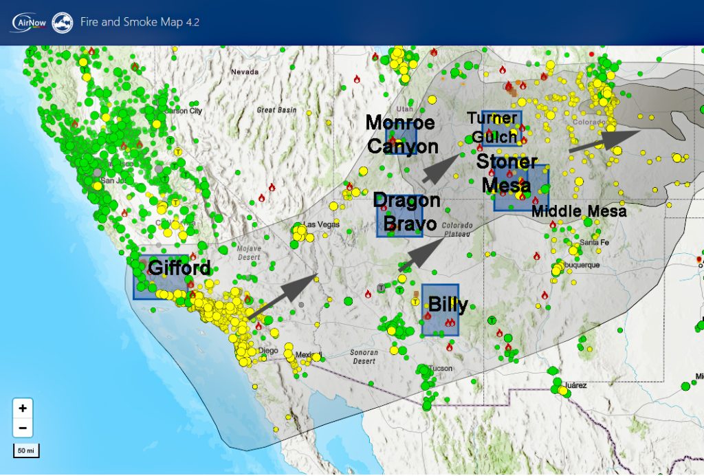
There are too many clouds on weather satellite to distinguish smoke as we have been doing.
Air quality is moderate at the Pagosa Springs Middle School sensor this afternoon with a reading of 53.
It will normally be worse at night and in the morning. As soon as the sun goes down, and we start to cool, the radiation inversion sets up – or the greenhouse effect. It is warmer a few hundred feet above us then it is at the surface. This keeps all moisture (fog) or smoke pushed down to the ground. It is amplified in low lying places such as downtown Pagosa. When we start to heat up the next day, the air lifts and fog or smoke dissipates into upper atmosphere. Unless more is coming in than dissipating.
I am sorry, but Pagosa Weather cannot do a smoke forecast. There are just entirely too many fires with erratic behavior and too many new fires popping up every day to forecast what it will be from day to day. If you are sensitive, monitor this site: Air and Smoke
The Oak Fire is at 75 acres and 73% contained. Sign up for Archuleta County Nixle system or download Watch Duty app or the Archuleta County Sheriff’s office for the latest updates.
The Middle Mesa Fire burning east of Navajo Lake just south of the CO/NM border is 5,031 acres and 92% contained. Unless something significant happens, this is the last time we will highlight this fire.
The Stoner Mesa Fire west of Rico in Dolores county is up to 7,389 acres and 0% contained.
The Dragon Bravo Fire that is in Arizona is at 144,984 acres and 56% contained.
The Gifford Fire in California is at 132,761 acres and 41% contained.
Forecast discussion…
Satellite

Satellite image: Valid Time August 14th, 7:20pm.
The subtropical ridge at long last is in place where it should be to our east. Monsoon moisture is streaming in from Mexico and up the AZ/NM border. A trof is pushing into southern California and will act as a kicker for our thunderstorm activity tomorrow.
Radar
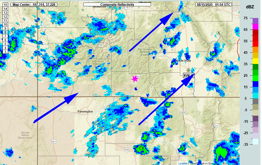
Radar valid time August 14th, 2025, 7:52pm. Isolated rainshowers moving through the southwest from the southwest.
Forecast highlights…
*** NOTE: Stage 2 Fire Restrictions are in effect for the entire San Juan National Forest!!!***
*** Stage 1 Fire Restrictions are in effect for Archuleta County and the Town of Pagosa***
*** Concerned about fire danger through the week with lots of sun, warm, dry, and breezy afternoon winds and isolated thunderstorm activity. ***
*** If you spot smoke, call Archuleta County dispatch at 970-731-2160. ***
The rest of Thursday
Mostly Cloudy with a few light rainshowers moving from the southwest to the northeast. The airfield reported a light rainshower at 5:35. We have not seen any lightning associated with these showers. But there still is a chance for an isolated thunderstorm.
Unfortunately, isolated thunderstorms also means lightning without higher relative humidities and rain. So the chances of wildfire outbreaks increases.
Temps: Highs were in mid-80s. Lows will be mid-40s.
Winds: Southwest blowing towards the northeast at 8 to 12 mph with afternoon gusts to 20mph. Variable at 5mph overnight
Friday
We have a nice mid-level monsoon moisture fetch coming up at us from the southwest. At the same time an upper level disturbance is moving at us from the west. Expect some scattered thunderstorms tomorrow. Precipitation amounts will vary considerably. Unfortunately, thunderstorms also means lightning. Even though we will be more moist, all the fuels are extremely dry. So the chances of a wildfire outbreak is good.
Temps: Highs were in upper-70s to low-80s. Lows will be mid-40s.
Winds: Southwest blowing towards the northeast at 8 to 12 mph with afternoon gusts to 20mph. Variable at 5mph overnight.

Saturday to Wednesday
There is a slight chance on for an isolated shower or thunderstorm every day. Unfortunately, isolated thunderstorms also means lightning without higher relative humidities and rain. So the chances of wildfire outbreaks increases.
Temps: Highs will be from low-80s to upper 80s. Saturday will be the coolest day of the week with upper 70s to low 80s. Lows will be mid-40s.
Winds: Winds in the morning will be variable at less than 5mph. In the mid mornings winds will switch to coming out of the southwest blowing towards the northeast at 8 to 12 mph with afternoon gusts to 20mph. As always, stronger variable, isolated gusts are likely near a shower or thunderstorm.

The 8-14 day period… A normal monsoon pattern with moisture and instability will set up after the 22nd. Expect showers and thunderstorms most afternoons. Precip amounts will vary considerably. There is the potential for a classic cold front and low to push through on the 26th.

The Euro model shows .79″ for Pagosa and up to 3″ for the mountains over the next two weeks.

The GFS model shows .92″ for Pagosa and up to 1″ for the mountains over the next two weeks.
We need a good, deep tropical moisture storm to give the southwest and the firefighters some relief.
Unless something interesting pops up, Shawn will have the next post out on Saturday.
– Arleen


