
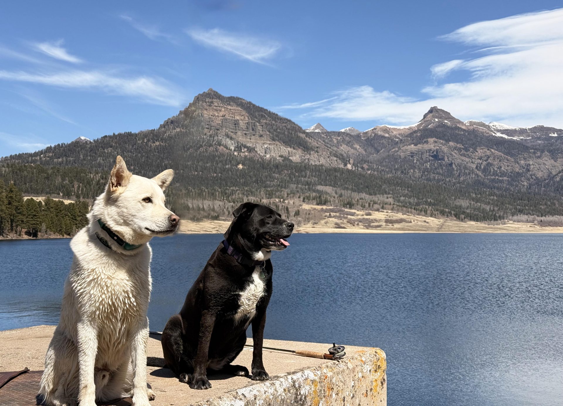
Tommy enjoying a day at the lake with one of his girlfriends, the goofy Miss Moxy.. – pic taken 4/12/2025
We had fun while it was here… “When spring came, even the false spring, there were no problems except where to be the happiest”. Ernest Heminway
Saturday – 12 Apr 2025 – 7:00pm
The past…
At Stevens Field the high temperature yesterday (Friday) was 73 and today it was 70. The low yesterday morning was 30 and this morning it was 29.
The peak wind at Stevens Field yesterday and today it has been 26mph.
| Average High | Record High / Year | Average Low | Record Low / Year |
| 58 | 75 / 1907 | 23 | 7 / 1951 |
Precipitation summary… There hasn’t been any reported precipitation in the last 48 hours.
Forecast discussion…
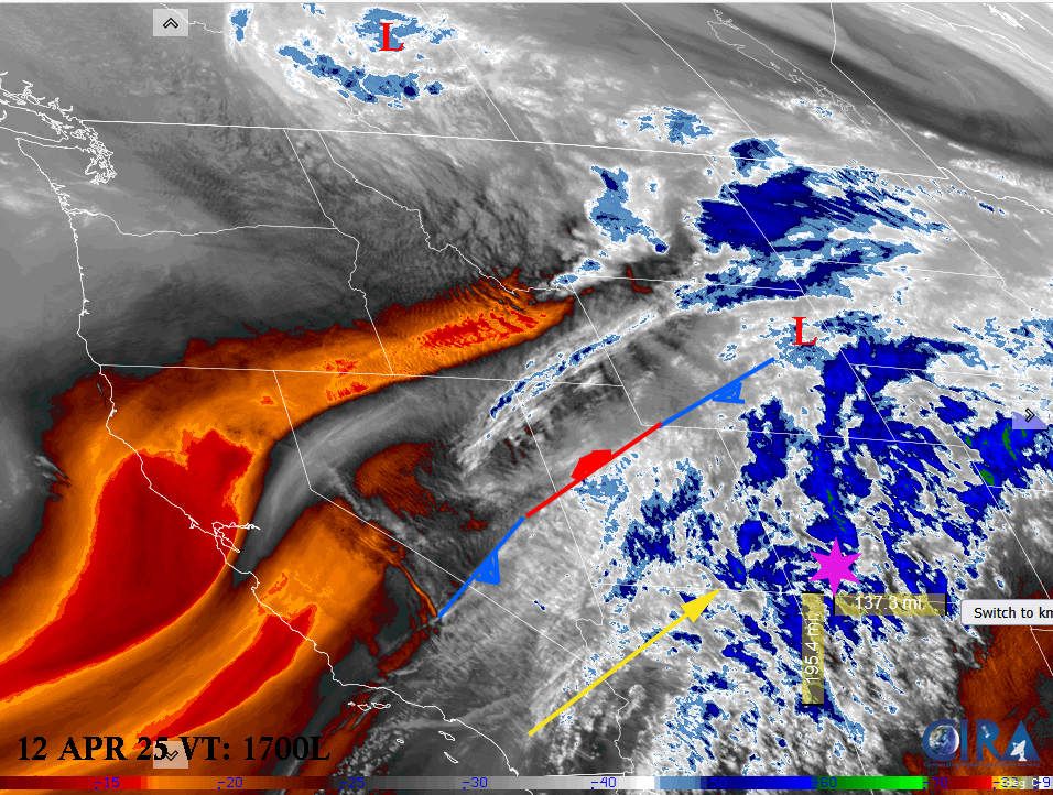
Water vapor satellite Saturday afternoon – area of low pressure anchored in Canada with a trailing frontal system into Nevada. Lots of clouds streaming into our area from the southwest.
There is nothing on radar in our area.
Forecast highlights…
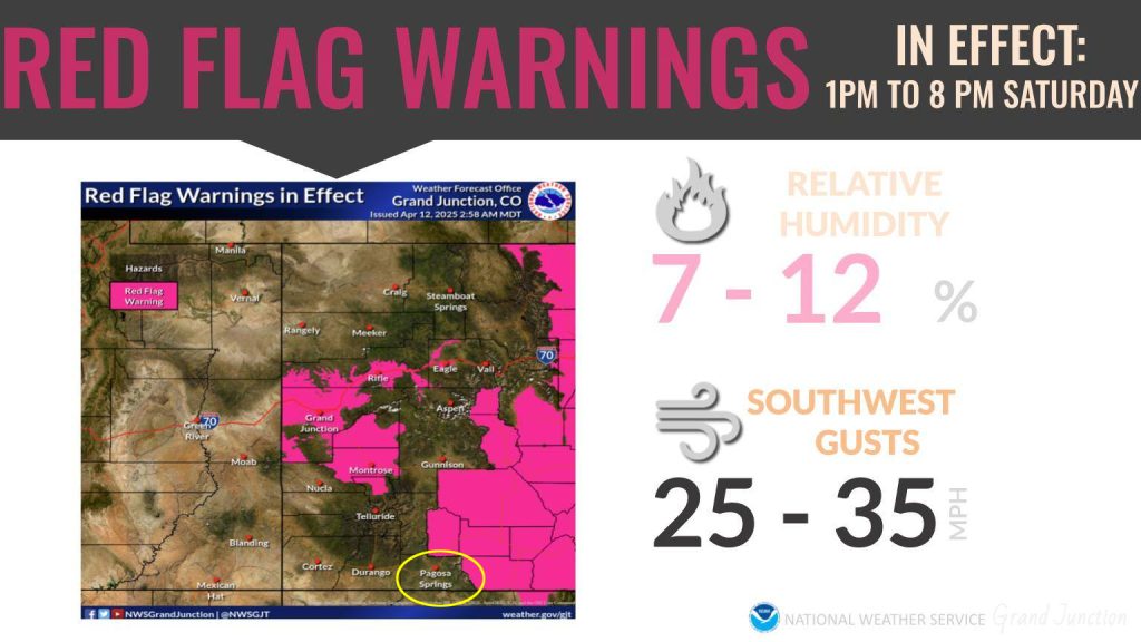
***Windy with rapid fire spread concern***
*** Slight chance of some Precip Tuesday***
*** Good chance of Precip starting Thursday ***
Rest of Saturday… Mostly Cloudy with mid and high level clouds. The ridge
Saturday Temps: Hi 20s to mid 30s. Highs mid 60s to lo 70s. It will feel like summer!
Gust to 30mph on as trough peeks into area.
Sunday and Monday: On Sunday a trough/cold front will push into northern Colorado. We’ll be mostly cloudy with mid-level and high-level clouds streaming in from the southwest. Sunday will be one of the gustiest days of the week. The precip won’t make it this far but Monday will be a bit cooler.
Winds… Spring winds! Sunday is going to be one the windiest day of the week with winds gusting up to 35mph. Wolf Creek and the divide will see gusts to 45mph.
Tuesday
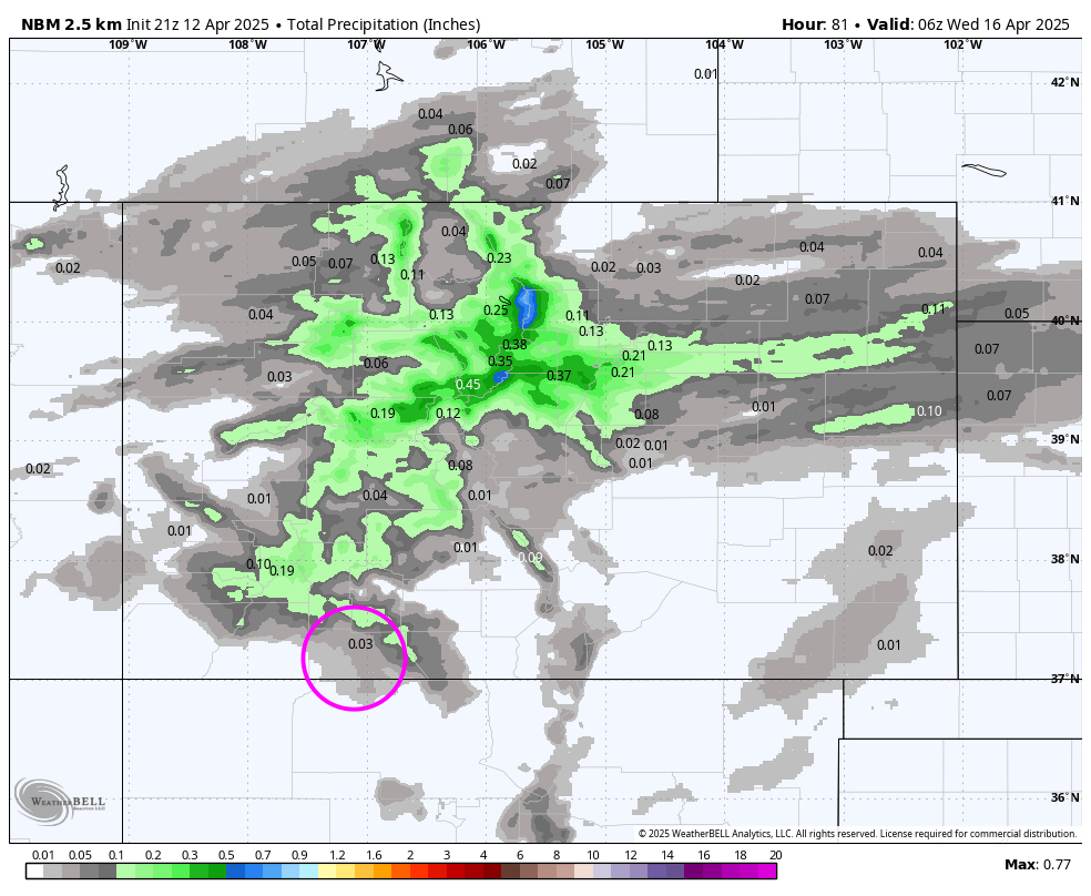
The first of two cutoff lows will move into our area from the southwest. We’ll see increasing clouds at all levels. On Tuesday afternoon we’ll see widely scattered rainshowers in the valley areas. Most areas will see just a trace to a few hundredths. There is a possibility of our first thunderstorm though it will probably be over the mountains. The mountains have the potential to see a few inches of snow Tuesday afternoon. Snow Level will be at 10,000 feet.
Lows: Hi 20s to Low 30s. Highs: Upper 60s.
Winds: Gust to 25mph both days associated with the showers in the afternoon.
Wednesday
Wednesday will be the prettiest day of the week with just partly cloudy skies.
Temps: Lows: lo 30s. Highs will be mid 60s.
Winds… Still breezy with winds gusting up to 26mph in the afternoon.
Thursday
Will start out pleasant with partly cloudy skies but with increasing clouds in the afternoon. Expected isolated afternoon showers. Snow level will be at 9,000 feet.
Temps: Lows: lo 30s. Highs will be upper 50s to lo 60s.
Winds… Gusty in the afternoon with gusts to 35mph in the afternoon.
Friday
Transition day ahead of an area of low pressure and frontal system approaching from the southwest. Will be Mostly Cloudy with clouds increasing at all levels throughout the day becoming cloudy.
Light showers will begin in the morning hours. Snow level will be at 8,000 to begin. Areas may see mixed rain and snow early changing to all rain then back in the late evening. Don’t expect any snow accumulation. The mountains could see 1 to 3 inches of snow.
Temps: Lows: lo 30s. Highs will be upper 50s to Lo 60s.
Winds… Breezy with winds gusting up to 25mph in the afternoon.
Saturday is looking to be a wet day with snow in the mountains. We’ll have all the details in the next weather post on Monday
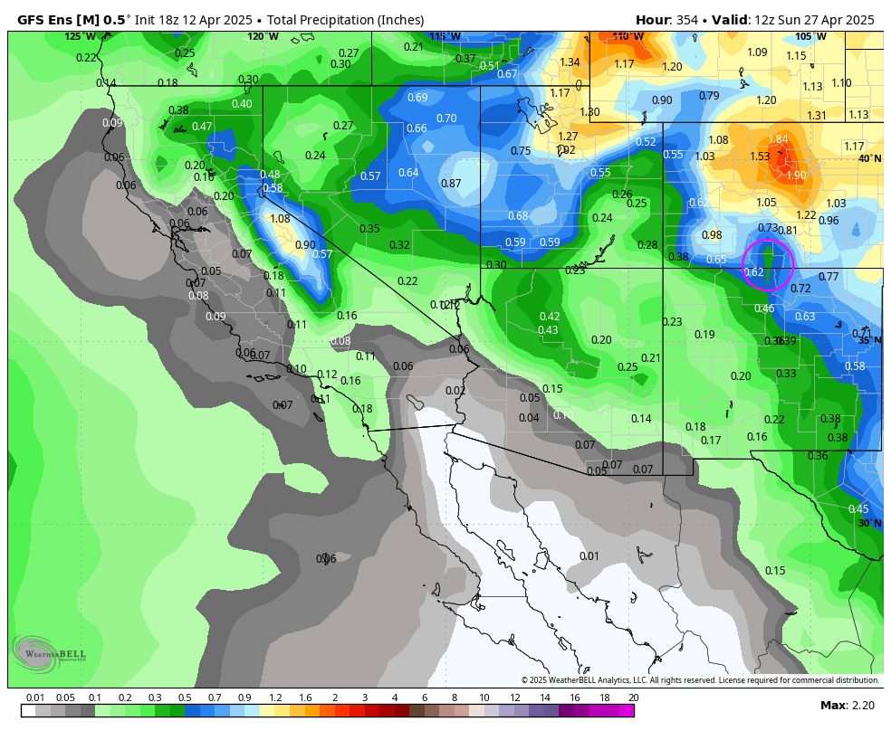
The 8-14 day period… A second cutoff low will move into the area late this week and into the weekend. Then we stay under southwest flow with occasional upper level disturbance bringing showers into the area. Precipitation has been increasing consistently with all models.
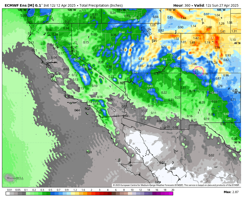
Euro ensemble precip above to 6am on 27 Apr shows 0.75” for Pagosa. The GFS ensemble precip below is close and shows .62″ for Pagosa. Though the Euro shows more for the mountains to our north. Both models are indicating a 1/2″ to 3/4″ of precipitation for our area over a week’s period of time. All models are indicating that we’ll be active starting late this Thursday as we come under a southwest flow.
Shawn will have the next forecast post will be on Monday.
– Arleen


