

Tommy’s favorite weather! – pic taken 4/3/2025
Thursday – 3 Apr 2025 – 2:45pm
The past…
At Stevens Field the high temperature on Wednesday was 41. The low this morning was 25.
The peak wind at Stevens Field on Wednesday was 26mph.
| Average High | Record High / Year | Average Low | Record Low / Year |
| 55 | 70 / 1959 | 21 | 3 / 1975 |
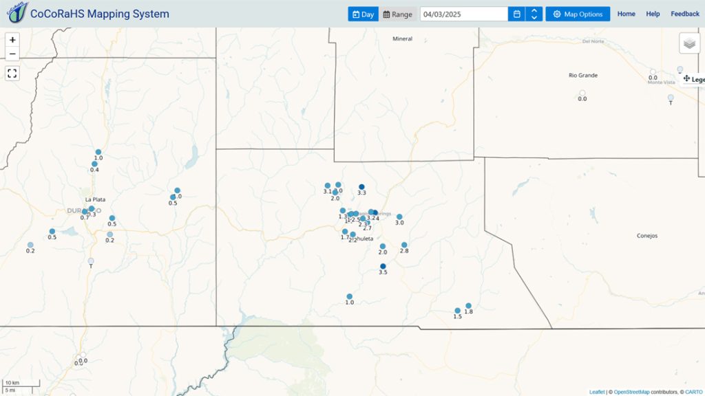
Precipitation summary… Snowshowers started falling in the area before midnight and fell on and off all night and into Thursday afternoon.
Wolf Creek reported another 9” of snow this morning to bring their storm total to 14”.
Forecast discussion…

Forecast highlights…
*** The WINTER WEATHER ADVISORY for the eastern San Juan Mountains will expire at 9pm Thursday. ***
*** Scattered snowshowers into early Thursday evening. ***
*** Another round of snowshowers Friday afternoon into Saturday evening. ***
*** Travel along the I-25 corridor could be rough Friday night into Saturday afternoon. ***
*** Lots of sun and warmer next week. ***
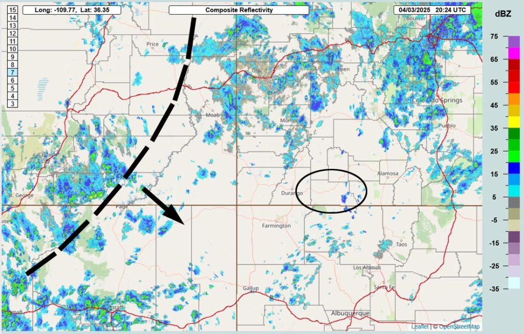
Rest of Thursday into Saturday evening… The trough is nearly stationary, extending southwest through UT and into northwestern AZ. A low is expected to form at the southern end of the trough and then move east through southern NM. I’m concerned that the best storm energy and moisture will miss us to the south, but I’m sticking with my forecast.
Into Thursday evening expect periods of sun and blue sky followed by 10-20 minute long, spotty showers with snow and graupel. Thursday night clouds will break up and temps will get chilly.
Snowshowers will ramp up again Friday afternoon into early Saturday evening, especially over the mountains. Clouds will break up and showers will end Saturday night.
Snow amounts Thursday afternoon through Friday morning…
Mountains: 1-2”
Pagosa area: up to a half inch – it will be spotty
Snow amounts Friday afternoon to early Saturday evening…
Mountains: 4-8”
Pagosa area: up to 2”
Temps…
Thursday highs will be in the low to high 30s and lows will be near 10 to near 20.
Friday and Saturday highs will be in the high 30s to mid-40s.
Friday night lows will be near 20 to near 30 and Saturday night lows will be in the mid-teens to mid-20s.
Winds… Friday and Saturday afternoons winds will peak in the 10-15mph range.
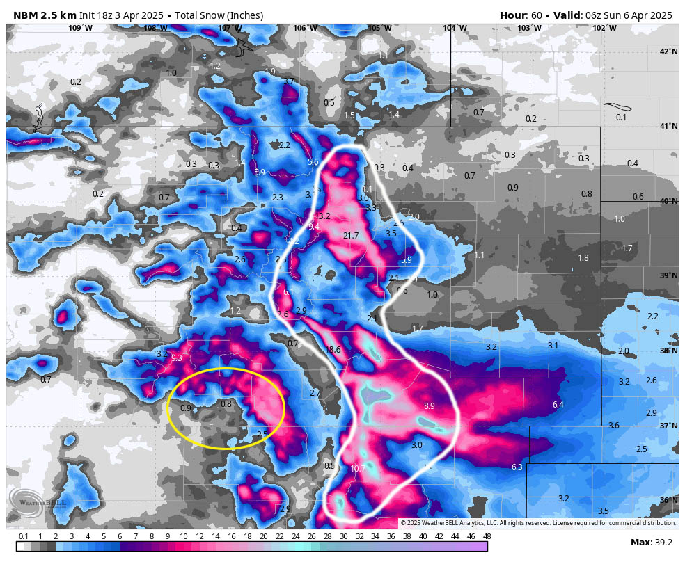
*** Travel along the I-25 corridor and Front Range could be rough Friday night into Saturday afternoon. ***
Sunday through next Friday… It looks like we will dry out and warm up. By the middle of next week, highs will be in the 60s with lots of bright blue sunny skies.
Temps…
Sunday highs will be in the mid-40s to low 50s and lows will be in the mid-teens to mid-20s.
Monday highs will be in the low to high 50s and lows will be in the low 20s to low 30s.
Tuesday highs will be in the mid-50s to low 60s and lows will be in the low 20s to low 30s.
Wednesday highs will be in the low to high 60s and lows will be in the mid-20s to mid-30s.
Thursday and Friday highs will be in the mid-60s to low 70s and lows will be in the high 20s to mid-30s.
Winds… Each afternoon winds will gust 15-20mph.
The next forecast post will be tomorrow. I finished the monthly weather summary earlier today.
– Shawn


