

Pagosa Peak poked through the clouds as the sun set yesterday – pic taken 4/1/2025
Wednesday – 2 Apr 2025 – 4:30pm
The past…
At Stevens Field the high temperature on Tuesday was 43. The low this morning was 10. The cold spots dipped into the low single digits – close to record low temps.
The peak wind at Stevens Field on Tuesday was 45mph at 1:35pm.
| Average High | Record High / Year | Average Low | Record Low / Year |
| 54 | 71 / 1959 | 21 | 1 / 1975 |
Precipitation summary… Fast-moving showers dropped a few snowflakes and graupel yesterday, but it didn’t add up to anything. Most folks reported just a trace of precip. The snow lottery winner was Leo who measured 0.3” on Catch Pole.
Wolf Creek reported another 2” this morning to bring their storm total to 6”.
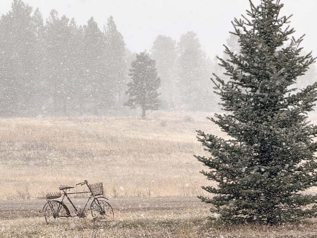
Forecast discussion…

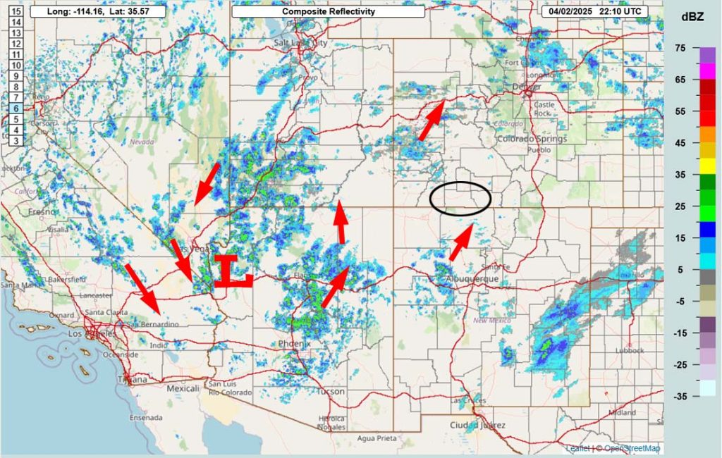
Forecast highlights…
*** Spotty snowshowers through Wednesday evening, mostly over the mountains. ***
*** The Pueblo NWS has issued a WINTER WEATHER ADVISORY for the eastern San Juan Mountains – this includes Wolf Creek and Cumbres Passes. 4-8” of snow is expected from 9pm Wednesday to 9pm Thursday. ***
*** I expect 1-2” of snow in the Pagosa area by sunrise Thursday. Roads throughout the area could get slick tonight. ***
*** Scattered snowshowers into early Thursday evening. ***
*** Another round of precip Friday afternoon into Saturday evening. ***
*** Travel along the I-25 corridor could be rough Friday night into Saturday afternoon. ***
*** Lots of sun and warmer next week. ***
Rest of Wednesday into next Sunday afternoon… The low currently spinning south of Las Vegas will move slowly east through AZ and NM over the next few days. It will spin off a couple of weak troughs that will push bands of showers through our area.
Below are the best chances for precip. Spotty showers are possible between these periods and into Sunday afternoon, mostly over the mountains.
– Wednesday night into Thursday evening
– Friday afternoon into Saturday evening
We won’t need our snowblowers and snow shovels. Temps will be in the mid-30s to low 40s each afternoon so snow will struggle to accumulate. Any snow that falls during the night will melt in the afternoons.
Snow amounts late Wednesday evening to 8am Thursday…
Mountains: 2-4”
Pagosa area: 1-2”
Snow amounts 8am to 8pm Thursday…
Mountains: 2-4”
Pagosa area: up to 1” – it will be spotty
Snow amounts Friday morning to Sunday afternoon… Most of this will fall Friday afternoon into Saturday evening.
Mountains: 4-8”
Pagosa area: up to 2”
Temps…
Wednesday night lows will be in the mid-teens to mid-20s.
Thursday highs will be in the mid-30s to low 40s and lows will be in the mid-teens to mid-20s.
Friday and Saturday highs will be in the high 30s to mid-40s.
Friday night lows will be near 20 to near 30 and Saturday night lows will be in the mid-teens to mid-20s.
Sunday highs will be in the mid-40s to low 50s and lows will be in the mid-teens to mid-20s.
Winds… Each afternoon winds will gust 15-20mph.
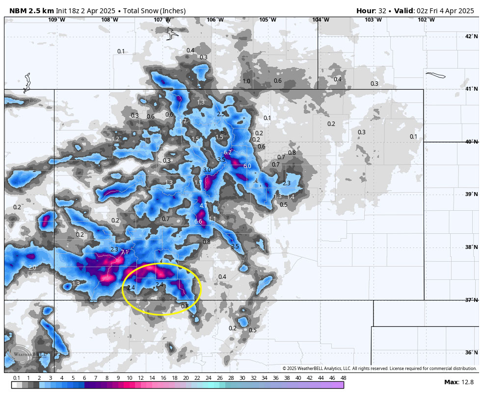
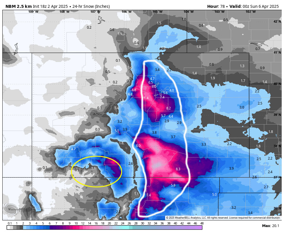
*** Travel along the I-25 corridor could be rough Friday night into Saturday afternoon. ***
The next week… It looks like we will dry out and warm up. By the middle of next week, highs will be in the 60s with lots of bright blue sunny skies.
Temps…
Monday highs will be in the low to high 50s and lows will be in the low 20s to low 30s.
Tuesday highs will be in the mid-50s to low 60s and lows will be in the low 20s to low 30s.
Wednesday highs will be in the low to high 60s and lows will be in the mid-20s to mid-30s.
Thursday and Friday highs will be in the mid-60s to low 70s and lows will be in the high 20s to mid-30s.
Winds… Each afternoon winds will gust 15-20mph.
The next forecast post will be tomorrow. I’ll finish the monthly weather summary on Thursday when the updated drought maps are released.
– Shawn


