

Nice day for a bike ride up by Williams Creek Reservoir. There should be 2 or 3 feet under those wheels! – Pic taken 1/28/2025
Wednesday – 29 Jan 2025 – 9:30am
The past…
At Stevens Field the high temperature on Tuesday was 48. The low this morning was 21.
The peak wind at Stevens Field Tuesday afternoon was 25mph.
| Average High | Record High / Year | Average Low | Record Low / Year |
| 40 | 54 / 1986 | 3 | -32 / 1909 |
Precipitation summary… There has been no recent measurable precip.
Forecast discussion…

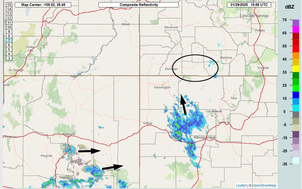
Wednesday morning we are on the northeast edge of the cloud bands. It will get more active this afternoon with a little surface heating.
Forecast highlights…
*** A WINTER WEATHER ADVISORY has been issued for the Southwest San Juan Mountains. 6-10” of snow is expected between now and 5am Thursday. *** This does not include Pagosa Springs.
*** Lots of sun, dry, and a warming trend Friday through next Wednesday. ***
*** The next storm is possible next Thursday and Friday (6-7 Feb). ***
Wednesday afternoon through Thursday morning… The low will move through northern NM. It’s moving slower than expected so I’m adjusting the timing. The best storm energy and moisture will be over us Wednesday afternoon to early Thursday morning.
Timing… Scattered snowshowers will gradually increase, especially near and over the mountains, through the rest of the morning. Most of the snow will fall Wednesday afternoon into early Thursday morning. Scattered snowshowers will taper off near Pagosa early Thursday morning but could persist over the mountains to around noon on Thursday.
Roads… Wolf Creek Pass will be slick most of this period. In the lower elevations, temps will be above freezing during the period of heaviest snowfall. If we’re lucky, most roads near Pagosa will just be wet or slushy during the day on Wednesday. Wednesday evening, starting around sunset, roads could ice up across the region.
Snow amounts…
Mountains: 6-10”
Pagosa area: 2-4”
Chromo and Chama areas: 3-6”
Temps… Wednesday and Thursday highs will be in the low to high 30s. Wednesday night lows will be in the mid-teens to mid-20s. Thursday night lows will be in the high single digits to the mid-teens.
Winds… Afternoon peaks will be around 15mph.

I think this is a little high for Pagosa due to temps above freezing.
Thursday afternoon through Tuesday… The storm track will shift back to our north. We’ll see a lot of blue sky and temps will warm to above average.
Clouds will increase Tuesday as the ridge moves east and upper-level southwest flow increases.
Temps…
Thursday highs will be in the mid-30s to low 40s and lows will be in the high single digits to the mid-teens.
Friday and Saturday highs will be in the mid-40s to low 50s and lows will be in the low teens to low 20s.
Sunday highs will be in the high 40s to mid-50s and lows will be in the mid-teens to the low 20s.
Monday and Tuesday highs will be in the low to high 50s and lows will be in the mid-teens to mid-20s.
Winds… Afternoon peaks will be 10-15mph each day.
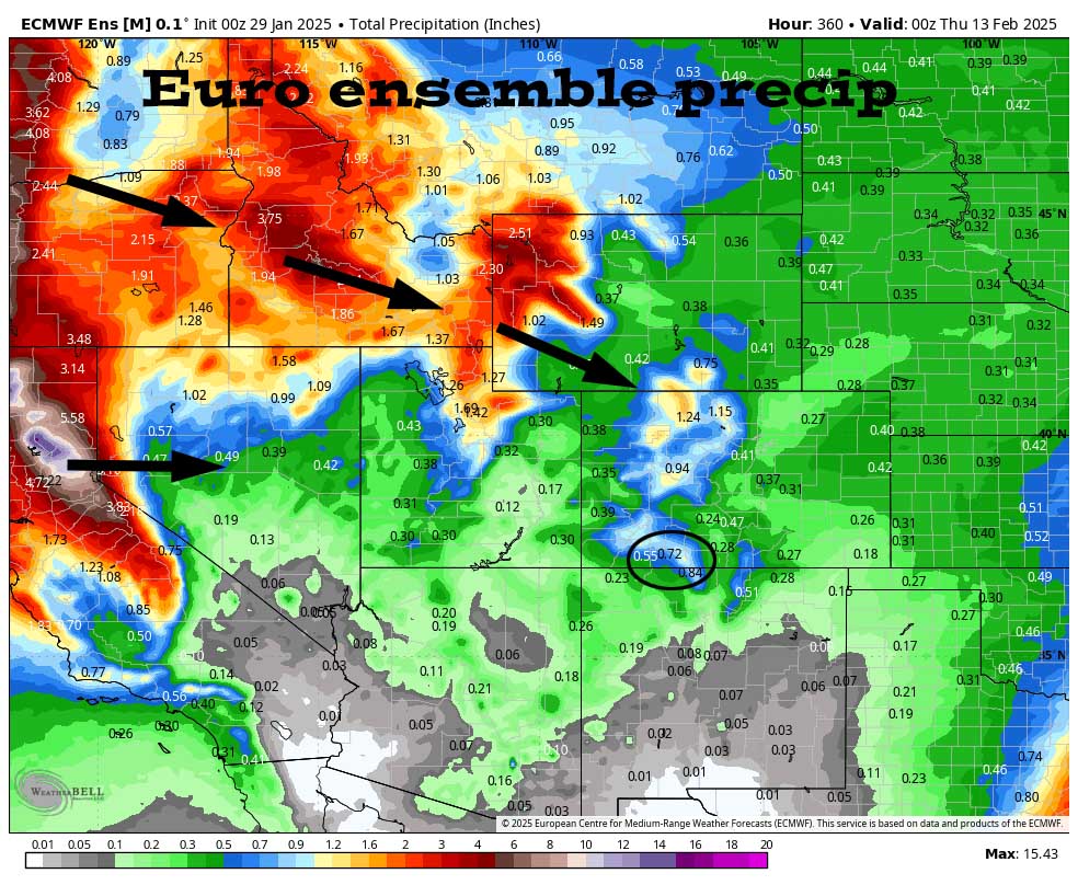
8-14 day period… Things are trying to line up for the next storm to move through Thursday and Friday next week (6-7 Feb). It’s too far out for details, but it doesn’t look impressive and could be warmer with higher snow levels.
It looks like the pattern will stay active. Nothing looks impressive now, but there’s plenty of time for something to develop into a good storm.

I’ll do a quick Facebook post first thing tomorrow morning and then I’m headed up to Wolf Creek for some powder turns! Unless there is a significant change to my forecast, the next forecast post will be Friday afternoon.
– Shawn


