

Our snowman hopes to get real snow soon – Pic taken 11/24/2024
Sunday – 24 Nov 2024 – 4:45pm
The past…
At Stevens Field the high temperature Saturday afternoon was 56 and Friday it was 58 – just 2 degrees shy of the record. The low this morning was 24.
The peak wind at Stevens Field on Saturday was 12mph and at Lobo Overlook the peak wind was 45mph at 9:55pm.
| Average High | Record High / Year | Average Low | Record Low / Year |
| 46 | 61 / 1943 | 13 | -20 / 1931 |
Precipitation summary… There has been no recent measurable precip.
Forecast discussion…
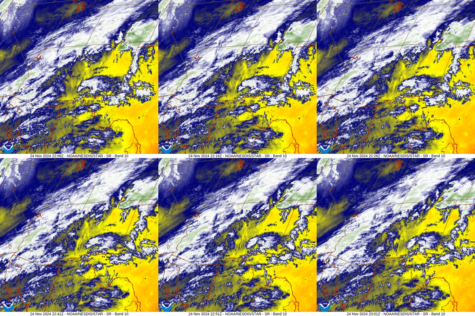
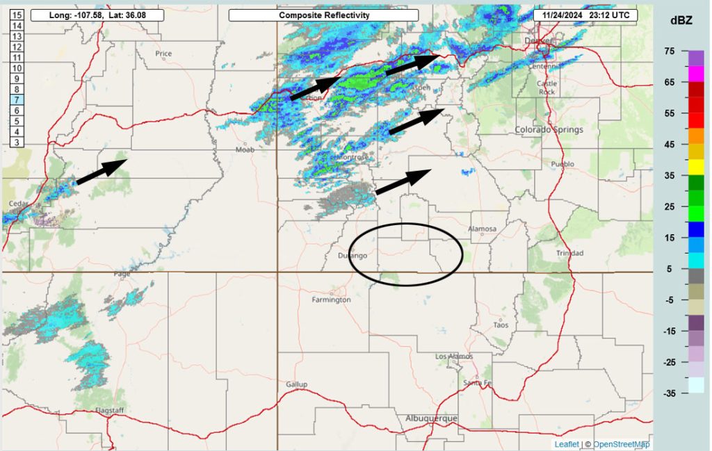
Forecast highlights…
*** Light spotty precip Sunday evening through Monday evening. ***
*** The Pueblo NWS has issued a WINTER STORM WATCH for the eastern San Juan Mountains above 10,000ft – this includes Wolf Creek Pass. Up to 28” of snow and winds gusting to 50mph are possible Monday evening through Wednesday evening. Expect poor travel conditions, especially in the mountains. ***
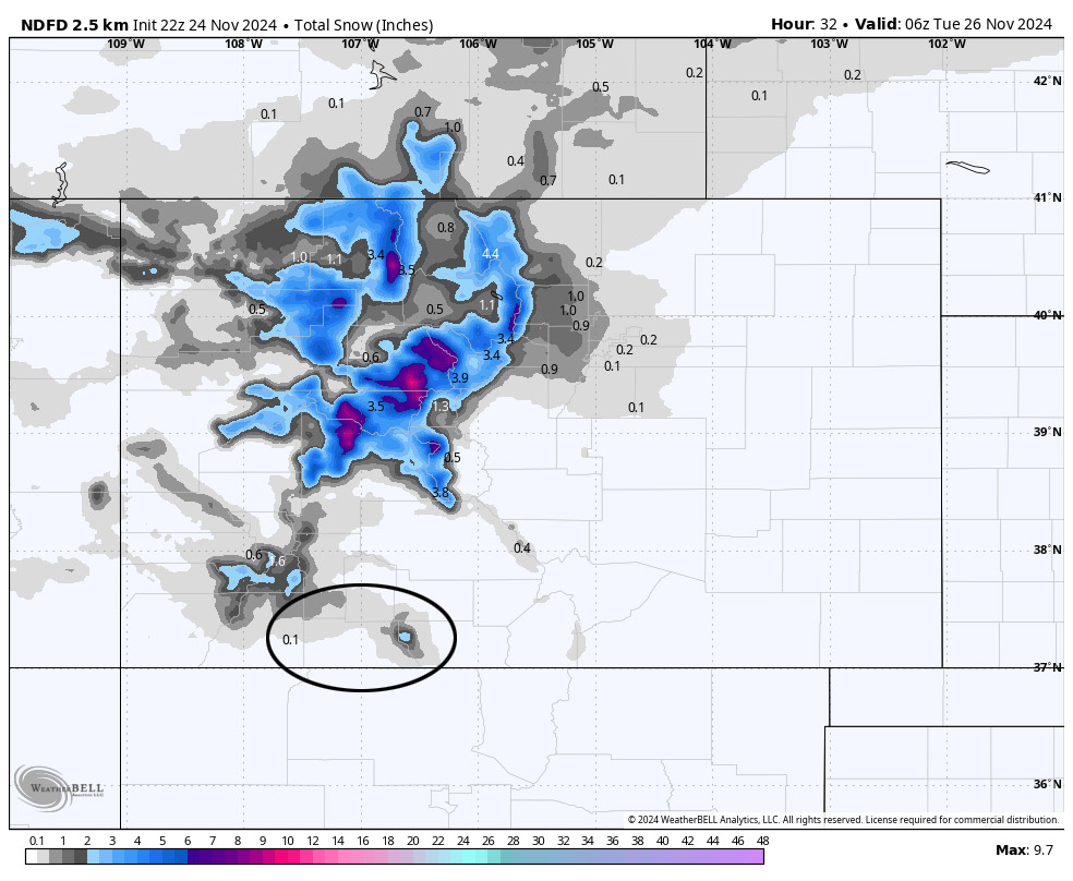
Sunday evening through Monday evening… The first surge of moisture will move through the region. The best storm energy will stay to our north. We’ll see lots of clouds and a few spotty showers, mostly over the mountains. Most of this period will be dry.
Snow levels…
Sunday night: 8,000ft dropping to 6,500ft
Monday day: 7,000-7,500ft
Snow amounts…
Mountains: a dusting to 2”
Valley: lucky spots could get a dusting
Winds… Gusts will be 15-20mph and 40-50mph in the mountains.
Temps… Sunday night lows will be in the mid-20s to low 30s. Highs Monday will be in the low 40 to high 40s and lows will be in the low to high 20s.
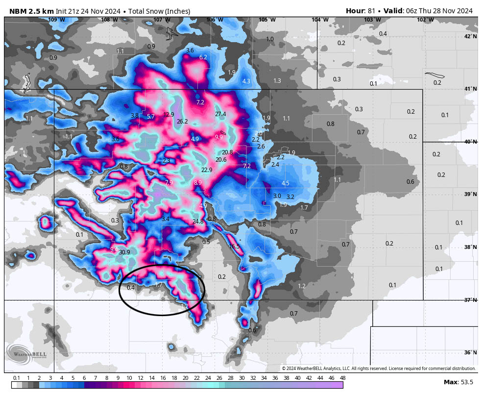
Monday night through Wednesday evening… The main band of moisture and storm energy will be over us. However, there are two strikes against us for getting a big snow event:
1. The storm will be “warm” with snow levels around 8,500ft for much of the event. Snow up at Wolf Creek will be wet and dense. Snow that falls in the valley will struggle to accumulate.
2. Upper-level winds will be out of the west-southwest. This is just ok for us. Southwest is more ideal.
Timing… Scattered snowshowers will start in the mountains late Monday evening. In the valley, scattered showers will start early Tuesday morning. The heaviest precip will fall in waves from sunrise Tuesday to early Wednesday afternoon. *** Driving conditions will be poor in the mountains during this period. *** Scattered showers will decrease Wednesday evening.
Snow levels…
Monday night: 6,500ft rising to around 7,200ft by sunrise
Tuesday day: rising to around 9,000ft
Tuesday night: around 8,500ft
Wednesday day: around 8,000ft
Wednesday night: dropping to around 6,000ft
Snow amounts…
Mountains: 18-24”
Valley above 8,000ft: 2-4”
Valley below 8,000ft: a dusting to 2”
Winds… Gusts will be 15-25mph.
Temps… Lows Monday night will be in the mid-20s to low 30s. High Tuesday will be in the high 30s to mid-40s and lows will be in the high 20s to mid-30s. Highs Wednesday will be in the high 30s to mid-40s and lows Wednesday night will be 10-20.
Wednesday night through Saturday… The trough will be to our east and upper-level flow will be out of the northwest. We’ll be dry most of this period, but cold air advection and cyclonic flow could give us a few spotty snowshowers, mostly over the mountains.
Snow amounts…
Mountains: 1-3”
Valley: a dusting in a few lucky spots
Winds… Afternoon peaks will be 10-15mph
Temps… Low Wednesday night will be 10-20. Thursday and Friday highs will be in the mid-30s to low 40s and lows will be in the high single digits to high teens. Saturday highs will be in the high 30s to mid-40s and lows will be in the low teens to low 20s.
The 8-14 day period… A blocking pattern will try to set up to our west. We could be dry for a while.

The temp outlook on the bottom expects a 50-60% chance of above average temps. I agree.
I have a busy day tomorrow, but I’ll try to get a post out in the evening.
– Shawn


