

Love these incredible reflections on Williams Creek Reservoir – Pic taken 11/21/2024
Friday – 22 Nov 2024 – 1:30pm
The past…
At Stevens Field the high temperature Thursday afternoon was 54. The low this morning was 17. The cold spots dipped into the mid-single digits.
The peak wind at Stevens Field on Thursday was 9mph and at Lobo Overlook the peak wind was 21mph.
| Average High | Record High / Year | Average Low | Record Low / Year |
| 46 | 60 / 1989 | 12 | -8 / 1985 |
Precipitation summary… There has been no recent measurable precip.
Forecast discussion…
There is nothing on radar around noon on Friday.
Forecast highlights…
*** Light spotty precip Sunday evening through Monday evening. ***
*** Main event Monday night through Wednesday afternoon. Expect poor travel conditions, especially in the mountains. ***
*** Light spotty precip Wednesday evening through Thursday afternoon. ***
Rest of Friday through Sunday afternoon… Friday the ridge will remain in control and give us a lot of blue sky, light winds, and temps 10 degrees above average.
Saturday the ridge will move to our east. We’ll see a few more clouds, slightly stronger winds, and temps will be a few degrees cooler.
Sunday clouds and winds will increase as the first trough approaches northern Colorado.
Winds… Friday afternoon peaks will be around 10mph. Saturday afternoon peaks will be 10-15mph. Sunday afternoon gusts will be 15-25mph.
Temps… Highs Friday will be in the mid-50s to low 60s and lows will be in the mid-teens to mid-20s. Highs Saturday will be in the low to high 50s and lows will be in the high teens to mid-20s. Sunday afternoon highs will be in the mid-40s to low 50s and lows Sunday night will be in the low 20s to low 30s.
Sunday evening through Monday evening… The first surge of moisture and storm energy will stay to our north. We’ll see more clouds and a few spotty showers mostly over the mountains. Most of this period will be dry.
Snow levels…
Sunday night: 8,000ft dropping to 7,000ft
Monday day: around 7,500ft
Snow amounts…
Mountains: a dusting to 2”
Valley: lucky spots could get a dusting
Winds… Gusts will be around 15mph.
Temps… Highs Sunday will be in the mid-40s to low 50s and lows will be in the mid-20s to low 30s. Highs Monday will be in the low 40 to high 40s and lows will be in the mid-20s to low 30s.
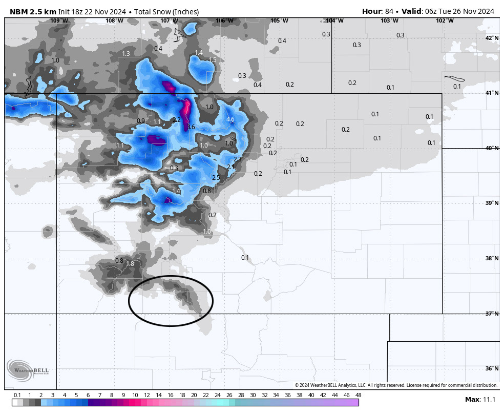
The northern CO mountains are favored for the first round.
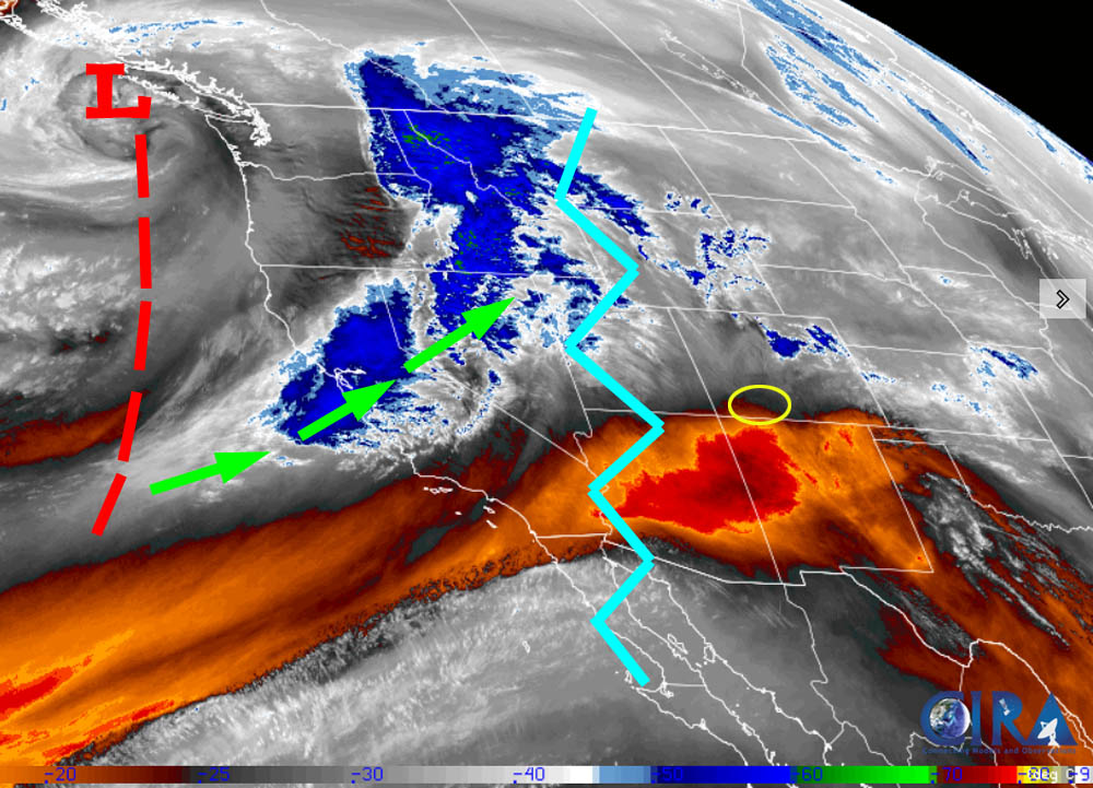
Monday night through Wednesday afternoon… The main band of moisture and storm energy will be over us. However, there are two strikes against us for getting a big snow event:
1. The storm will be “warm” with snow levels 8,000-8,500ft for much of the event. Snow up at Wolf Creek will be wet and dense. Snow that falls in the valley will struggle to accumulate.
2. Upper-level winds will be out of the west-southwest. This is just ok for us. Southwest is more ideal.
Snow levels…
Monday night: around 7,500ft
Tuesday day: rising to around 8,500ft
Tuesday night: around 8,000ft
Wednesday day: around 8,000ft
Snow amounts…
Mountains: 12-20”
Valley above 8,000ft: 2-4”
Valley below 8,000ft: a dusting to 2”
Winds… Gusts will be 15-20mph.
Temps… Lows Monday night will be in the mid-20s to low 30s. High Tuesday will be in the high 30s to mid-40s and lows will be in the high 20s to mid-30s. Highs Wednesday will be in the mid-30s to low 40s and lows Wednesday night will be in the high teens to high 20s.

Wednesday evening through Thursday evening… The trough will be to our east. Cold air advection and cyclonic flow will give us a few spotty snowshowers, mostly over the mountains. Upper-level flow will out of the northwest and drier so snow amounts will be light.
Snow amounts…
Mountains: 1-3”
Valley: up to 1” in the lucky spots
Winds… Afternoon peaks will be 10-15mph
Temps… Low Wednesday night will be in the high teens to high 20s. Thursday highs will be in the mid-30s to low 40s and lows will be in the mid-teens to mid-20s.
Friday and beyond… A blocking pattern will try to set up to our west. We could be dry for a while.
The next post will be on Sunday. I’ll try to do a post every day this week.
– Shawn


