
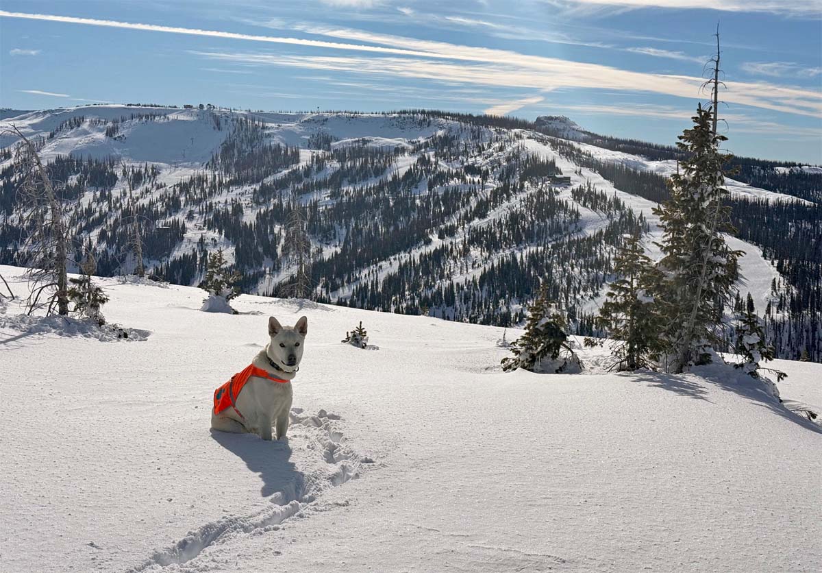
Happy snow pup admiring a great view of Wolf Creek – Pic taken 11/10/2024
Thursday – 14 Nov 2024 – 9:45am
The past…
At Stevens Field the high temperature Wednesday afternoon was 48. The low this morning was 21. The cold spots dipped into the mid-teens.
The peak wind at Stevens Field on Wednesday was 8mph.
| Average High | Record High / Year | Average Low | Record Low / Year |
| 50 | 65 / 1990 | 17 | -10 / 1950 |
Precipitation summary… There has been no recent measurable precip.
Forecast discussion…
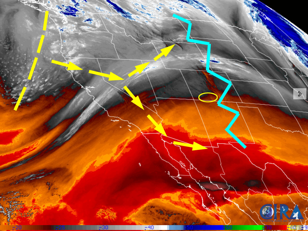
There is nothing on radar in our area Thursday morning.
Forecast highlights…
*** Dry through Saturday. ***
*** Windy on Friday. ***
*** The next system looks like a dud for us. We could be dry for a while. ***
Rest of Thursday through Saturday… Thursday a transient ridge will give us lots of blue sky. Friday and Saturday clouds will increase ahead of the next trough. A few spotty snowflakes are possible in the mountains Saturday.
Temps will be near seasonal averages through Friday and then drop 5-10 degrees below average on Saturday.
Winds… Thursday afternoon winds will be 10-15mph. *** Friday afternoon gusts in the valley will be 25-35mph, and along mountain ridges gusts to 50mph are possible. *** Saturday afternoon gusts will be 20-25mph.
Temps… Thursday and Friday highs will be low to high 50s and lows will be in the high teens to mid-20s. Saturday highs will be around 40 to the high 40s and lows will be in mid-teens to mid-20s.
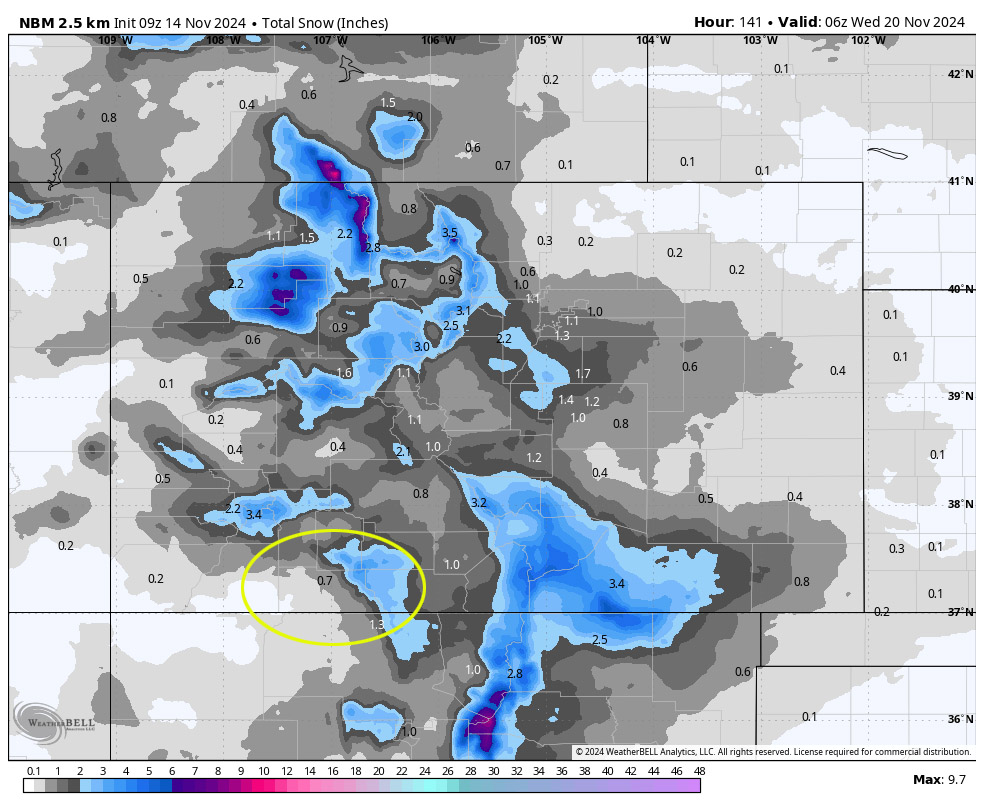
Sunday through Tuesday… A broad trough will move through with some of the energy going to our north and some to the south – split flow. We’ll see more clouds and a few spotty showers. The best chance for precip is Tuesday. Precip amounts will be minimal.
Snow forecast…
Mountains: 1-2”
Valley: up to a half inch in the lucky spots
Winds… Afternoon gusts will be 10-20mph
Temps… Sunday and Monday highs will be near 40 to the high 40s and lows will be in the mid-teens to mid-20s. Tuesday highs will be in the mid-30s to low 40s and lows will be in the high single digits to high teens.
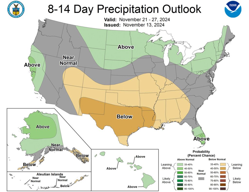
The 8-14 day period… Upper-level flow will be from the west and northwest. For us, it’s what I call “the scraps pattern”. The coastal mountains get most of the most moisture while we just get scraps.

The next post will be on Saturday.
– Shawn


