

Happy pup in the snow! – Pic taken 11/6/2024
Wednesday – 6 Nov 2024 – 4:30pm
The past…
At Stevens Field the high temperature on Wednesday was 28 and the low this morning was 25.
The peak wind at Stevens Field on Wednesday was 10mph.
| Average High | Record High / Year | Average Low | Record Low / Year |
| 55 | 70 / 1950 | 19 | 4 / 1943 |
Precipitation summary… Snow started slowly yesterday evening and ramped up overnight and into the morning. Wolf Creek reported 14” of new snow and another 5″ fell during the day bringing their total to 19″.

Forecast Discussion…

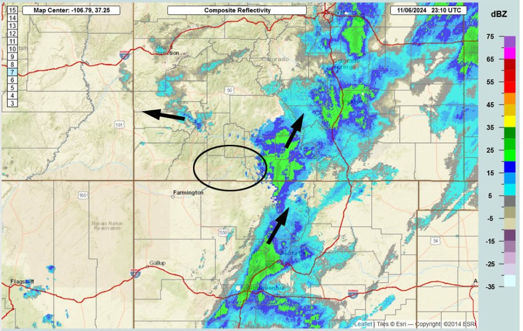
Forecast highlights…
*** The WINTER WEATHER ADVISORY for the eastern San Juan Mountains above 10,000ft, which includes Wolf Creek Pass, will expire 11pm Wednesday. ***
*** Snowshowers will decrease Wednesday evening but not end. Expect poor driving conditions, especially in the mountains. ***
*** Scattered snowshowers will persist Wednesday night into Friday evening. ***
Thanks to The Springs Resort for sponsoring this snow storm!
Rest of Wednesday… A strong low-pressure system is near the Four Corners and will continue to move south along the AZ/NM border over the next 24 hours. Snow showers will decrease in our area due to upper-level flow more from the southeast, but the showers won’t end.
Snow amounts for this period…
Mountains above 9,000ft: 3-6”
Valley: up to 1″
Winds… Gusts will be 15-25mph.
Temps… Highs Wednesday will be near 30 to the high 30s and lows Wednesday night will be in the low teens to low 20s.
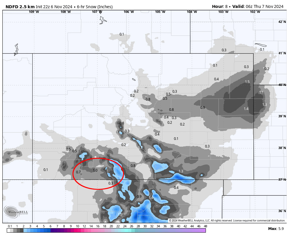
Wednesday night through Friday evening… The low will take a similar track to the previous one. This means the low will be to our south and we’ll see a similar pattern with hit and miss snowshowers. Accumulating snow will come in spurts and will be spotty.
Snow levels…
Wednesday night: 4,000-4,500ft
Thursday: 5,500ft rising to 6,500ft
Thursday night: around 6,000ft
Friday: 7,000-7,500ft
Snow amounts during this period…
Wolf Creek area: 5-10”
Valley: 1-3” – it will fall spurts
Winds… Gusts Thursday afternoon will be 15-20mph. Friday afternoon peak winds will be 10-15mph.
Temps… Lows Wednesday night will be in the mid-teens to low 20s. Highs Thursday will be in the mid-30s to low 40s and lows Thursday night will be in the mid-teens to low 20s. Highs Friday will be near 40 to the high 40s and lows Friday night will be in the low teens to low 20s.
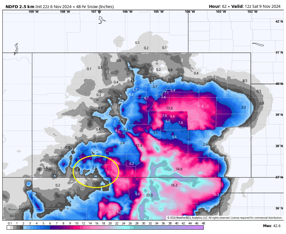
Southeast CO and northeast NM are going to get hammered. Expect road closures along parts of I-25.
Saturday through Monday… Ridging will build over the region. We’ll see a lot of blue sky and temps will gradually warm closer to season averages.
Winds… Afternoon peaks will be 10-15mph
Temps… Highs will be in the mid-40s to low 50s and lows will be in the mid-teens to mid-20s.
Tuesday and Wednesday… The next system could move through 12-13 Nov. Right now it doesn’t look too impressive – a few spotty snowflakes in the valley and an inch or two in the mountains.
Winds… Tuesday afternoon gusts will be 15-25mph and on Wednesday gusts will be around 15mph.
Temps… Highs will be in the low to high 40s and lows will be in the mid-teens to mid-20s.
My next post will be on Thursday.
– Shawn


