
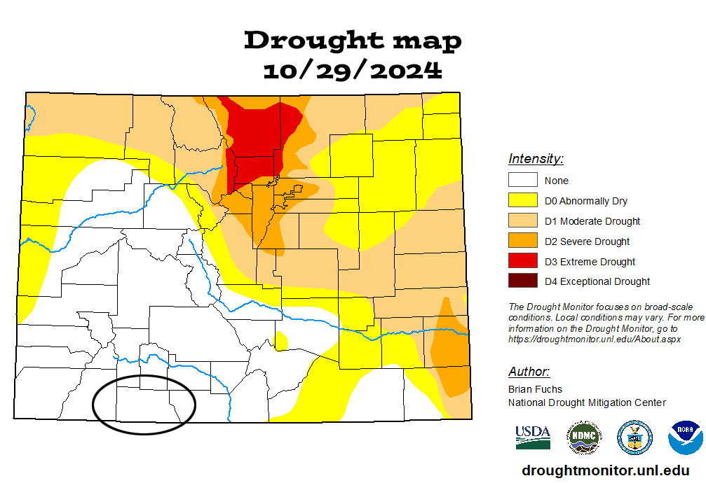
The drought map still looks good for southwest Colorado
Tuesday – 5 Nov 2024 – 7pm
October Summary…
The average high for October is 63 and the average low is 26. The record high of 85 occurred on 14 October 1940. The record low of -5 occurred on 21 October 1910. October precip averages 2.27″ and average snowfall is 3.2″. Wolf Creek Pass averages 4.39″ of precip and 26.7″ snow.
At Stevens Field the highest temp was 79 on 1 and 3 October and the lowest temp was 20 on 31 October.
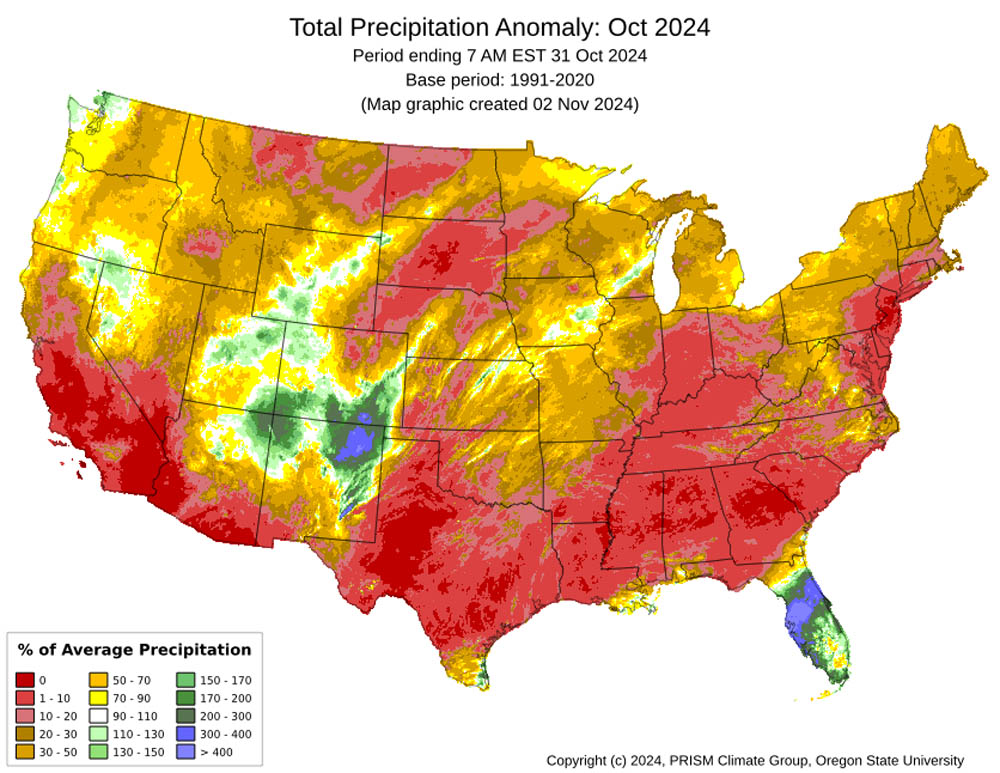
How did we do?



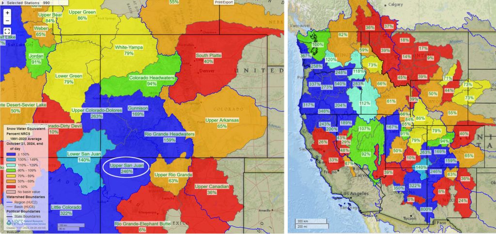
Snowpack and Drought…
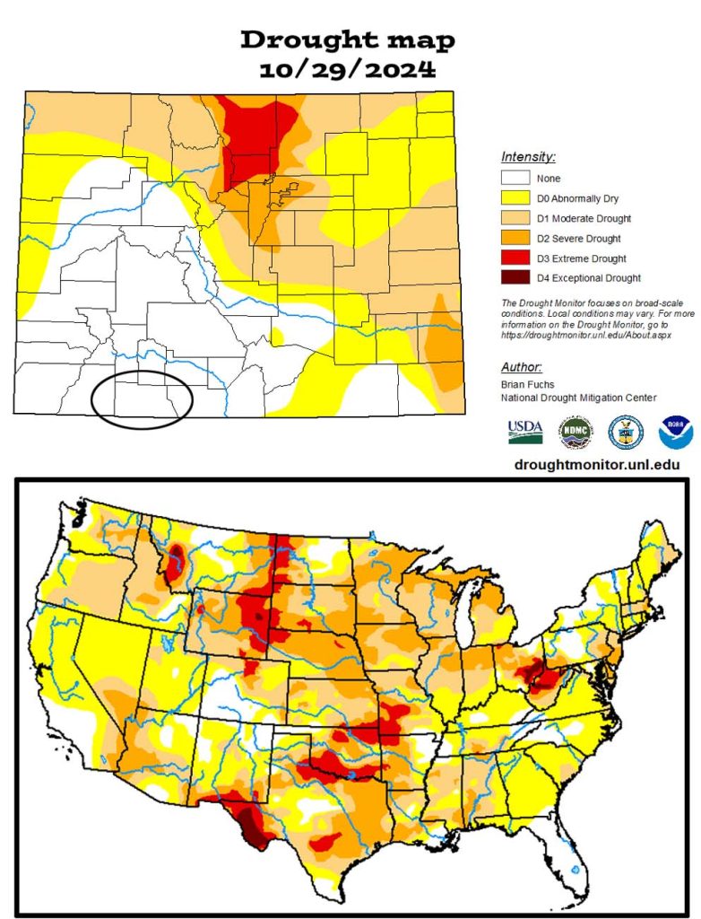
The US drought map on the bottom shows that much of the country is experiencing drought conditions.
November outlook…
The average high for November is 49 and the average low is 16. The record high of 75 occurred on 2 November 1945. The record low of -18 occurred on 17 November 1907. November precip averages 1.62″ and average snowfall is 10.0″. Wolf Creek Pass averages 4.13″ of precip and 54.5″ snow.
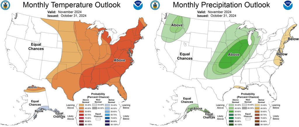

And what do we expect?
Arleen is the expert, and this is what she says…
November outlook… November is looking to build a good base of snow for the winter. The Madden Julian is active and will impact us this week. The ENSO is still neutral so the polar front jet with associated fronts and weather is progressing around the northern hemisphere rather than getting stuck. We’ll see above average precipitation and snow for the month and average temperatures.
A HUGE thanks for your precip reports and pictures! Reports help verify our forecasts and make us better forecasters.
Another HUGE thanks to our donors and sponsors! You help cover the cost of this web page and our weather subscriptions, necessary to provide you accurate weather reports!
- Shawn


One Response
Have to ask a question. Curious about the national precipitation anomaly map for October 2024. It seems that the rainfall with Hurricane Milton alone that areas of GA, SC, NC, etc. would have exceeded their monthly average precipitation totals. What’s the reason for what is reported on the chart?