

9” of new snow at Wolf Creek under bright blue skies – Pic taken 10/31/2024
If images fail to load in the email, please click the title of the post. Thanks!
Friday – 1 Nov 2024 – 2:45pm
The past…
At Stevens Field the low temperature Thursday morning was 20 and the high temperature on Thursday was 46. The low Friday morning was 22.
The cold spots dropped into the low teens Thursday morning.
The peak wind at Stevens Field on Thursday was 7mph.
| Average High | Record High / Year | Average Low | Record Low / Year |
| 54 | 71 / 1934 | 21 | 0 / 1929 |
Precipitation summary… Wolf Creek ended up with a storm total of 9”.
Forecast discussion…
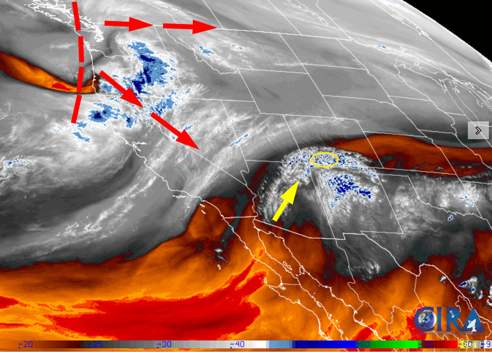
There is nothing on radar in our area.
Forecast highlights…
*** First chance for snow Sunday and Monday and then another chance Wednesday into Friday. ***
*** It’s fun to see an active weather pattern! ***
Friday afternoon through Saturday evening… A transient ridge will keep us dry and push occasional mid and upper-level clouds through our area. Clouds will increase Saturday when the ridge moves to our east.
Winds…Afternoon gusts will be 15-20mph.
Temps… Friday and Saturday highs will be in the low to high 50s and lows will be in the low 20s to low 30s.
Saturday night through Monday evening… A low will move through the region from the west. This system is trending towards lower precip due to weak jet support and storm energy.
Scattered snowshowers will start over the mountains after midnight Saturday and then over the valley around sunrise Sunday. Hit and miss showers will persist until the system moves through Monday evening.
Snow levels will be 7,500-8,000ft during the day and 6,500-7,000ft at night.
Snow amounts for this period:
Mountains above 9,000ft: 3-7”
Valley above 7,600ft: up to 2”
Valley below 7,600ft: up to 1”
Winds… Afternoon gusts will be 15-20mph
Temps… Highs will be in the low to high 40s. Saturday and Sunday lows will be in the low 20s to low 30s. Monday lows will be in the mid-teens to mid-20s.
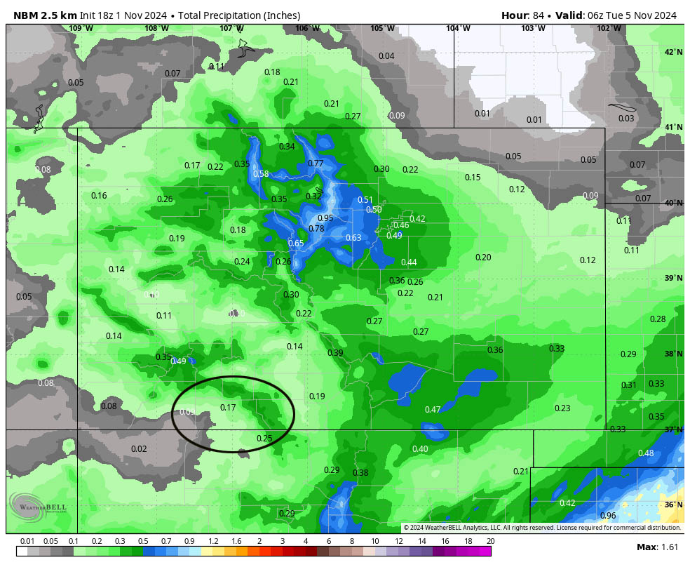
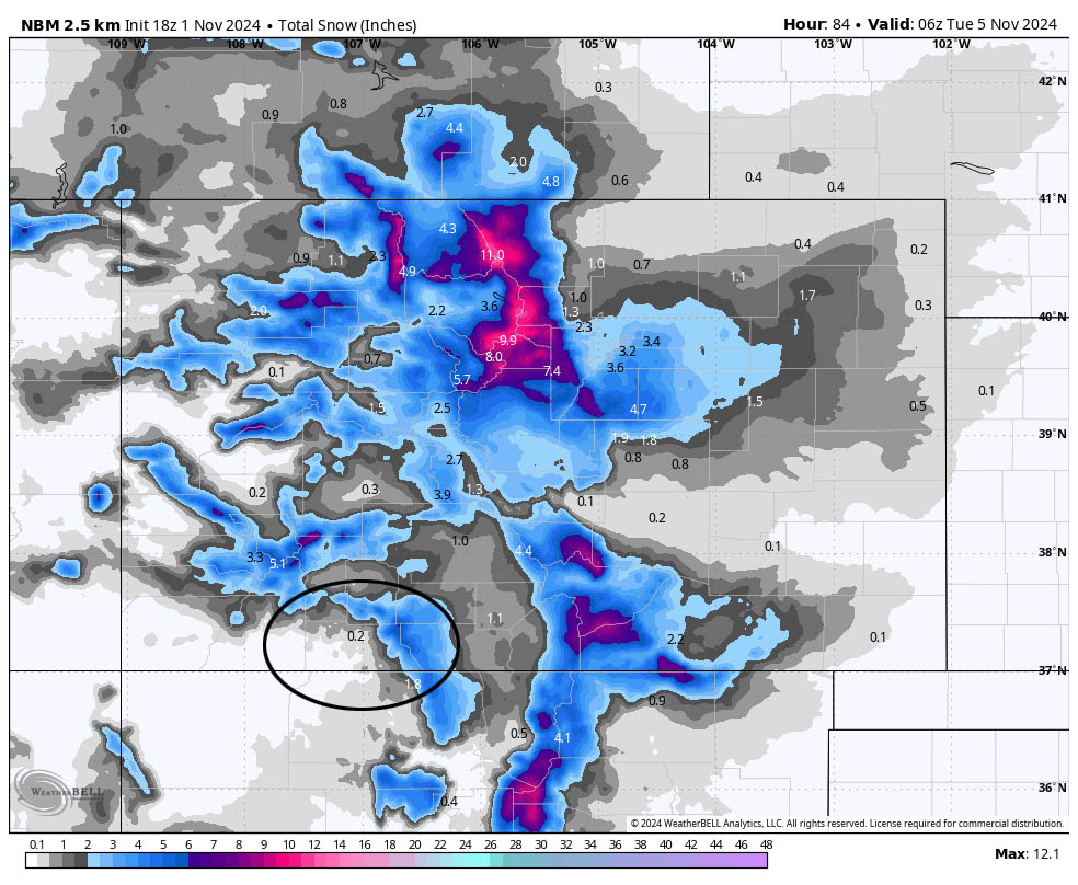
Tuesday… Transient ridging will give us a brief break. Occasional patches of clouds will move through. The mountains could get a few spotty snowshowers Tuesday night.
Winds… Afternoon gusts will be around 15mph.
Temps… Highs will be in the low 40s to low 50s and lows will be in the high teens to mid-20s.
Early Wednesday into Friday… The forecast models indicate another low-pressure system moving through. Timing and precip amounts are all over the place so my forecast confidence is low.
Currently snow amounts range from 2” to 10” in the valley and 10” to 24” in the mountains. I want these ranges to narrow before I make a call.
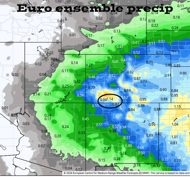
Forecast models vary from 0.40” to 1.5”. A wide range like this does not inspire forecast confidence.
My next post will be on Saturday.
– Shawn


2 Responses
Thank you, Shawn! Your forecasts are really helpful, as we plan trips and wonder how things are going up there.
Thank you, Eric! Safe travels to you!