

We had brief periods of big, fat snowflakes today. They were pretty but only amounted to a dusting. – Pic taken 10/30/2024
If images fail to load in the email, please click the title of the post. Thanks!
Wednesday – 30 Oct 2024 – 3:40pm
The past…
At Stevens Field the high temperature on Tuesday was 55 shortly after midnight. The low Tuesday was 28 shortly before midnight. The low Wednesday morning was 27 and the high so far on Wednesday is 39.
The peak wind at Stevens Field on Tuesday was 37mph and on Wednesday it was 24mph.
| Average High | Record High / Year | Average Low | Record Low / Year |
| 55 | 69 / 1990 | 22 | 6 / 1989 |
Precipitation summary… Wolf Creek reported another 3” of snow today for a storm total of 7”. Precip amounts were lower than I expected, especially for Wolf Creek.
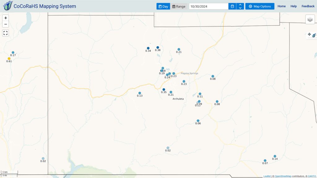
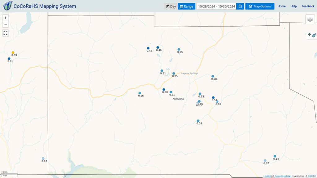
Storm totals were lower than I expected, especially for Wolf Creek.
Forecast discussion…
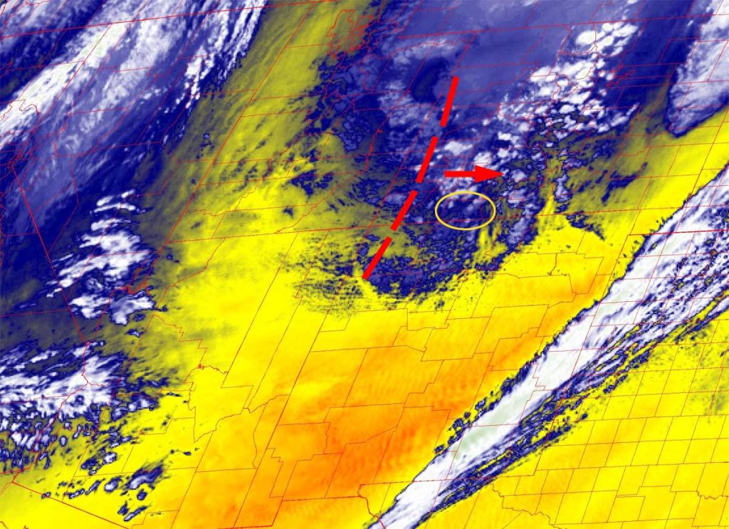

Forecast highlights…
*** Wednesday night/Thursday morning will be chilly with temps down to 10 in the cold spots. ***
*** Snow Sunday and Monday. ***
*** Another potential system Thursday and Friday. ***
*** It’s fun to see an active weather pattern! ***
Wednesday evening through Saturday evening… Wednesday evening scattered snowshowers will taper off. Parts of the valley will get a dusting, and the mountains could get another 1”.
Wednesday night the clouds will clear, and temps will cool off quickly.
Then a transient ridge will keep us dry and push occasional mid and upper-level clouds through our area. Clouds will increase Saturday when the ridge moves to our east.
Winds…Afternoon gusts will be 15-20mph.
Temps… *** Lows Wednesday night will be 10-20. *** Highs Thursday will be in the mid-40s to mid-50s and lows Thursday night will be in the mid-teens to mid-20s. Friday and Saturday highs will be in the low to high 50s and lows will be in the low 20s to low 30s.
Saturday night through Monday evening… The forecast models are coming into alignment with our next low-pressure system. Timing and precip amounts vary, but here’s what I think right now…
Scattered snowshowers will start over the mountains after midnight Saturday and then over the valley around sunrise Sunday. Scattered showers will persist until the system moves through Monday evening.
Snow levels will be 7,500-8,000ft during the day and 6,500-7,000ft at night.
In the valley, snow that sticks overnight will melt as we warm up each day. We might not need our snow shovels!
Snow amounts for this period:
Mountains above 9,000ft: 6-10”
Valley above 7,600ft: 2-3”
Valley below 7,600ft: 1-2”
Winds… Afternoon gusts will be 15-20mph
Temps… Highs will be in the low to high 40s and lows will be in the low 20s to low 30s.
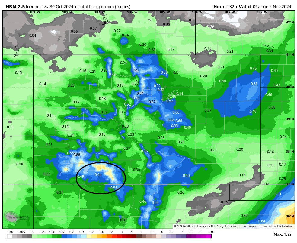

Tuesday morning through Wednesday evening… Transient ridging will give us a brief break. Occasional patches of clouds will move through, and the mountains could get a few spotty snowshowers, especially on Wednesday.
Winds… Afternoon gusts will be around 15mph.
Temps… Highs will be in the low 40s to low 50s and lows will be in the high teens to mid-20s.
Next Thursday and Friday… Some forecast models show another low-pressure system moving through, while other forecast models keep the system far to our southwest with little impact. I’m hoping for snow! Stay tuned for the details.
My next post will be on Friday.
– Shawn


