

Fresh snow on the mountains! – Pic taken 10/29/2024
If images fail to load in the email, please click the title of the post. Thanks!
Tuesday – 29 Oct 2024 – 7:00pm
*** We are aware of problems with our web page and are working on it. ***
The past…
At Stevens Field the high temperature Monday was 62. The low on Monday was 34. The high on Tuesday was 55 shortly after midnight. The low will probably occur shortly before midnight tonight.
The peak wind at Stevens Field on Monday was 20mph and on Tuesday it was 37mph.
| Average High | Record High / Year | Average Low | Record Low / Year |
| 57 | 75 / 1915 | 23 | 6 / 1955 |
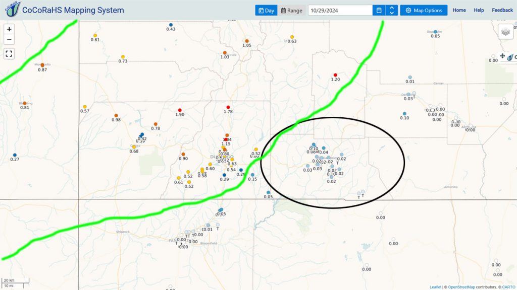
Precipitation summary… The first band of precip stalled to our west last night so it was a dud for Wolf Creek and much of Archuleta County.
Precip picked up this morning as the front moved through. Wolf Creek reported 4” of new snow this afternoon.
Forecast discussion…


Forecast highlights…
*** Hit and miss snowshowers into Wednesday afternoon. ***
*** The WINTER WEATHER ADVISORY for the southwest San Juan Mountains above 9,000ft will end at 6am Wednesday. Up to 4” of snow and winds gusting to 45mph are possible. ***
*** Roads could be slick in the valley Wednesday morning. ***
*** Wednesday night/Thursday morning will be chilly with temps down to 10 in the cold spots. ***
Tuesday night into Wednesday afternoon… The trough will move through our area Wednesday afternoon. Storm energy, moisture, and jet support are weak, but cold air advection is strong. Strong cold air advection can result in higher snow totals, but I’m keeping my expectations low.
Showers will be hit and miss with low precip amounts. The best chance for showers is early Wednesday morning to around noon Wednesday. Spotty showers will persist over the mountains until sunset.
Snow levels…
Tuesday night: 7,500ft dropping to 6,500ft
Wednesday morning: 5,500-6,000ft
Snow amounts…
Mountains above 9,000ft: 2-5”
Eastern part of the Valley: up to 1”
Rest of the Valley: a dusting for most, but a half inch for the lucky spots
Winds… The gusty winds will taper off this evening as we cool off. Wednesday afternoon gusts will be in the 15-25mph range.
Temps… Lows Tuesday night will be in the high teens to high 20s. Highs Wednesday will be in the high 30s to high 40s.

Wednesday night through Saturday… Wednesday night the clouds will clear out and temps will cool off quickly. Then a transient ridge will keep us dry and push occasional mid and upper-level clouds through our area. Clouds will increase Saturday when the ridge moves to our east.
Winds…Afternoon gusts will be 15-20mph.
Temps… *** Lows Wednesday night will be 10-20. *** Highs Thursday will be in the mid-40s to mid-50s and lows Thursday night will be in the mid-teens to mid-20s. Friday and Saturday highs will be in the low 50s to low 60s and lows will be in the low 20s to low 30s.
Sunday through Thursday… A pesky low or lows could spin over southern AZ for a good chunk of next week. The forecast models struggle with patterns like this, so my confidence in the details is low.
At this point I expect occasional waves of energy and moisture to move through our area and bring us rounds of showers. If the low wobbles north, we’ll get more precip. If it wobbles south, we’ll get less.
The snow levels will bounce around between 7,500ft each night to 8,500ft in the afternoons. In the valley, snow that sticks overnight will melt as we warm up each day. We might not need our snow shovels!
Rough snow amounts for this whole period:
Mountains above 9,000ft: 12-20”
Valley above 7,600ft: 2-4”
Valley below 7,600ft: 1-3”
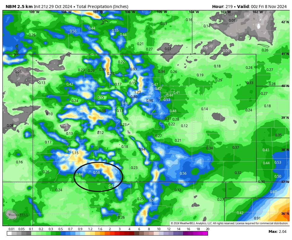

There is still a lot of uncertainty with this storm. I’ll dial in the details as the data gets better.
My next post will be tomorrow.
– Shawn


2 Responses
Have you guys seen this? Looks like the new Durango radar is finally available online.
https://www.lpcgov.org/departments/emergency_management/regional_weather_radar_system_project/index.php
John, Thank you. Yes we saw it. Unfortunately, it is not useful information yet. We reported on the radar in our October newsletter. I maintain that they have it set on the lowest reflectivity beam & not composite reflectivity. But I haven’t been able to get anyone to answer that question. It also still needs to be integrated with NWS data. – Arleen