

Meet Dusty and Precious! Sadly, their people had to go into assisted living and now these two loveable pups are looking for a new home. Please contact the Humane Society of Pagosa Springs to learn more about them. – Pic taken 10/27/2024
If images fail to load in the email, please click the title of the post. Thanks!
Sunday – 27 Oct 2024 – 5:00pm
The past…
At Stevens Field the high temperature Saturday was 68. The low this morning was 32.
The peak wind at Stevens Field on Saturday was 12mph.
| Average High | Record High / Year | Average Low | Record Low / Year |
| 59 | 73 / 1910 | 22 | 8 / 1913 |
Precipitation summary… There has been no recent precip.
Forecast discussion…
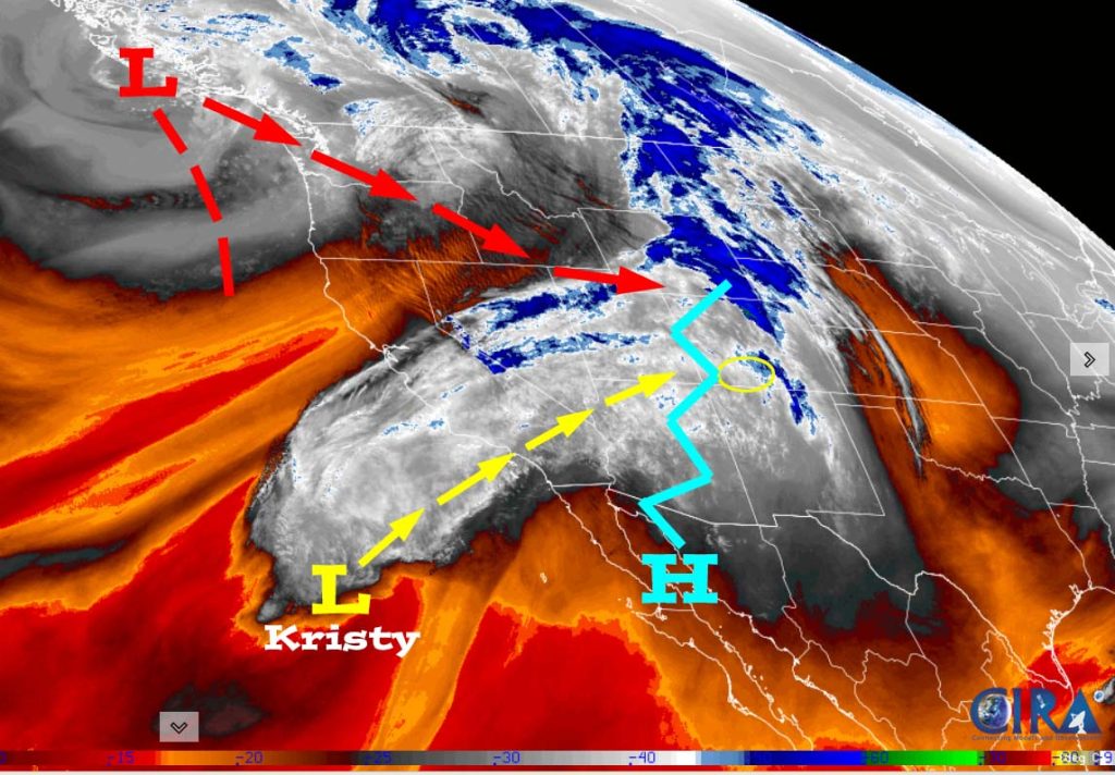
There is nothing significant on radar in our area.
Forecast highlights…
*** Mountain snow, and mostly valley “rainflakes” Monday evening into Wednesday morning. ***
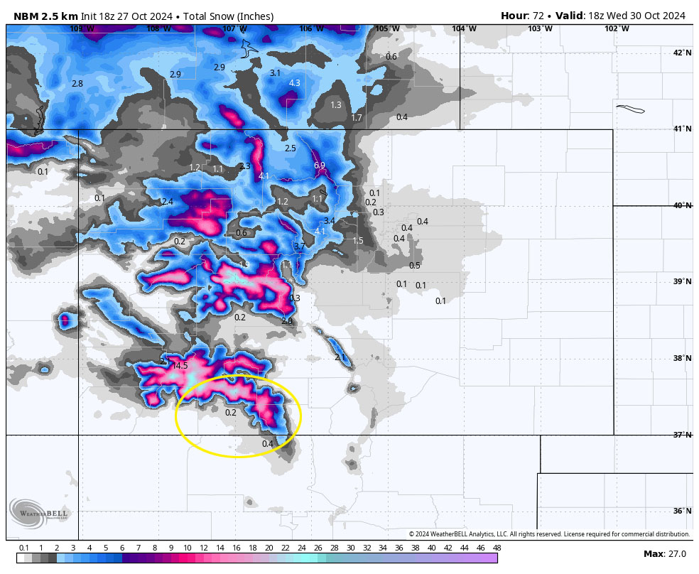
*** The Grand Junction NWS has issued a WINTER WEATHER ADVISORY for the southwest San Juan Mountains above 9,000ft. Up to 12” of snow and winds gusting to 45mph are expected 9pm Monday to 6am Wednesday. ***
*** Roads could be slick in the valley Tuesday night into Wednesday morning. ***
*** Wednesday night/Thursday morning will be chilly with temps down to 10 in the cold spots. ***
Sunday evening through Monday afternoon … Mid and upper-level clouds will increase as upper-level flow increases out of the southwest.
Winds… Sunday evening peaks will be 5-10mph. Monday afternoon gusts will be 15-25mph.
Temps… Sunday night lows will be in the high 20s to high 30s. Highs Monday will be in the high 50s to mid-60s.
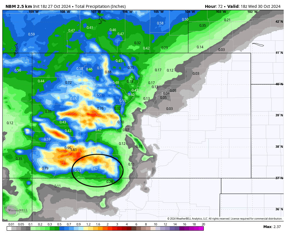
Monday evening through Wednesday morning… A trough and cold front will move through Colorado. It will dip far enough south for us to get some decent precip.
Precip will be snow in the mountains and mostly rain in the valley. As the snow level drops to the valley floor late Tuesday afternoon into the evening, moisture and precip will decrease.
Timing…
Showers will develop over the mountains early Monday evening and then over the valley late Monday evening. The heaviest precip will fall late Monday evening into Tuesday afternoon. Precip will taper off with hit and miss showers into Wednesday morning.
Snow levels…
Monday night: 10,500ft dropping to 10,000ft by sunrise Tuesday.
Tuesday morning to sunset on Tuesday: 9,500ft dropping to 7,500ft
Tuesday night: 7,500ft dropping to 6,500ft
Wednesday morning: 5,500-6,000ft
Snow amounts…
Mountains above 9,000ft: 10-15”
Valley above 7,800ft: up to 2”
Valley below 7,800ft: up to 1”
Winds… Monday night there will be occasional gusts in the 15-20mph range in the valley and around 40mph in the mountains. *** Tuesday gusts to 30mph are likely in the valley and gusts to 50mph are possible in the mountains. *** Winds will taper off Tuesday evening.
Temps… Lows Monday night will be in the mid-30s to low 40s. Highs Tuesday will be in the mid-40s to low 50s and lows Tuesday night will be in the low to high 20s.
Wednesday afternoon through Saturday… A transient ridge will keep us dry and push occasional mid and upper-level clouds through our area. Clouds will increase Saturday when the ridge moves to our east.
Winds…Afternoon gusts will be 15-20mph.
Temps… Highs Wednesday will be near 40 to the high 40s and *** lows Wednesday night will be 10 to 20. *** Highs Thursday will be in the high 40s to mid-50s and lows Thursday night will be in the high teens to high 20s. Friday and Saturday highs will be in the low 50s to low 60s and lows will be in the low 20s to low 30s.
Sunday through Wednesday… A cut-off low will set up over northern Mexico and southern AZ. It will be too far to our south to deliver good precip, but it will keep our weather unsettled with periods of showers. Right now it looks like precip amounts will be low.
This storm is still 7-10 days out and there is lot of uncertainty. I’ll tackle the details as the data gets better.
I’ll do a forecast each day through Wednesday.
– Shawn


