
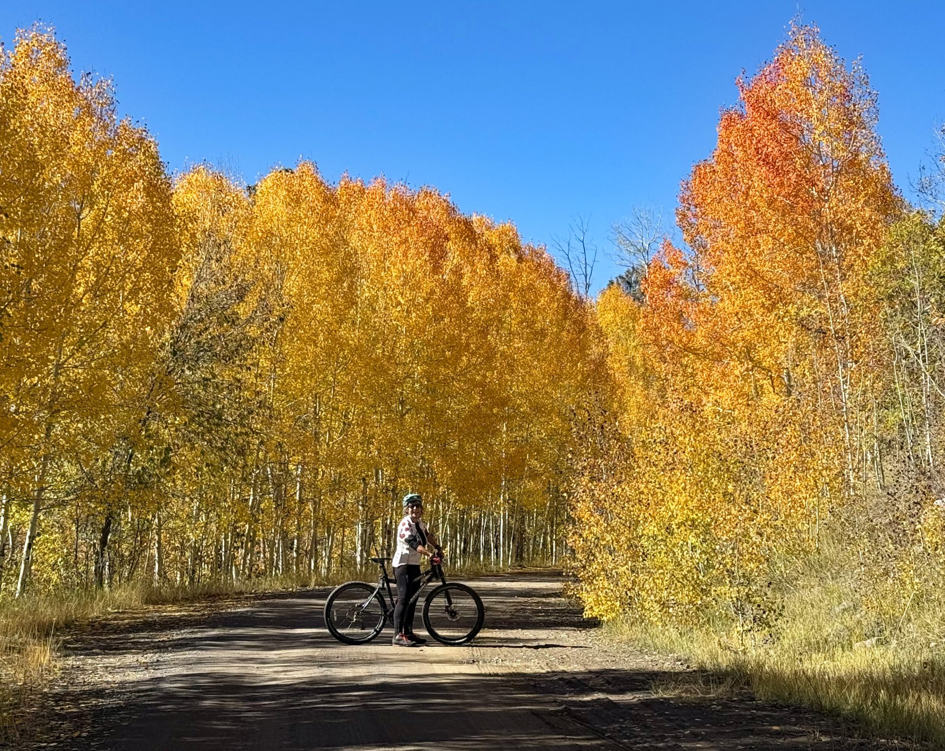
Plumtaw Road is the quintessential road in Pagosa for a fall color drive. The other day, Jane and I had a fantastic bike ride along the curves, enjoying peeks of Pagosa Peak, and the spectacular last snippets of color as we rolled along! (click on title of post to see image)
Friday – 25 Oct 2024 – 8:00pm
The past…
At Stevens Field the high temperature today was 67. The low this morning was 31. Cold spots have been down to 21. TWENTY ONE degrees! That is a cold sink!
The peak wind at Stevens Field today was 8mph.
| Average High | Record High / Year | Average Low | Record Low / Year |
| 61 | 75 / 1988 | 23 | 8 / 1975 |
Precipitation summary… There has not been any precipitation in the last 2 days. Though there has been a lot of frost deposited on everything with the cooler temperatures.
Forecast discussion…
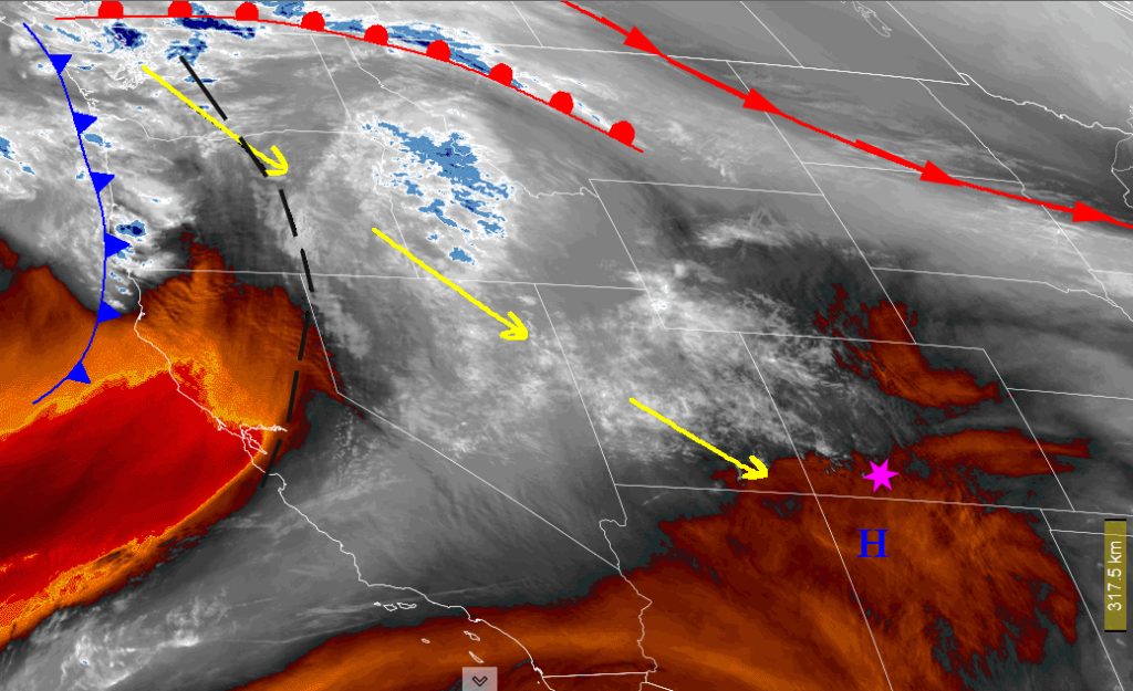
Satellite Friday afternoon – High pressure is firmly in place over Colorado. The Polar Front Jet, associated fronts and weather is well to the north.
There is nothing significant on radar in our area.
Forecast highlights…
*** Lots of sun and temps slightly above average through Sunday. ***
*** Tracking a potential storm 28-30 October. ***
Rest of Friday through Sunday… A dirty ridge is in over the region. Only upper level clouds are making their way over the ridge and into our area. We’ll have mostly sunny to partly cloudy skies, dry weather, and temps above seasonal averages.
Winds… Afternoon peaks will be around 15mph.
Temps… Friday, Saturday, and Sunday highs will be in the low 60s to low 70s and lows will be in the upper-20s to mid-30s.
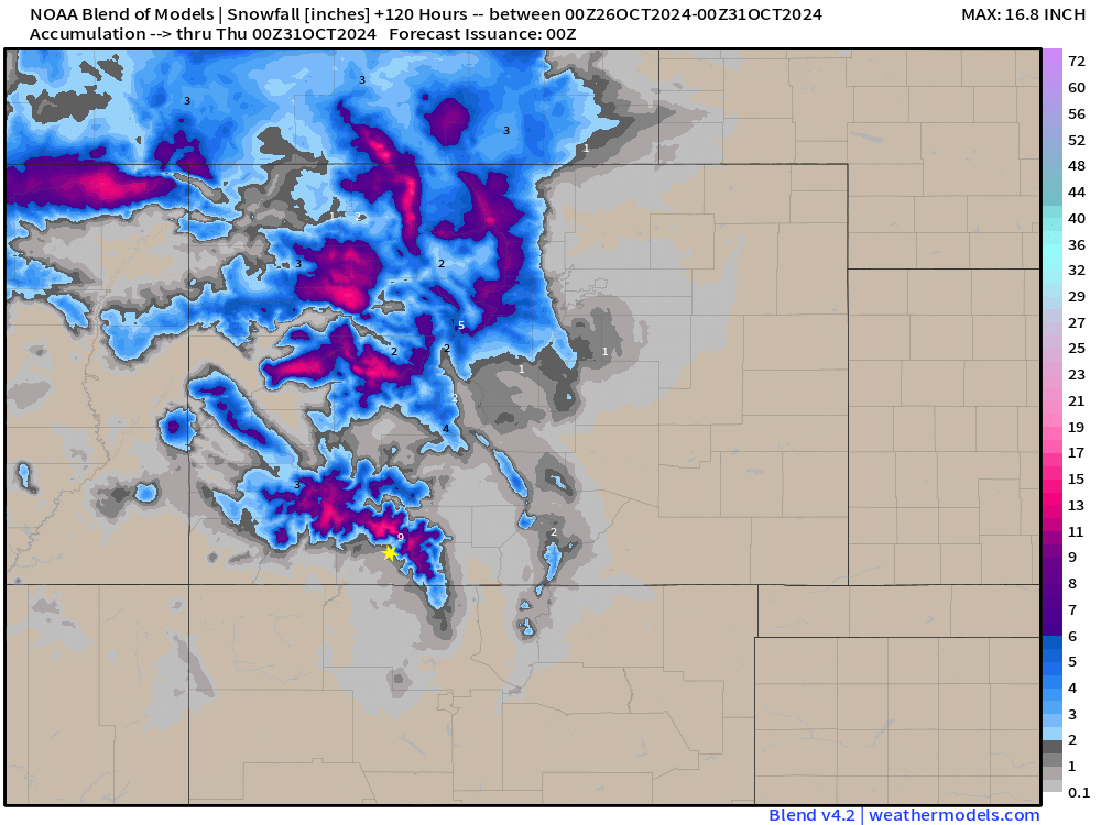
Round one: All models are coming into agreement with a deep trough sinking into our area with a shot of cold air sinking into our area and impacting us from the 28th to the 30th. The mountains could get 10-15″ of snow, while valley areas will only get 1-2″. Upper valley areas could see 2-4″ of snow. Heaviest precipitation will be from late Monday evening to Tuesday evening.
Monday… Will see increasing clouds and go from partly cloudy to cloudy with rain in the lower valley areas and snow above in the evening hours. Snow levels will start out at 10,000 feet late Monday.
Winds… Afternoon peaks will be around 20mph in the valley with gusts to 35mph in the afternoon in the mountains.
Temps… will be much cooler with highs in the upper 50s to low 60s and lows will be in the upper-20s to low-30s.
Tuesday… Will be mostly cloudy to cloudy with rain in the lower valley areas and snow above in the morning hours. Snow levels will sink to 8,000 by Tuesday afternoon and 7,000 feet by midnight. All precipitation will switch to snow after midnight. As we are cooling off enough for the snow making process in the lower valleys we’ll also be drying out.
Winds… Afternoon peaks will be around 30mph in the valley with gusts to 40mph in the afternoon in the mountains.
Temps… will be much cooler with highs in the mid 40s to low 50s and lows will be in the low-20s to mid-20s with cold spots into the teens.
Wednesday will be cold! It will start out cloudy with areas of snowshowers and fog. Moisture will slowly clear out throughout the day so we’ll see partly cloudy skies with sun by the afternoon.
Winds… Afternoon peaks will be around 20mph in the valley with gusts to 25mph in the afternoon in the mountains.
Temps… cold air will still be sinking in so highs will be mild in the upper 30s to mid 40s and lows will be in the low TEENS by Thursday morning with cold spots into single digits!!!

The 7-14 day period…
Round two: An additional area of low pressure will impact our area starting late next Friday, November 1st and linger in the area through November 7th.
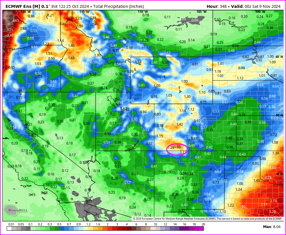
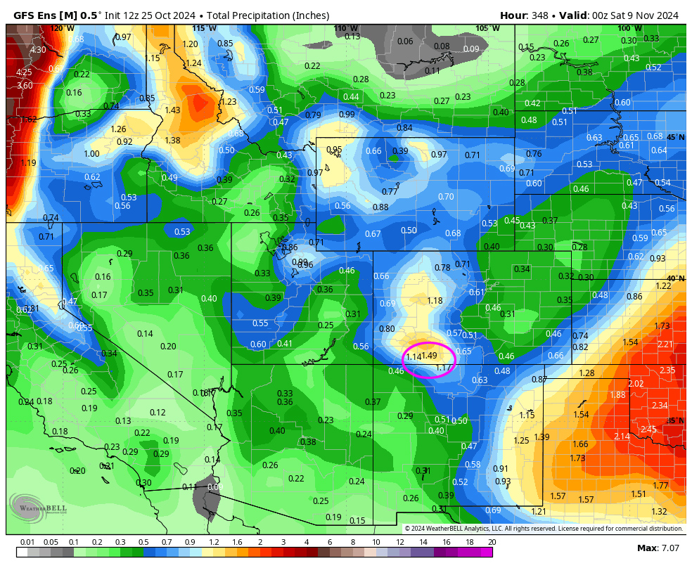
Euro ensemble precip to 5pm on 8 Nov above shows 1.60” near Pagosa. GFS ensemble precip to 5pm on 8 Nov below shows 1..49 near Pagosa Springs. These medium range models are in fair agreement showing the San Juan mountains as areas for heaviest precipitation in the area.
Our next forecast post will be on Sunday.
– Arleen


