
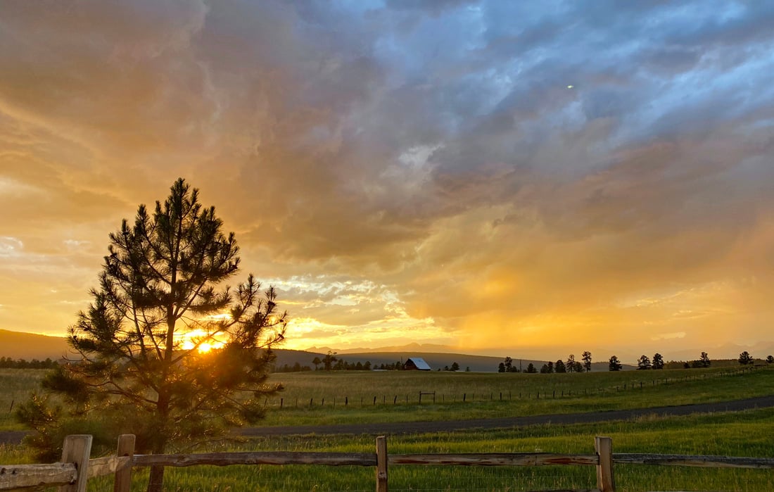
Friday’s sunset was spectacular after some strong thunderstorms moved through the area! (photo credit: Shawn Prochazka. Click on title of post to see image)
Sunday – 28 July 2024 – 5:30pm
The past…
At Stevens Field the high temperature Friday afternoon was 80 and the high on Saturday was 84 and so far today it has been 84. The lows the last three mornings have slowly been lowering; 57, 52, and 49 this morning.
The dew point Friday afternoon was 50, Saturday afternoon it was 43, and this afternoon it is 28 with a relative humidity of 13%. We’ve been getting drier.
The peak wind at Stevens Field Friday afternoon was a convective gust to 30mph and on Saturday it was a convective gust to 25mph. This afternoon the peak wind has been straight line wind gust of 30mph.
| Average High | Record High / Year | Average Low | Record Low / Year |
| 83 | 93 / 1947 | 46 | 27 / 1913 |
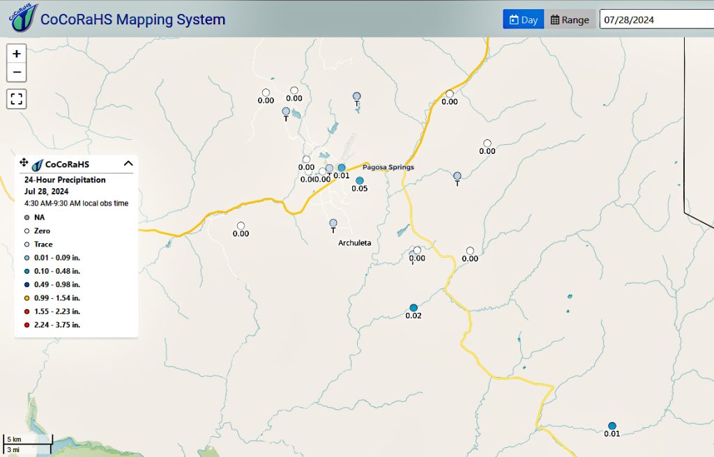
Precipitation summary… There were heavy showers and thunderstorms in the area on Friday as the ridge moved to our east and a trough moved through. Some spotty showers were in the area yesterday from the residual moisture and the convective heat. Totals are below.

Fire and Smoke Update… Most skies over Archuleta County are free of smoke. However some southern areas of the county may see some smoke from a wild fire on County Road 500 near Coal Mine Road. Report from Archuleta County Sheriff’s Office yesterday, “Crews from Archuleta County Sheriffs Office, Pagosa Fire Protection District and USFS Pagosa Ranger District hiked into a 5 acre fire approximately 19:00 last night on County Road 500 near Coal Mine Road.”
The report from 10:14 this morning, “The fire is at 11 acres. Firefighters are actively working on containment lines before the heat of the day and winds pick up. Smoke will be visible throughout the day.”
We’ll see some smoke in the area tomorrow morning from the wildfire burning in Arizona. Smoke from major fires burning in Canada, Oregon, and California is staying north of us under the current set up.

Forecast discussion…
As of 4pm Sunday afternoon, there is nothing on radar in our area. I only see fair weather cumulus clouds in the area.
Forecast highlights…
*** Today (Sunday) through Tuesday chances are very weak we will see any shower in the area. ***
*** Wednesday through Friday chances are weak we will see any shower activity in the valley area. Chances increase for afternoon thunderstorms over the mountains***
*** Saturday onward: The monsoon will return to the area with our spotty afternoon showers***
*** All storms are capable of short periods of heavy rain, small hail, gusty winds, and lightning. ***
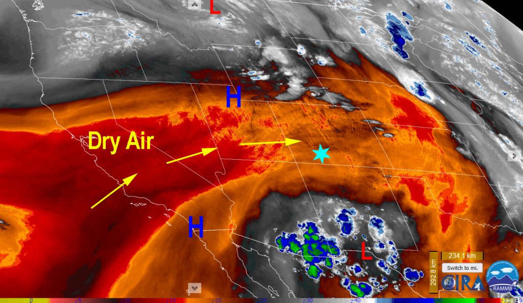
Sunday through Tuesday… If you have been waiting for a break in the weather to get outside in the afternoon, this is your chance! Skies will be clear to partly cloudy. Upper-level westerly flow will dry us out.
Winds… Sunday afternoon peak winds will be 25-30mph. Monday and Tuesday afternoon peaks will be 20mph. Winds will be higher in the mountains.
Temps… Temps will gradually warm and the air will continue to dry. Sunday through Tuesday highs will be in lo 80s to upper 80s. Lows will be in the upper 40s to low 50s. The dry air will allow the temperatures to drop at night. A few folks might see low 40s.
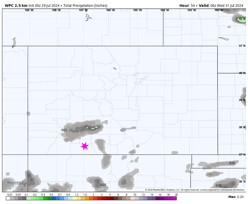
Wednesday through Friday… The ridge tries to rebuild at first to our east. We’ll see a few weak shots of moisture. In addition, on Wednesday we could see a shot of instability from an upper level trough skirting by to the north. The ridge continues to build but more over our heads on Thursday.
Skies will still be clear to partly cloudy. We could see an isolated thunderstorm or two but they should be primarily over the mountains with a few sneaking into the valley.
Winds… Afternoon peak winds will be 15mph.
Temps… Temperatures will continue to warm. Wednesday through Friday highs will be in mid 80s to lo 90s. Lows will be in the low 50s.
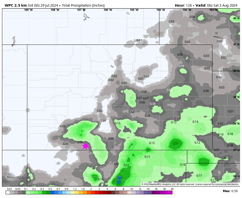
7-14 day precip… Monsoon moisture will gradually work its way back into the region as the high reestablishes itself over the Four Corners area. The position of the high isn’t ideal – it’s a weak monsoon pattern for us. So our chance for afternoon storms will increase but storms will remain hit and miss.
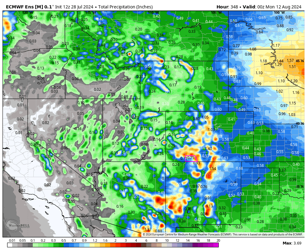
Euro ensemble precip above to 6pm 11 Aug expects 0.75” while GFS ensemble precip on below expects 1.83”. This is all convective showery precip, so amounts will vary considerably. But both models indicate a return of the monsoon and our cooling afternoon showers.

Our next post will be on Tuesday.
– Arleen


