

Another classic Pagosa Country sunset!
If images fail to load in the email, please click the title of the post. Thanks!
Friday – 26 July 2024 – 10:15am
The past…
At Stevens Field the high temperature Wednesday afternoon was 81 and the high on Thursday was 85. The low this morning was 58.
The minimum relative humidity Wednesday was 23% with a dew point of 39. Thursday it was 17% with a dew point of 35.
The peak wind at Stevens Field Wednesday afternoon was 25mph and on Thursday it was 24mph.
| Average High | Record High / Year | Average Low | Record Low / Year |
| 82 | 91 / 2023 | 47 | 31 / 1913 |
Precipitation summary… Showers and thunderstorms continue to be “spotty”. Precip reports this morning ranged from zero to 0.02”. Most of the storms stayed over the mountains. There were a couple of soakers Tuesday and Wednesday afternoons. Totals are below.


Where are the hazy skies coming from?… Upper-level clockwise flow around the high currently centered over southern CA is pushing smoke across a good chunk of the US from fires in eastern Oregon, other fires across the Pacific Northwest, and Canada.

Forecast discussion…

As of 10am Friday morning, there is nothing on radar in our area. Clouds are building over the mountains as I type. I expect radar to be active the afternoon.
Forecast highlights…
*** Today (Friday) is our best chance for afternoon storms and then the chance will decrease a bit on Saturday. Sunday through Thursday the chance drops considerably, but an isolated afternoon storm is still possible, mostly over the mountains. Afternoon storms will gradually ramp back up starting next Friday and through next weekend. ***
*** All storms are capable of short periods of heavy rain, small hail, gusty winds, and lightning. ***
Rest of today through Saturday evening… The high pressure ridge is over our heads Friday morning. The moisture plume and instability will peak today for us and then decrease a bit Saturday as the moisture gets pushed east.
Friday will be active with showers and thunderstorms developing in the afternoon and persisting into the evening. There will be fewer storms on storms on Saturday.
Storms on Friday will move slowly from the northwest to the southeast or west to east. Storms Saturday will move more quickly from west to east.
Winds… Friday afternoon peaks will be around 15mph, but isolated higher gusts are likely near a shower or thunderstorm. Saturday afternoon peaks will be around 20mph, but higher gusts are possible near showers and thunderstorms.
Temps… Highs will be near 80 to the high 80s and lows will be in the mid-40s to low 50s.
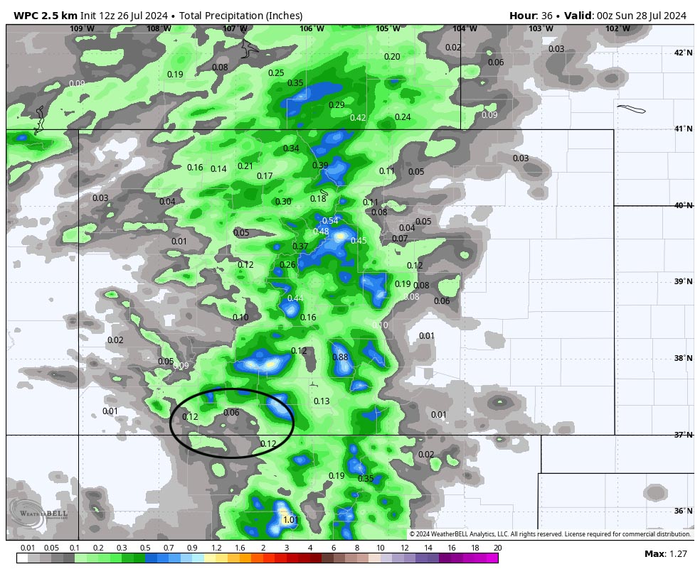
Sunday through Thursday… Upper-level westerly flow will dry us out. There will still be a slight chance for an afternoon shower or thunderstorm, but most of us will stay dry. Temps will gradually warm. I expect highs in the low 90s in town during the second half of the week.
Winds… Sunday and Monday afternoon peaks will be 20-25mph. Tuesday through Thursday afternoon peaks will be around 15mph, but isolated higher gusts are likely near a shower or thunderstorm.
Temps… Sunday and Monday highs will be in the low to high 80s and lows will be in the mid-40s to low 50s. Tuesday through Thursday highs will be in the mid-80s to low 90s and lows will be in the mid-40s to low 50s.
8-14 day precip… Monsoon moisture will gradually work its way back into the region as the high reestablishes itself over the Four Corners area. The position of the high isn’t ideal – it’s a weak monsoon pattern for us. So our chance for afternoon storms will increase but storms will remain hit and miss.

The next post will be on Sunday.
– Shawn


