

Geese at sunrise – my morning wake-up alarm – pic taken 7/22/2024
If images fail to load in the email, please click the title of the post. Thanks!
Tuesday – 22 July 2024 – 2:10pm
The past…
At Stevens Field the high temperature Sunday afternoon was 75 and the high so far on Monday is 76. The low this morning was 47.
The minimum relative humidity yesterday was 30% with a dew point of 41. Today it was 28% with a dew point of 40.
The peak wind at Stevens Field yesterday afternoon was 21mph. Today’s peak wind so far is 9mph.
| Average High | Record High / Year | Average Low | Record Low / Year |
| 82 | 92 / 1940 | 46 | 31 / 1973 |
Precipitation summary… Showers and thunderstorms continue to be “spotty”. Most locations get less than a tenth of an inch of precip each day while a few lucky folks get a good soaking.


Where are the hazy skies coming from?… Upper-level clockwise flow around the high currently centered over NV is pushing smoke across a good chunk of the US from fires in eastern Oregon, other fires in the Pacific Northwest, and Canada.

Thankfully most of this smoke is aloft in our area. Air quality at noon in our area is on the lower end of “moderate”. Some spots along the Front Range have air quality rated “unhealthy for sensitive groups”.
Forecast discussion…
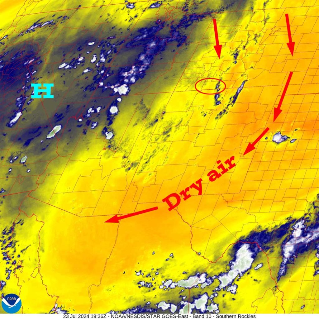

Forecast highlights…
*** The chance for afternoon storms is lower through Thursday and then will ramp up a bit Friday and Saturday. Starting Sunday the chance will drop considerably, but isolated afternoon storms won’t totally go away. ***
*** All storms are capable of short periods of heavy rain, small hail, gusty winds, and lightning. ***
Rest of today through Saturday evening… The upper-level high is currently over NV with a high-pressure ridge extending north into Alberta. It will continue to wobble around that area through the week.
Things could get a little more interesting Friday and Saturday as the remnants of a weak tropical system get absorbed in the upper-level west to east flow. Right now there is a lot of uncertainty, but it doesn’t look too impressive.
The daily routine will continue…
Each morning we’ll wake up to bright blue skies. Then scattered cumulus clouds will build over the mountains during the late morning. By early afternoon, some of those cumulus clouds will grow into showers and a thunderstorm or two. Clouds will decrease each evening and we could be treated to pretty sunsets and a rainbow.
Winds… Afternoon peaks will be around 15mph, but isolated higher gusts are likely near a shower or thunderstorm.
Temps… Highs Tuesday through Wednesday will be in the high 70s to mid-80s and lows will be in the mid-40s to mid-50s. Highs Thursday and Friday will be near 80 to the high 80s and lows will be in the mid-40s to low 50s. Highs Saturday will be in the high 70s to mid-80s and lows will be in the mid-40s to low 50s.

Sunday and Monday… Upper-level westerly flow will dry us out. There will still be a slight chance for an afternoon shower or thunderstorm, but most of us will stay dry.
Winds… Afternoon peaks will be around 15mph, but isolated higher gusts are likely near a shower or thunderstorm.
Temps… Highs will be in the low to high 80s and lows will be in the mid-40s to low 50s.
8-14 day precip… Monsoon moisture will get partially cut-off by upper-level westerly flow starting Sunday/Monday next week. Afternoon storms will be fewer and weaker, but they’ll stick with us.

I will do the next forecast post on Thursday.
– Shawn


2 Responses
The photo of the geese at sunrise is AMAZING.
Thank you for sending out photos and of course the weather.
Barb R
Barb, thank you for your kind words. Shawn has an incredible eye and enjoys taking and sharing pictures of our paradise. Thank you for following us.
Arleen