
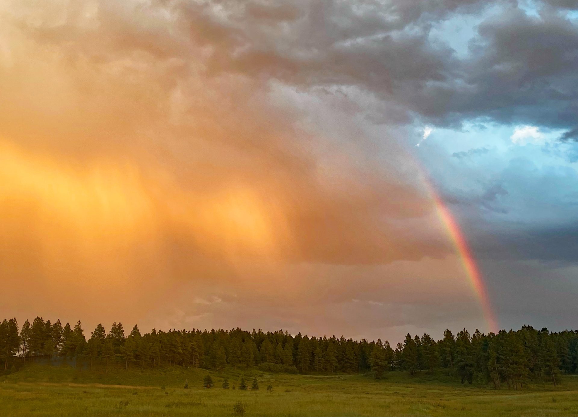
Every night the sky puts on a show! Picture taken 16 Jul 24, 8:14pm (Click on title of post to see image)
Wednesday – 17 July 2024 – 5:30pm
The past…
At Stevens Field the high temperature Tuesday afternoon was 86 and the high so far on today (Wednesday) is 80. The low this morning was 53. Yesterday morning it was 55.
The minimum relative humidity yesterday was 15% with a dew point of 33. Today it was 25% with a dew point of 40. This is still marginal moisture though it has increased slightly today. For good monsoon action, we like to see the dew points around 50.
The peak wind at Stevens Field yesterday afternoon was 24mph. Today’s peak wind so far is 18mph.
| Average High | Record High / Year | Average Low | Record Low / Year |
| 83 | 91 / 1910 | 46 | 35 / 1907 |
Precipitation summary… Showers and thunderstorms were “spotty” over the last few days. Most locations get less than a tenth of an inch of precip each day while a few lucky folks get a good soaking. We have already had .23″ in O’Neal Park this afternoon from a 3pm storm.
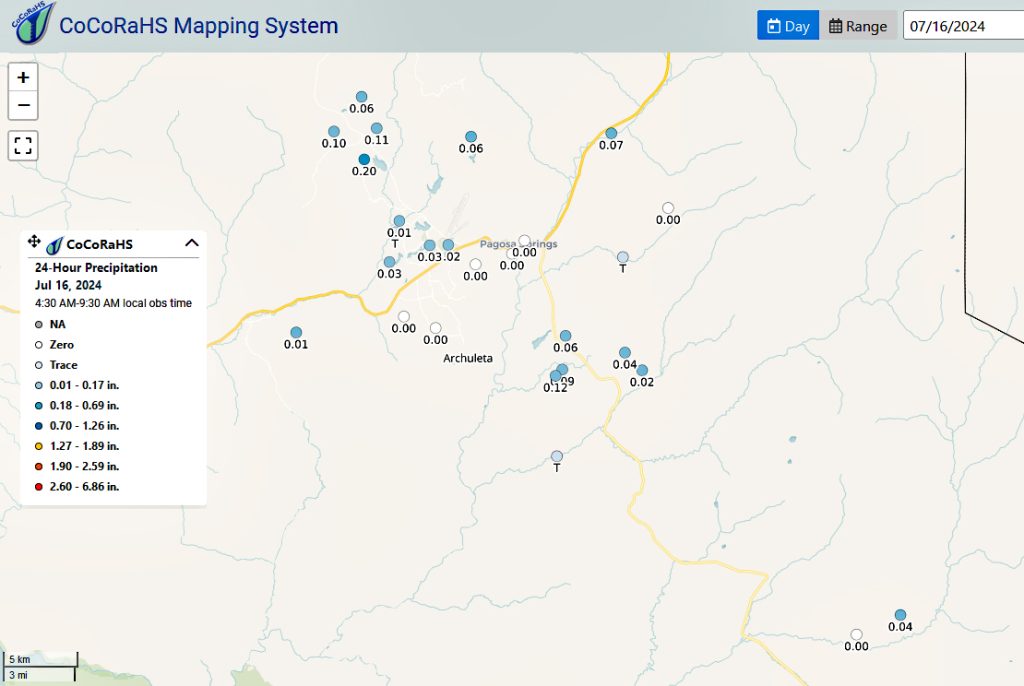
CoCoRaHS 24-hour precip reports yesterday morning for MONDAY afternoon showers ranged from zero to .20”. The rain lottery winner was Robert in Hatcher!
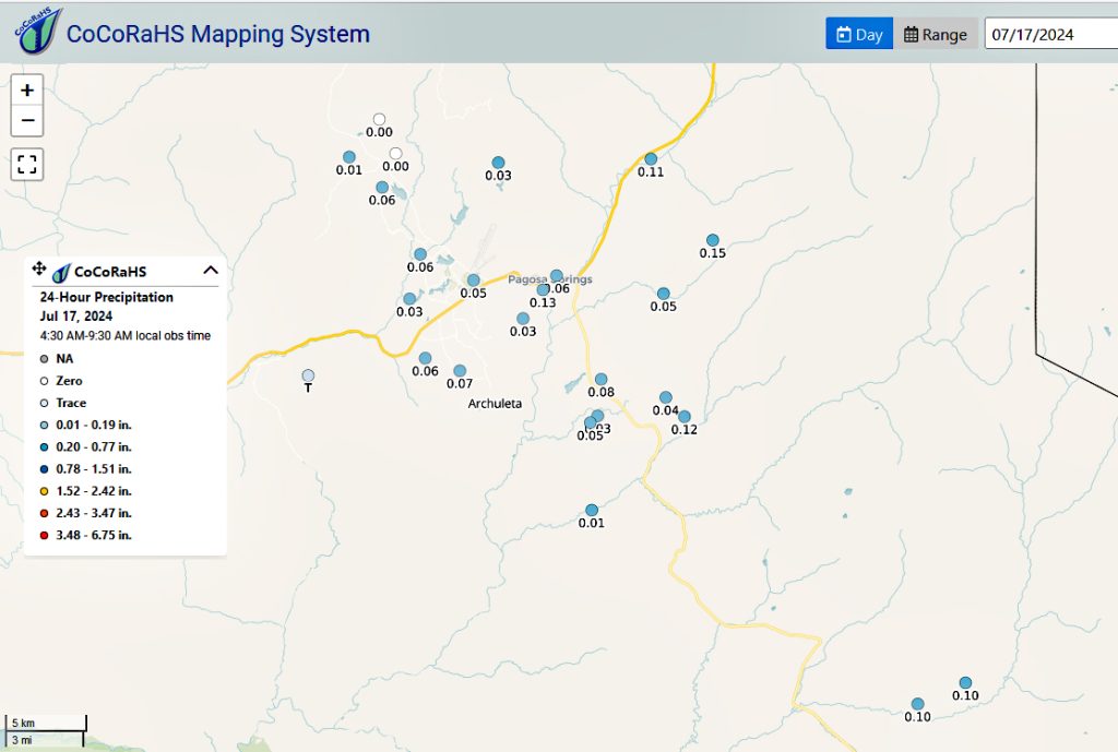
CoCoRaHS 24-hour precip reports from this morning for TUESDAY afternoon showers range from trace to 0.15”. The rain lottery winner (again) was Mike in High West to the east!
Forecast discussion…
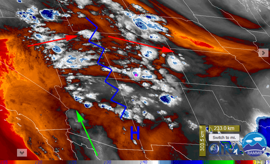
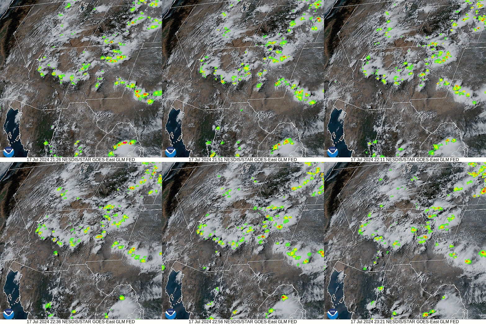
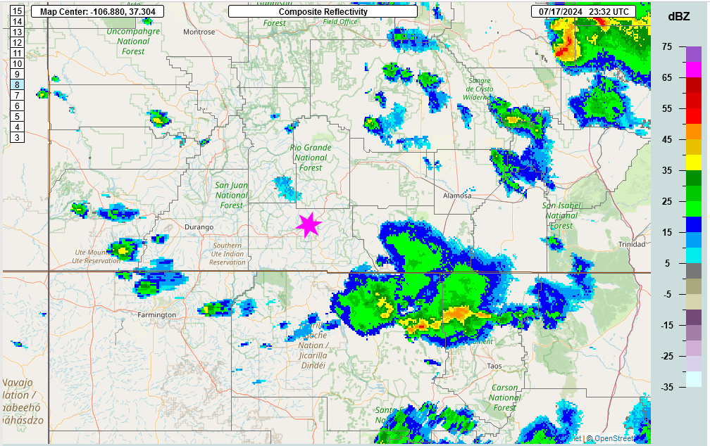
Radar at 5pm Wednesday evening – A number of thunderstorms with light to moderate rain moved from northwest of the county to the southeast. O’Neal Park picked up .23″. There are a few showers to the northwest that are under the radar beam (see satellite) and could move into our area and give us a few sunset showers.
Forecast highlights…
*** A 60-80% chance that you will get hit by a shower or thunderstorm each afternoon through and including Monday. ***
*** All storms are capable of short periods of heavy rain, small hail, gusty winds, and lightning. ***
Today through Monday: The high is currently over southeast Arizona. A ridge extends north of that into Wyoming. This is not ideal for us but (for now) there is some moisture that is advecting north into the eastern intermountain rocky region from the Gulf of Mexico and the Baja areas. Plus, we continue to recycle the moisture that is here.
A deep unseasonably cool trough is sinking into the mid-west. The affect on us will be that the upper-level high will retrograde to the west. This is even less than an ideal position for us. However, we still have moist air advecting in from Mexico and getting wrapped in to the ridge. In fact, the precipitable water numbers are above normal.
In addition, the trough to our northeast is causing a bit of squeeze play with the ridge. This will help destabilize our atmosphere and enhance thunderstorm activity.
Each morning we’ll wake up to bright blue skies. Then scattered cumulus clouds will build over the mountains by mid-morning. By mid day, those cumulus clouds will grow into round one of showers and thunderstorms. Then it will be calm for a bit before round two kicks off. Saturday, which looks to be a real soaker, there is the potential for a round three and nocturnal thunderstorms.
The storms will move at us from the northwest today and from the north-northwest through Monday. The ridge will continue to move to the west and will be over the Great Basin by Monday.
Clouds will decrease late each evening. We still have smoke advecting into the area from wild fires throughout the western states. So the combination of lingering multi level clouds and smoke will treat us to pretty sunsets and maybe even a rainbow!
Winds… Afternoon peaks will be around 15mph, but isolated higher gusts are likely near a shower or thunderstorm. Given the squeeze play of the unseasonable trough in the mid-west, we could winds higher winds on Sunday and Monday.
Temps… Highs today through Saturday will be in the high 70s to mid 80s and lows will be in the mid 40s to low 50s. Highs Sunday and Monday will be cooler; low 70s to high 70s and lows will be in the mid-40s to low 50s.

Other forecast models precip total for the same period: Euro: 0.59”, GFS: 1.44”, WPC: 0.68”, Canadian: 1.23”.
7-14 day precip… The ridge will remain to our west and wobble around the Great Basin area. The deep moisture will get cut off this weekend and we’ll see a decrease in thunderstorm activity starting on Tuesday. Though we’ll still see isolated thunderstorm activity each day with most folks getting nothing to a trace but a few lucky folks will get soaked. It appears that the unwelcome trough will fill and move along allowing our ridge to resume it’s position to our east by the 1st of August.

Euro ensemble precip above to 6pm 31 Jul expects 1.26” while GFS ensemble precip below expects 2.01”. Still a significant difference over the next two weeks. It’s all convective, showery precip so amounts can vary greatly.

We look forward to your reports! My next forecast post will be Friday afternoon.
– Arleen


2 Responses
Arleen, you guys are AMAZING!!! Thank you for all of your work!! We’re out here in the Chromo metropolis and we appreciate this information!! So GOOD!!!
Dawn & Chris Olson
Crowley Ranch Reserve
Dawn & Chris, thank you for your kind words. Also, under this pattern for the next 6 days, you might see more precip than we do in Pagosa if you are on the east side of the highway. Enjoy!