

A spectacular sunrise is greeted by a young buck! Photo Credit: Shawn Prochazka (Click on title of post to see image)
Monday – 15 July 2024 – 7:30pm
The past…
At Stevens Field the high temperature Sunday afternoon was 83 and the high so far on today (Monday) is 87. The low this morning was 52.
The minimum relative humidity yesterday was 21% with a dew point of 39. Today it was 15% with a dew point of 35. This is still marginal moisture. For good monsoon action, we like to see the dew points around 50.
The peak wind at Stevens Field yesterday afternoon was 28mph. Today’s peak wind so far is 18mph.
| Average High | Record High / Year | Average Low | Record Low / Year |
| 84 | 92 / 1948 | 44 | 33 / 1942 |
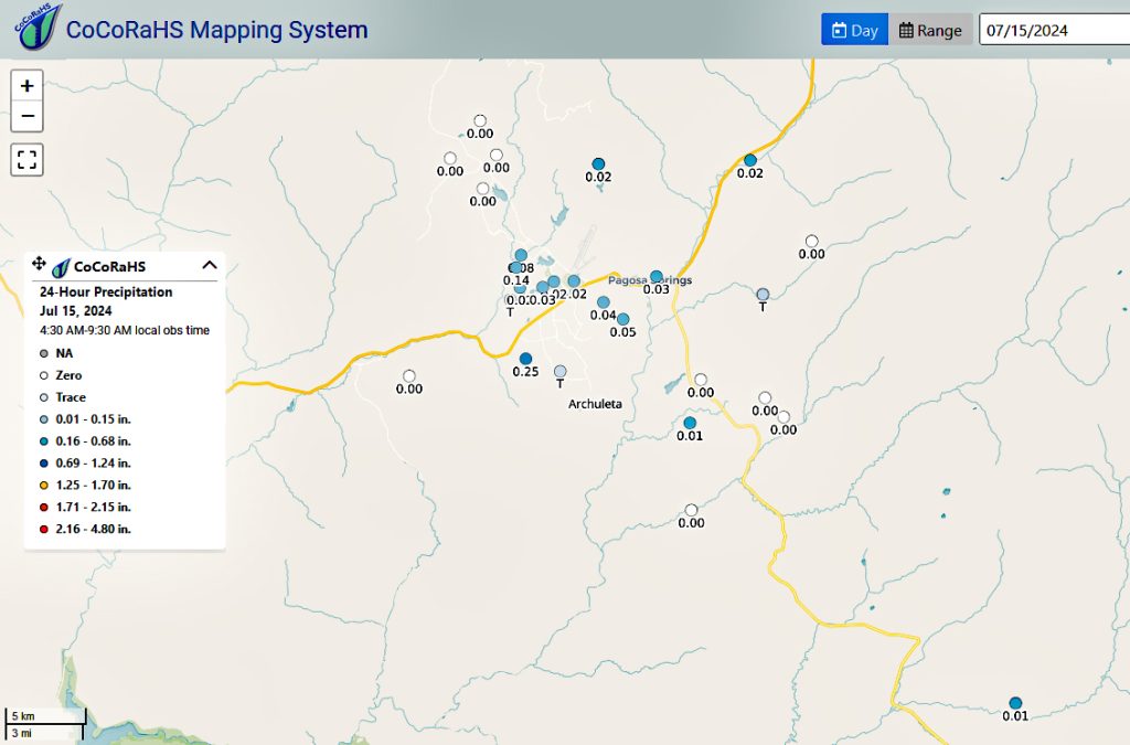
Precipitation summary… Showers and thunderstorms continue to be “spotty”. Most locations get less than a tenth of an inch of precip each day while a few lucky folks get a good soaking.

Forecast discussion…

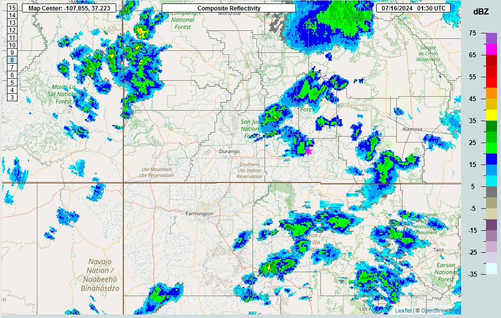
Radar at 7pm Monday evening – A number of thunderstorms with light to moderate rain and small hail moved from southwest of the county to the northeast.
Forecast highlights…
*** A 30-40% chance that you will get hit by a shower or thunderstorm tomorrow, Tuesday. Chances increase for Wednesday, Thursday and Friday to 60-80% chance each afternoon. ***
*** All storms are capable of short periods of heavy rain, small hail, gusty winds, and lightning. ***
Rest of today and tomorrow, Tuesday… The upper-level high is currently wobbling over and to the north of the four corners area. This is not ideal for us but there is some moisture that is advecting north into the eastern intermountain rocky region and we continue to recycle the moisture that is here.
A deep unseasonably cool trough sinks into the mid-west. The affect on us will be that the upper-level high will retrograde to the west. This is even less of an ideal position for us. Thunderstorm activity will again become spotty starting on Friday and continue to wane each day there after.
Each morning we’ll wake up to bright blue skies. Then scattered cumulus clouds will build over the mountains during the late morning. By early afternoon, some of those cumulus clouds will grow into showers and a thunderstorm or two. Expect more numerous storms on Wednesday and Thursday.
The storms will move from the west to the east over the next few days and then move at us from the northwest to the southeast later this week.
Clouds will decrease each evening. We still have smoke advecting into the area from wild fires throughout the western states. So the combination of lingering multi level clouds and smoke will treat us to pretty sunsets and maybe even a rainbow! There is one out there as of the time of this post!
Winds… Afternoon peaks will be around 15mph, but isolated higher gusts are likely near a shower or thunderstorm.
Temps… Highs Tuesday will be in the low 80s to low 90s and lows will be in the mid-40s to low 50s. Highs Wednesday through Saturday will be in the mid 70s to mid 80s and lows will be in the mid-40s to low 50s.
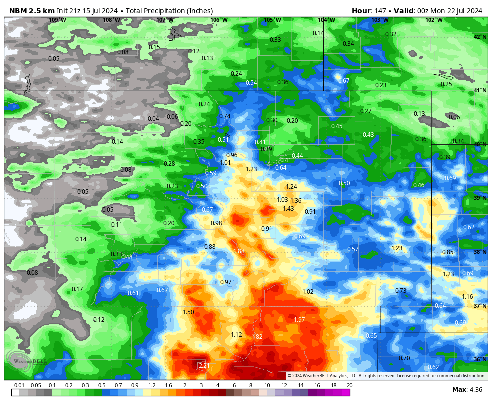
Other forecast models precip total for the same period: Euro: 0.37”, GFS: .83”, WPC: 0.75”, Canadian: 1.28”.
8-14 day precip… The high will wobble around the region. Monsoon moisture and instability will stick with us. All models are pointing to different solutions as to what the ridge will do.

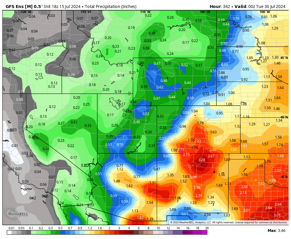
Euro ensemble precip on the left to 6pm 29 Jul expects 1.15” while GFS ensemble precip on the right expects 2.11”. That’s a big difference, but it’s all convective showery precip so amounts will vary that much.
My next forecast post will be Wednesday afternoon.
– Arleen


