

CoCoRaHS 24-hour precip totals are impressive!
If images fail to load in the email, please click the title of the post. Thanks!
Monday – 1 July 2024 – 12:30pm
The past…
At Stevens Field the high temperature Sunday afternoon was 79. The low this morning was 57.
The minimum relative humidity yesterday was 36% with a dew point of 49.
The peak wind at Stevens Field yesterday afternoon was 28mph.
| Average High | Record High / Year | Average Low | Record Low / Year |
| 82 | 92 / 1990 | 41 | 29 / 1968 |
Precipitation summary… That was a doozy yesterday! Thanks so much for your reports, pictures, and videos on our Facebook page. Your reports were very helpful to us and the Grand Junction NWS.

Andy, our longest consistently active CoCoRaHS observer since May 2014, said it’s the first time that he’s measured over 2” in 24 hours!
Forecast discussion…
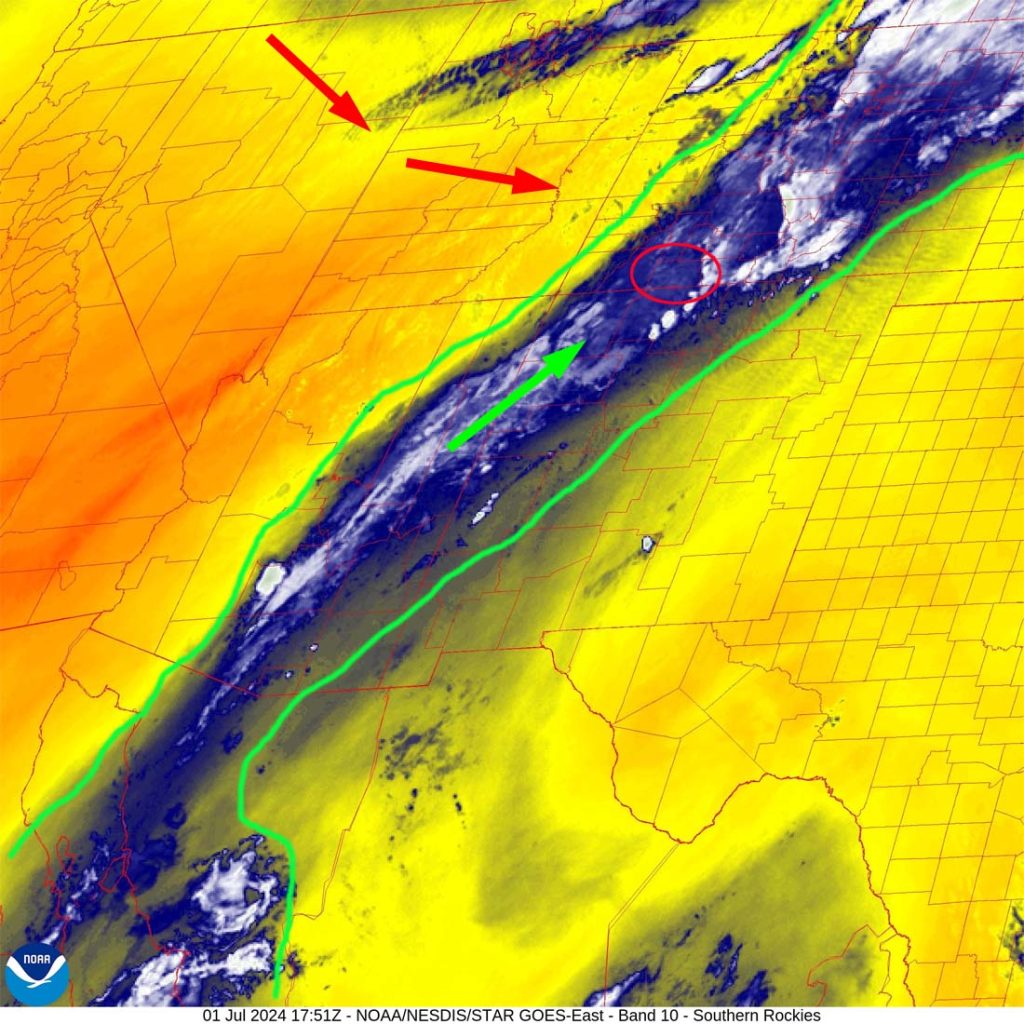

Forecast highlights…
*** The Grand Junction NWS has issued a FLOOD WATCH for all of southwestern Colorado valid through Monday afternoon. ***
*** A drier weather pattern will start to set up Tuesday and could last a week or longer. ***
Rest Monday… Deep tropical moisture is over our heads and will stay with us into Monday night. Precip will come in waves, occasionally heavy for brief periods. Lightning, small hail, and gusty winds are also possible.
Winds… Afternoon gusts will be 15-20mph, but isolated stronger gusts are possible near showers and thunderstorms.
Temps… Highs will be in the high 60s to high 70s and lows will be in the high 40s to mid-50s.
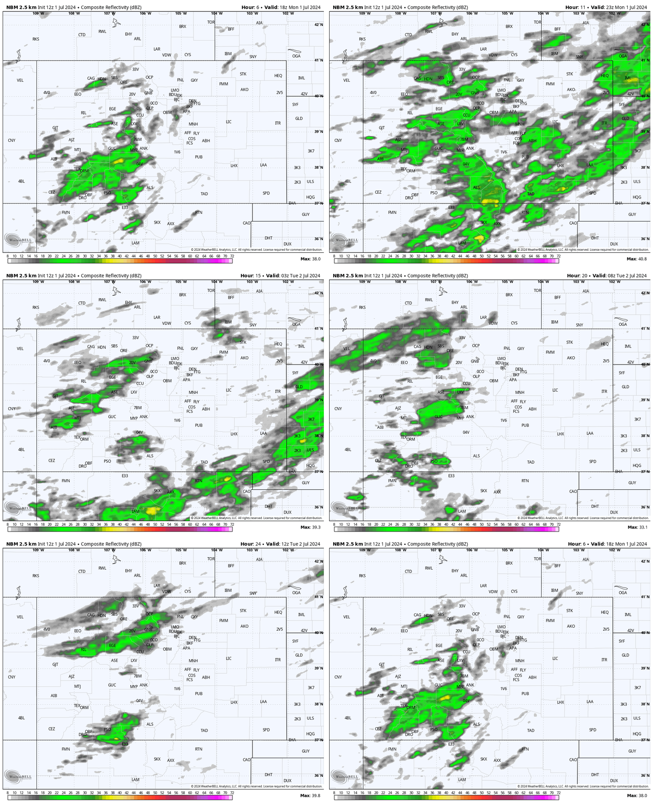

This is all convective, showery precip, so amounts will vary considerably.
Tuesday and Wednesday… We’ll wake up to bright blue sunny skies each morning, and then clouds will build over the mountains starting around noon. A spotty afternoon/early evening shower or thunderstorm is possible, mostly over the mountains. Consider yourself lucky if you get a few raindrops!
Winds… Afternoon gusts will be 15-20mph, but isolated stronger gusts are possible near showers and thunderstorms.
Temps… Highs will be in the high 70s to mid-80s and lows will be in the mid-40s to low 50s.
Thursday through Sunday… Unfortunately the upper-level high will set up to our west. Flow over us will be mostly out of the northwest and dry. Temps will be near to slightly above seasonal averages.
I don’t expect any precip.
Winds… Gusts each afternoon will be 15-20mph.
Temps… Highs will be in the high 70s to high 80s and lows will be in the low to high 40s.

I think there is a slight chance for a spotty shower or thunderstorm Wednesday afternoon, but I expect most of us to stay dry.
My next forecast post will be on Wednesday. I also plan to get the June summary/July outlook in a day or two.
The weather looks great for 4th of July festivities. We hope to see you at the parade!
– Shawn


