

Mama Mia and Mater would love a home! They’re available for adoption at the Humane Society of Pagosa Springs.
If images fail to load in the email, please click the title of the post. Thanks!
Sunday – 28 Apr 2024 – 2:40pm
The past…
At Stevens Field the high temperature yesterday afternoon was 44 and the low this morning was 36.
The peak wind at the airfield yesterday was 18mph.
| Average High | Record High / Year | Average Low | Record Low / Year |
| 61 | 76/ 1992 | 26 | 14 / 1991 |
Precipitation summary… A few scattered showers moved through the area yesterday. Precip amounts varied quite a bit.
Based on snotel data, I estimate that Wolf Creek Pass got 5-7” of snow for the storm.
Thanks to everyone for your reports and pictures on Facebook!
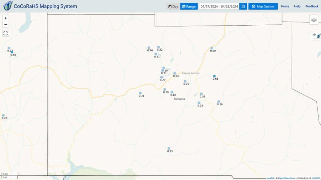
Forecast discussion…


Forecast highlights…
*** Scattered showers and maybe a thunderstorm Sunday afternoon ***
*** Lots of sun with breezy afternoons the rest of the week ***
Rest of Sunday… A weak trough will move through our area this evening. There is enough moisture and instability to kick up a few spotty showers and an isolated thunderstorm.
Rain, graupel, and small hail are possible in the valley while snow is also possible above 9,000ft in the mountains.
Drier, more stable air will move in tonight.
Additional Snow to Sunday evening…
Valley: no accumulation
Mountains: 1-2” but it will be spotty
Winds… Sunday afternoon gusts will be 15-20mph. Isolated stronger gusts are possible near thunderstorms.
Temps… Highs Sunday will be in the low to high 50s and lows will be in the mid-20s to mid-30s.
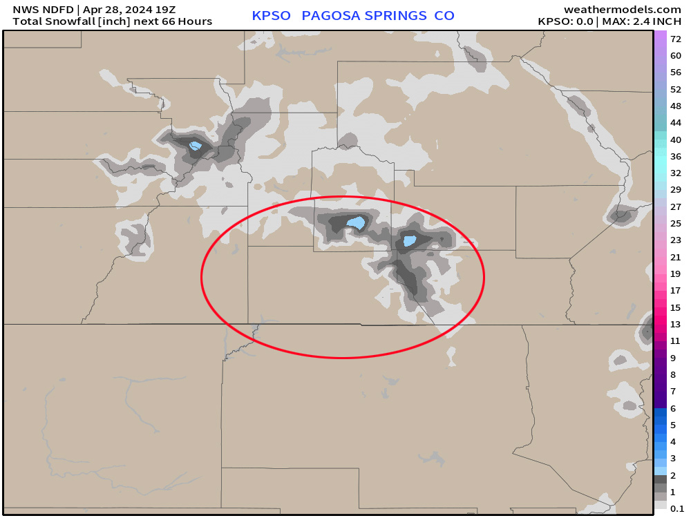
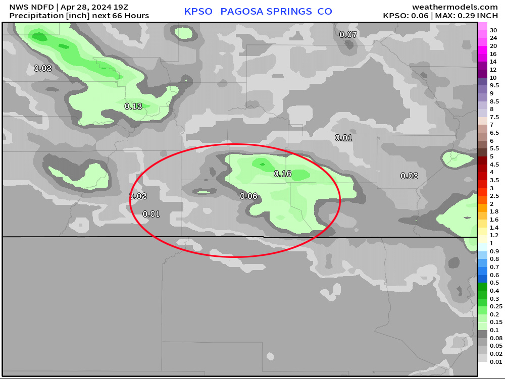
*** This will be spotty convective precip so amounts will vary considerably. ***
Monday through Saturday… Upper-level flow will be flat – west to east. For us that means mostly sunny skies, no precip, and gusty afternoon winds.
Thursday we will see a few more clouds as a system skirts across northern Colorado.
Winds… Afternoon gusts will be around 25mph each day, except for Wednesday with gusts around 30mph.
Temps…
Monday highs will be in the high 50s to high 60s and lows will be in the high 20s to mid-30s.
Tuesday and Wednesday highs will be in the mid-60s to low 70s and lows will be in the high 20s to high 30s.
Thursday highs will be in the high 50s to high 60s and lows will be in the mid-20s to mid-30s.
Friday highs will be in the low 60s to low 70s and lows will be in the high 20s to mid-30s.
Saturday highs will be in the mid-60s to low 70s and lows will be in the high 20s to high 30s.
My next post will be on Tuesday.
– Shawn


One Response
Thanks for your thoughts and predictions!