
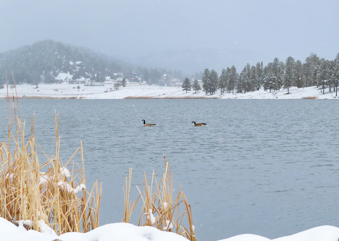
A goose pair hanging out at Echo Canyon Reservoir – pic taken 3/14/2024
If images fail to load in the email, please click the title of the post. Thanks!
Friday – 15 Mar 2024 –1:45pm
The past…
At Stevens Field the high temperature yesterday afternoon was 40 and the low this morning was 30.
The peak wind at the airfield yesterday was 20mph.
| Average High | Record High / Year | Average Low | Record Low / Year |
| 48 | 62 / 1995 | 14 | -10 / 1912 |
Precipitation summary… Two bands of precip moved through – one during the early morning hours and the second one after the sun came up. Wolf Creek reported 14” of new snow in the last 24 hours and a storm total of 19” so far.


Forecast discussion…


Forecast highlights…
*** A slow-moving cut-off low will keep things unsettled into Sunday. ***
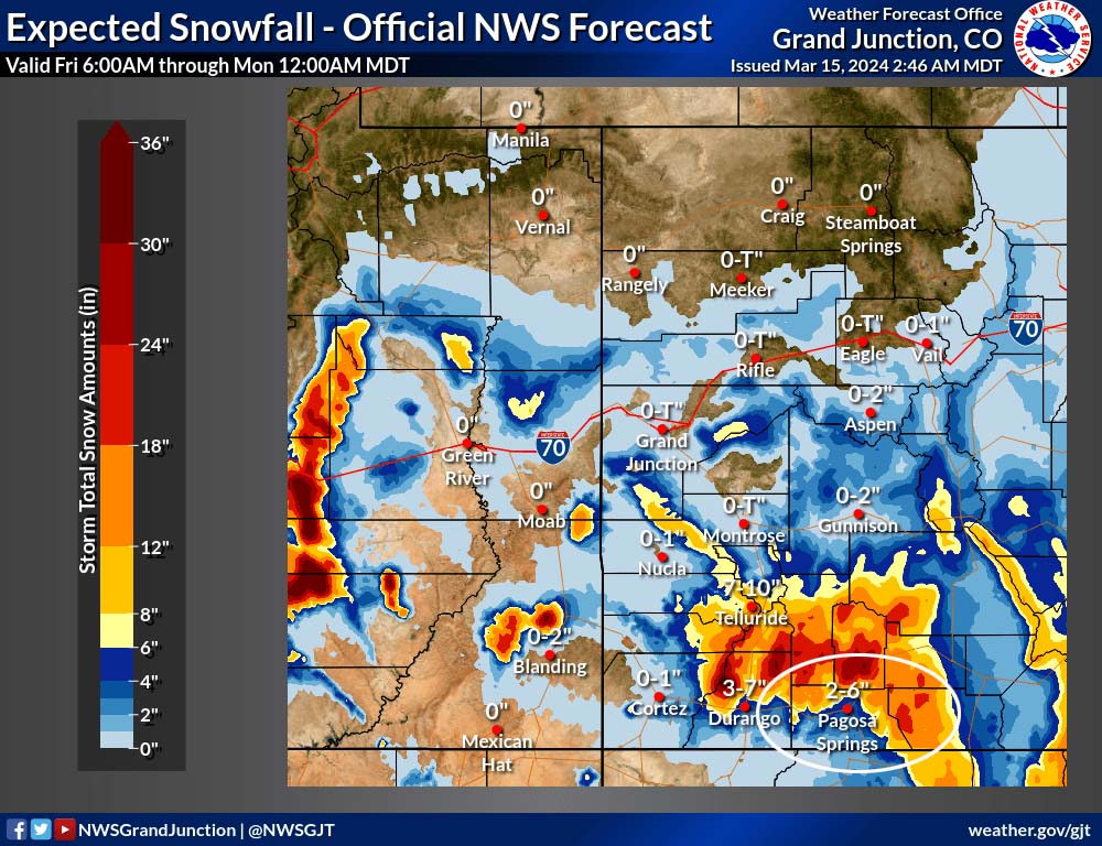
*** WINTER STORM WARNING is out for the southwest San Juan Mountains for 10-20” of additional snow to 6am Saturday. *** This does not include Pagosa Springs.
*** Wolf Creek Pass will close at 5am Saturday for up to 2 hours for winter maintenance operations. ***
Rest of Friday into Sunday… The cut-off low will wobble around AZ and push multiple troughs and batches of moisture into our area. The low will gradually weaken through the period.
The details…
Friday afternoon we’ll have a lull, but scattered showers and an isolated thunderstorm is possible. Precip could fall heavily for brief periods over small areas but won’t amount to much. A rain/snow mix is possible up to 8,200ft this afternoon. Snow levels will drop to around 7,000ft by midnight.
Snow amounts for the rest Friday…
Valley below 8,000ft: up to 1” but it will be spotty
Valley above 8,000ft: up to 2” but it will be spotty
Mountains: 2-4”
The next band of organized showers will move into our area during the early morning hours Saturday and will persist on and off into Sunday morning. An isolated afternoon thunderstorm or two is possible along with various kinds of precip: rain/snow/graupel/small hail. The snow level will rise to 7,600ft Saturday afternoon and then drop below 7,000ft late Saturday evening.
Snow amounts early Saturday morning to Sunday morning…
Valley below 7,600ft: 1-3”
Valley above 7,600ft: 2-5”
Mountains: 8-12”
By Sunday there won’t be much left of the cut-off low. Instability and residual moisture will fuel spotty afternoon showers and maybe an isolated thunderstorm. The snow level will rise to 7,600ft Sunday afternoon and then drop below 7,000ft late Sunday evening.
Snow amounts Sunday morning to Sunday evening…
Valley below 7,600ft: up to 1” but it will be spotty
Valley above 7,600ft: up to 2” but it will be spotty
Mountains: 1-3”
Winds… Peak winds will be 10-15mph each afternoon.
Temps… Highs will be near 40 to the mid-40s. Lows Friday night and Saturday night will be in the mid-20s to low 30s. Lows Sunday night will be in the high teens to high 20s.

Monday through Thursday… The pesky cut-off low will still be wobbling near us into Wednesday morning. There won’t be much left of it, but instability and residual moisture will be enough to kick up spotty showers, mostly in the afternoons over the mountains.
Snow levels could pop up to 8,200ft each afternoon. All types of precip are possible: rain, snow, graupel, and small hail.
Definition of “spotty showers”: They cover small areas, precip changes intensity quickly, and they start and stop abruptly. In other words, if you don’t like the weather, just wait a few minutes or drive a mile or two! Most of the time it will be dry with brief periods of “fun”.
Snow totals for the entire period…
Valley below 8,200ft: mostly rain but up to an inch of snow in a few lucky spots
Valley above 8,200ft: up to 2” in the lucky spots
Mountains: 2-4” but it will be spotty
Winds… Gusts will be around 15mph Monday, Tuesday, and Wednesday afternoons. Thursday afternoon gusts will be 15-20mph.
Temps… Monday, Tuesday, and Wednesday highs will be in the mid-40s to mid-50s and lows will be in the low 20s to low 30s. Highs Thursday will be in the high 40s to high 50s and lows will be in the low 20s to low 30s.
My main source for a suitable graphic is inop today.
My next forecast will be Saturday morning.
– Shawn


