

Windmill in the falling snow this morning – pic taken 3/14/2024
If images fail to load in the email, please click the title of the post. Thanks!
Thursday – 14 Mar 2024 – 9:30am
The past…
At Stevens Field the high temperature yesterday afternoon was 52 and the low this morning was 30.
The peak wind at the airfield yesterday was 23mph.
| Average High | Record High / Year | Average Low | Record Low / Year |
| 47 | 62 / 1995 | 14 | -21 / 1913 |
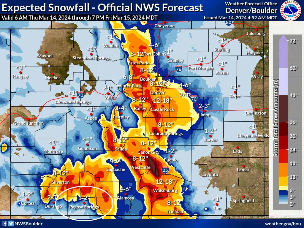
Precipitation summary… Wolf Creek reported 3” of new snow this morning for a storm total of 5” so far. There were a few surprise snow totals in the Pagosa Springs area this morning!

Linda was the snow lottery winner downtown! It’s unusual for the most snow to fall in town.
Forecast discussion…


Forecast highlights…
*** A slow-moving cut-off low will keep things unsettled into Sunday. ***
*** Travel into the mountains or to the Front Range will be treacherous through Friday. ***
*** WINTER STORM WARNING is out for the southwest San Juan Mountains for up to 20” of snow to 6am Saturday. *** This does not include Pagosa Springs.
Rest of Thursday into Sunday… The cut-off low will wobble around AZ and push multiple troughs and batches of moisture into our area.
The details…
Snow will come in waves with 1-3” possible each day in the valley – an inch below 7,500ft and up to 3” above 8,000ft. The best chance for accumulating snow is each night when temps will be a little cooler.
It could snow pretty hard for brief periods during the day, but temps above freezing will make it difficult for snow to accumulate. Locations below 8,000ft will see a rain/snow mix Friday and Saturday afternoons. An isolated thunderstorm or two is also possible each afternoon.
In the mountains snow will also fall on and off but will gradually pile up. The heaviest snow will fall Thursday into Friday evening. I expect Wolf Creek to get 10-16” during this period. Friday and Saturday will be good powder days, just expect bad driving conditions and poor visibility on the slopes.
Total additional snow amounts Thursday to Sunday evening…
Valley below 8,000ft: 2-4”
Valley above 8,000ft: 4-8”
Mountains: 18-24”
Winds… Thursday afternoon, Thursday night, and Friday afternoon: 15-20mph. Saturday and Sunday afternoons: 10-15mph.
Temps… Highs will be near 40 to the mid-40s and lows will be in the mid-20s to low 30s.

Monday, Tuesday, and Wednesday… The pesky cut-off low will still be wobbling around nearby. There won’t be much left of it, but instability and residual moisture will be enough to kick up a spotty showers, mostly in the afternoons over the mountains.
Snow levels could pop up to 8,200ft each afternoon. All types of precip are possible: rain, snow, graupel, and small hail.
Definition of “spotty showers”: They cover small areas, precip changes intensity quickly, and they start and stop abruptly. In other words, if you don’t like the weather, just wait a few minutes or drive a mile or two! Most of the time it will be dry with brief periods of “fun”.
Snow totals for the entire period…
Valley below 8,200ft: mostly rain but up to an inch of snow in a few lucky spots
Valley above 8,200ft: up to 2” in the lucky spots
Mountains: 2-4” but it will be spotty
Winds… Gusts will be around 15mph each afternoon.
Temps… Highs will be in the mid-40s to mid-50s and lows will be in the low 20s to low 30s.

My next forecast will be Saturday morning.
– Shawn


