

Pretty sunset colors last night over Pagosa Peak – Pic taken 27 Feb 2024
If images fail to load in the email, please click the title of the post. Thanks!
Wednesday – 28 Feb 2024 – 9:15am
The past…
At Stevens Field the high temperature yesterday afternoon was 48 and the low this morning was 7. The cold spots were near zero this morning.
The peak wind at Stevens Field yesterday was 40mph. We hit 45mph just north of Turkey Springs. The peak wind up at Wolf Creek Pass was 81mph.
| Average High | Record High / Year | Average Low | Record Low / Year |
| 44 | 62 / 1986 | 10 | -23 / 1962 |
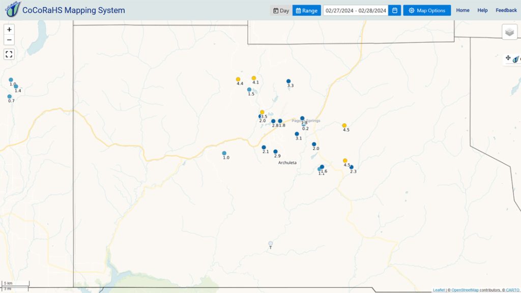
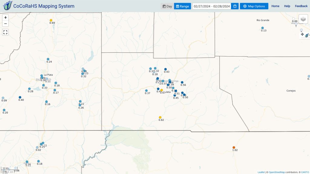
Precipitation summary… Snow amounts were less than I expected, especially for Wolf Creek who reported just 10” for the storm total.
We got lots of great reports and pictures on our Facebook page – THANKS!
Forecast discussion…
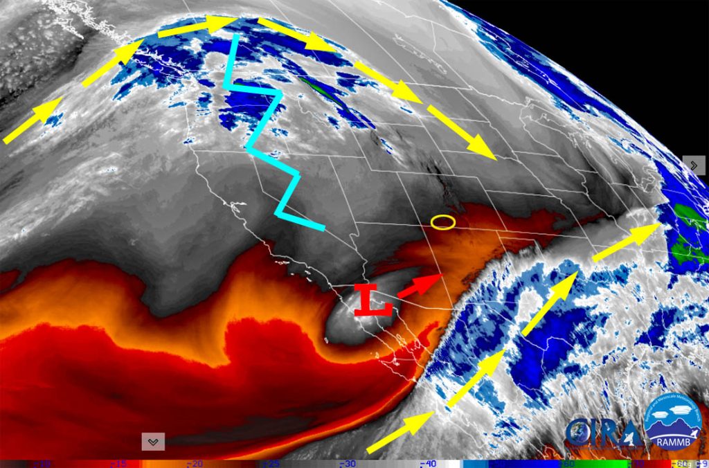
There is nothing on radar in our region this morning.
Forecast highlights…
*** Avalanche danger is rated “considerable”. ***
*** Lots of sun with temps slightly above average the rest of the week. ***
*** Next system will move through Saturday night to Sunday night. ***

Wednesday through Saturday afternoon… Ridging will build over the region and give us lots of sun. Temps Wednesday will be near average and then temps will be slightly above average the rest of the week.
Clouds and winds will increase Saturday ahead of the next system.
Winds… Wednesday afternoon: 5-10mph. Thursday afternoon: 10-15mph. Friday afternoon: 15-20mph. Saturday afternoon through Saturday night: 30-40mph.
Temps… Highs Wednesday will be in the high 30s to mid-40s and lows will Wednesday night will be in the mid-single digits to mid-teens. Highs Thursday, Friday, and Saturday will be in the mid-40s to low 50s. Lows Thursday night and Friday night will be in the low teens to low 20s. Lows Saturday night will be in the low to high 20s.
Saturday night to Sunday evening… The next system will move through. It will move west to east, and we’ll catch the southern end of it. The best storm energy and moisture will be to our north. If the system dips a little farther south, we’ll see slightly higher snow amounts. A little good news: This system will be a little colder so snow will accumulate more efficiently. The bad news: It’s going to be windy again.
Snow amounts…
Valley: 2-6”
Mountains: 8-15”
Winds… Gusts will be 30-40mph Saturday night to around sunset Sunday. In the mountains winds will gust 60-70mph.
Temps… Lows Saturday night will be in the low to high 20s. Highs Sunday will be in the low to high 30s and lows Sunday night will be in the low to high teens.
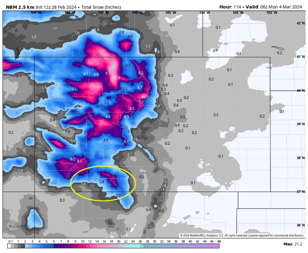
Right now this looks reasonable to me. If the system dips a little farther south, snow amounts will go up a bit. If the system slides farther north, amounts will go down.

Monday… We’ll get a brief break between systems with partly cloudy skies and temps below average.
Winds… Afternoon peaks will be 10-15mph.
Temps… Highs Monday will be in the mid-30s to mid-40s.
Late Tuesday through the rest of next week… An active pattern is trying to set up. The forecast models are all over the place, so I have no confidence in the details.
My next post will be on Friday.
– Shawn


