

Frosty is definitely frosted – Pic taken 27 Feb 2024
If images fail to load in the email, please click the title of the post. Thanks!
Tuesday – 27 Feb 2024 – 10:00am
The past…
At Stevens Field the high temperature yesterday afternoon was 48 and the low this morning was 33.
The peak wind at Stevens Field yesterday evening was 30mph. So far this morning the peak has been 31mph. Wolf Creek Pass hit 81mph last night at 9pm.
| Average High | Record High / Year | Average Low | Record Low / Year |
| 43 | 64 / 1986 | 11 | -9 / 1971 |
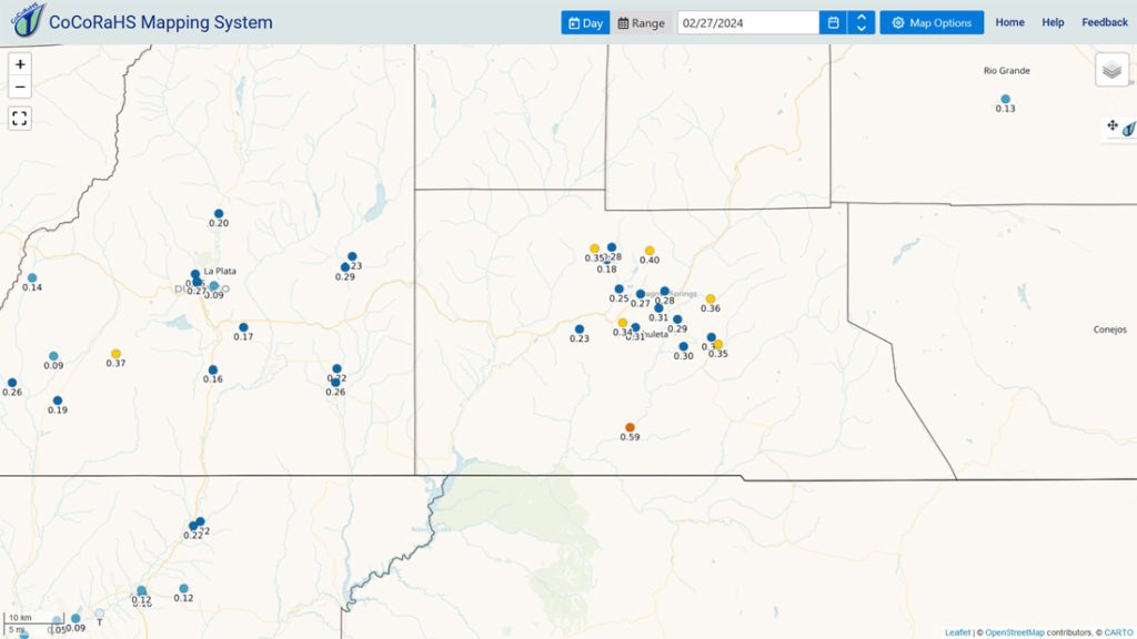
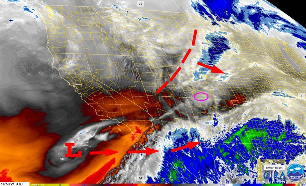
Precipitation summary… Yesterday was a dud, but I’m glad we got very little rain. Two out of three ingredients were in place: lots of moisture and a strong jet stream. We lacked a good “trigger” like storm energy from a trough.
Snow started falling up at Wolf Creek around sunset and mixed precip started falling in the valley later in the evening. It started snowing lightly at my house at 8,000ft elevation around 9pm.
Wolf Creek reported 6” of snow overnight.
We got lots of great reports and pictures this morning on our Facebook page – THANKS!

Forecast discussion…
Forecast highlights…
*** An AVALANCHE WARNING is out for the south San Juan Mountains between Wolf Creek and Cumbres Passes until 6am Wednesday. ***
*** A WINTER STORM WARNING is out for the eastern San Juan Mountains above 10,000ft valid until 11pm Tuesday. ***
*** My concerns: 1. Strong winds and heavy wet snow could lead to spotty power outages Tuesday. 2. Occasional blizzard-like conditions are possible into early Tuesday afternoon, especially above 7,500ft. ***

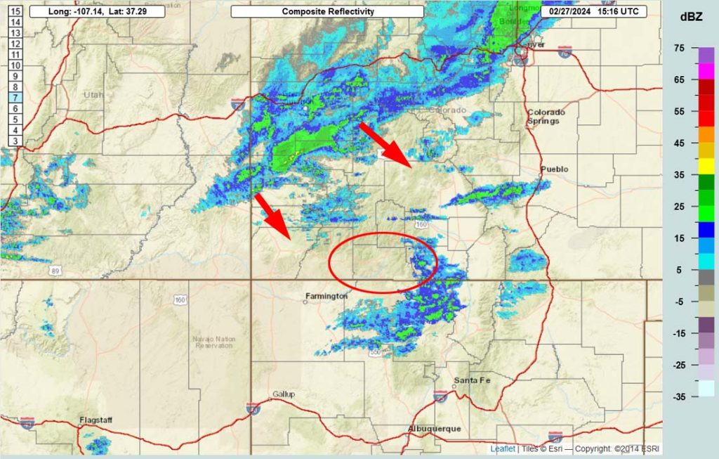
Rest of Tuesday… The trough will move through our area this afternoon. Ahead of the trough, we’ll see occasional peeks of blue sky and occasional bands of snowshowers with poor visibility and gusty winds. A few thundersnow storms are also possible.
Clouds and precip will clear pretty quickly this afternoon and we could be treated to a pretty sunset.
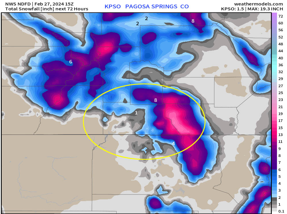
Snow amounts…
Western 2/3 of Archuleta County: dusting to 1”
Eastern 1/3 of Archuleta County and Chama area: 2-4”
Mountains above 9,000ft: 4-8”
Winds… *** Gusts into Tuesday afternoon will be 35-50mph. In the mountains winds will gust 60-75mph.
Temps… Highs Tuesday will be in the mid to high 30s and lows Tuesday night will be near zero to the mid-teens.

Wednesday through Saturday afternoon… Ridging will build over the region and give us lots of sun. Temps Wednesday will be below average and then temps will be near average Thursday and Friday.
Clouds and winds will increase Saturday ahead of the next system.
Winds… Afternoon peaks Wednesday and Thursday will be 10-15mph. Friday afternoon winds will gust 15-20mph. Saturday afternoon and evening winds will gust 20-30mph.
Temps… Highs Wednesday will be in the high 30s to mid-40s and lows will Wednesday night will be in the mid-single digits to mid-teens. Highs Thursday, Friday, and Saturday will be in the mid-40s to low 50s. Lows Thursday night and Friday night will be in the low teens to low 20s. Lows Saturday night will be in the low to high 20s.
Saturday night to Sunday evening… The next system will move through. I’ll dig deeper into this one in tomorrow’s post, but here’s a rough first guess on snow amounts…
Valley: 2-6”
Mountains: 8-15”

My next post will be tomorrow morning. It will include a storm summary.
– Shawn


