
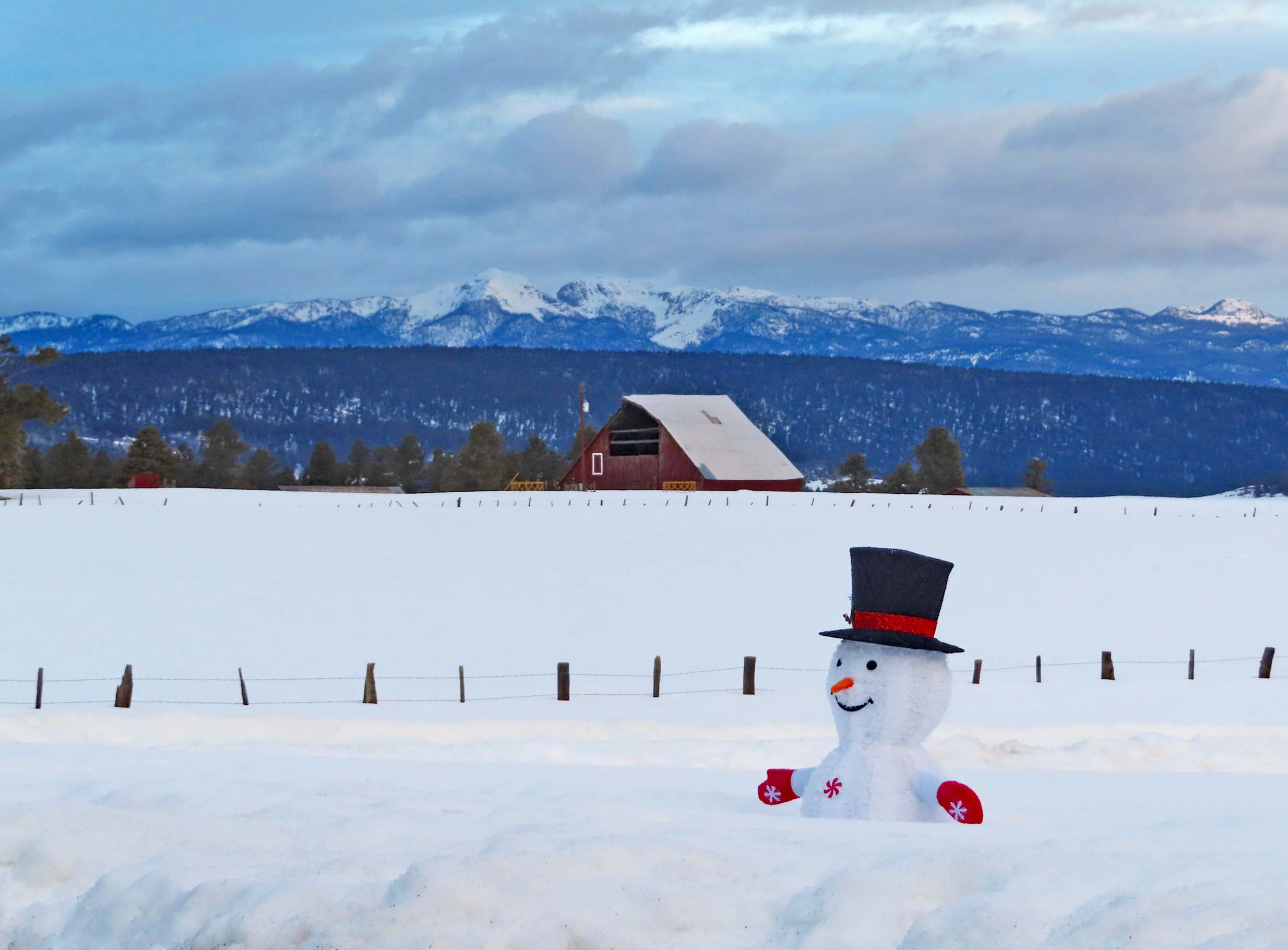
Frosty is looking for more snow – Pic taken 26 Feb 2024
If images fail to load in the email, please click the title of the post. Thanks!
Monday – 26 Feb 2024 – 10:00am
The past…
At Stevens Field the high temperature yesterday afternoon was 52 and the low this morning was 32.
The peak wind at Stevens Field yesterday afternoon was 29mph.
| Average High | Record High / Year | Average Low | Record Low / Year |
| 44 | 70 / 1986 | 10 | -21 / 1942 |
Precipitation summary… A few spotty showers moved through the area last night but hardly amounted to anything. A couple of folks in the valley reported 0.01” of precip. Wolf Creek had a trace of snow overnight.
Forecast discussion…
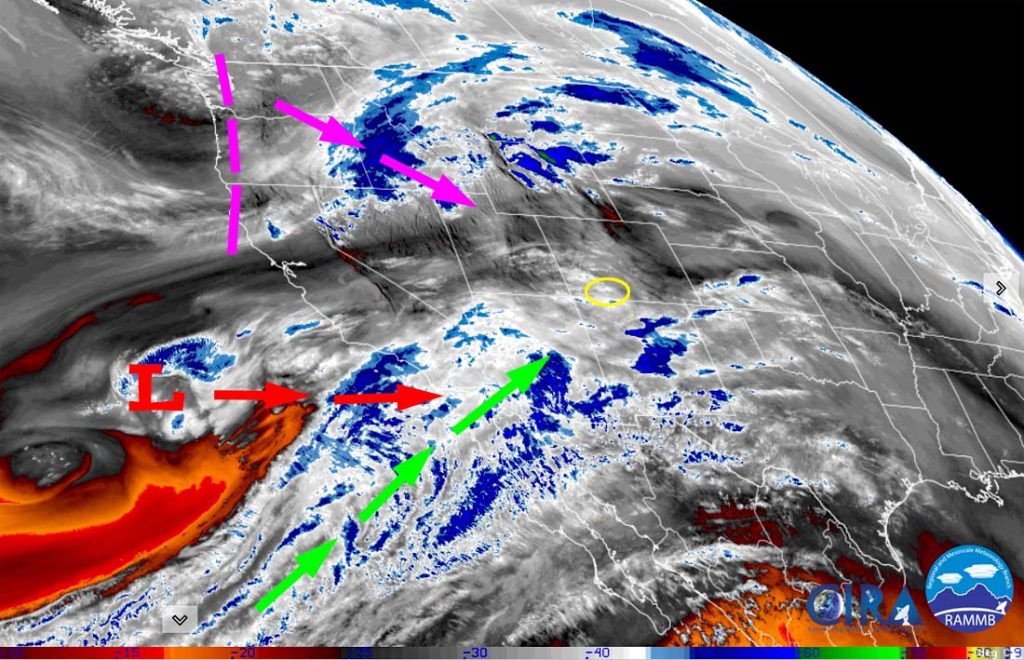

Forecast highlights…
*** A WINTER WEATHER ADVISORY has been issued for the eastern San Juan Mountains above 10,000ft for 4-8″ of snow and winds to 60mph valid until 5pm Monday. ***
*** A WINTER STORM WARNING has been issued for the eastern San Juan Mountains above 10,000ft for total accumulations of 1-3ft of snow and winds gusting to 85mph valid from 5pm Monday to 11pm Tuesday. ***
*** My concerns: 1. Strong winds and heavy wet snow could lead to spotty power outages Tuesday. 2. Occasional blizzard-like conditions are possible late Monday evening into early Tuesday afternoon, especially above 7,500ft. ***

Rest of Monday through Tuesday… Today a strong jet stream will continue to push warm air and moisture into the region. Tuesday a strong system with colder air will move through the region from the northwest.
Timing… Monday morning into early Monday evening scattered showers will stay mostly over the mountains. Brief periods of rain, snow, and graupel are possible in the valley. Late Monday evening into early Tuesday afternoon precip will fall the heaviest. Occasional thundersnow is also possible. Scattered showers will taper off quickly in the valley Tuesday afternoon but will linger over the mountains into Tuesday night.
Snow levels… Through Monday evening precip will be rain below 8,000ft and a rain/snow mix 8,000ft to 8,500ft. Monday night snow levels will gradually lower to around 7,200ft. Tuesday snow levels will bounce around between 6,500ft and 7,000ft. Temps will be above freezing so snow will struggle to accumulate. Graupel or small hail is possible with spotty showers and thunderstorms.
Snow amounts…
Valley below 7,900ft: 1-3”
Valley above 7,900ft: 3-7”
Mountains above 9,000ft: 18-24”
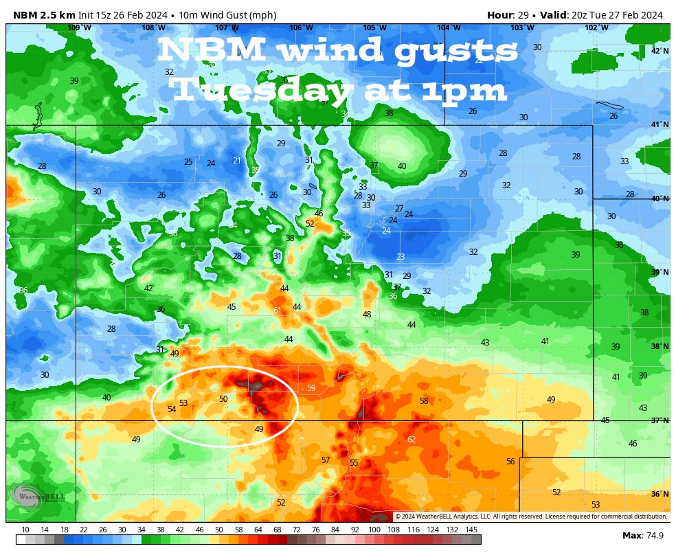
Winds… *** Gusts Monday afternoon to early Tuesday morning will be 30-35mph. Early Tuesday morning to Tuesday afternoon gusts will be 35-50mph. In the mountains winds will gust 60-80mph. ***
Temps… Highs Monday will be in the mid to high 40s and lows Monday night will be in the near 30 to mid-30s. Highs Tuesday will be in the mid to high 30s and lows Tuesday night will be near zero to the mid-teens.

Wednesday through Saturday afternoon… Ridging will build over the region and give us lots of sun. Temps Wednesday will be below average and then temps will be near average Thursday and Friday.
Clouds and winds will increase Saturday ahead of the next system.
Winds… Afternoon peaks Wednesday and Thursday will be 10-15mph. Friday afternoon winds will gust 15-20mph. Saturday afternoon winds will gust 20-30mph.
Temps… Highs Wednesday will be in the mid-30s to mid-40s and lows will Wednesday night will be in the mid-single digits to mid-teens. Highs Thursday, Friday, and Saturday will be in the mid-40s to low 50s. Lows Thursday night and Friday night will be in the low teens to low 20s. Lows Saturday night will be in the high teens to high 20s.
Good news… I’m tracking two more systems – one around 3-4 Mar and another around 8-9 Mar.
I’ll probably do a quick Facebook post first thing tomorrow morning and then a more thorough post later tomorrow morning.
– Shawn


One Response
Thank you Shawn for the consistently good information!! As a newcomer (7 years) to the Chromo Valley and the various winter sports, it has been very helpful to use your postings to navigate different activities. Including coming and going through Durango and Albuquerque airports as we travel.