

Susie scarecrow is happy about the snow! – Pic taken 12/1/2023
If images fail to load in the email, please click the title of the post. Thanks!
Saturday – 2 Dec 2023 – 11:00am
The past…
At Stevens Field the high temperature yesterday afternoon was 32. The low this morning was 11.
The peak wind at Stevens Field yesterday afternoon was 25mph.
| Average High | Record High / Year | Average Low | Record Low / Year |
| 44 | 63 / 1906 | 10 | -10 / 1913 |
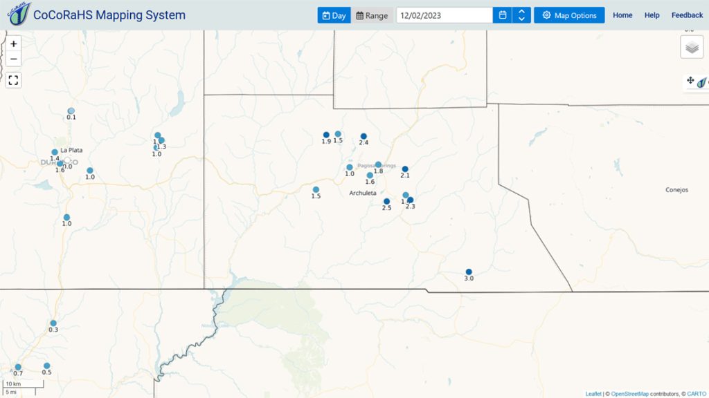
Precipitation summary… Wolf Creek reported another 12” of snow this morning for a storm total of 16”. Below are CoCoRaHS snowfall totals for the last 24 hours and 2-day storm totals.

Forecast discussion…

Forecast Highlights…
*** Warmer, sunny, and dry next week. ***
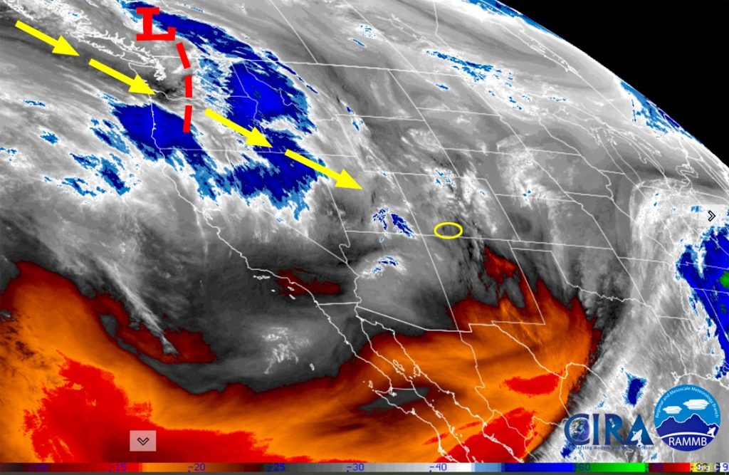
Rest of Saturday and Sunday… Moist northwest flow will stream into northern Cololorado, turning on the snow machine for the central and northern mountains, especially the Steamboat area. In our area, we’ll see spotty snow showers along and on the other side of The Divide, and over the south San Juans into Sunday morning.
Additional Snow amounts:
Pagosa area: a dusting in a few lucky spots
Chromo/Chama area: up to an inch closer to the mountains
Mountains: 1-3” with the south San Juans favored
Winds… Peak winds will be in the 20-25mph range on Saturday and then in the 15-20mph range on Sunday.
Temps… Highs Saturday will be in the high 20s to mid-30s and lows will be in the low single digits to low teens. Highs Sunday will be in the mid-30s to low 40s and lows will be 0 to 10.

Check out the Steamboat area: 12-18” in town and 3-4 feet in the Park Range!
Monday through Friday afternoon… The ridge will continue to build through Wednesday leading to lots of sun and a warming trend. We’ll see a few more clouds Friday as the ridge weakens and moves to our east, but we’ll stay dry and warm.
Winds… Afternoon peaks will be 10-15mph on Monday, and 5-10mph on Tuesday, Wednesday, and Thursday. Friday afternoon winds will peak in the 15-20mph range.
Temps… Monday highs will be in the low to high 40s and lows will be in the low teens to low 20s. Tuesday, Wednesday, Thursday, and Friday highs will be in the high 40s to mid-50s and lows will be in the mid-teens to mid-20s.

The next system?… The forecast models are hinting at another storm roughly Friday night to Sunday afternoon. Some forecast models indicate a decent storm while others think it will be weak or miss us. Let’s cheer for those models showing a decent storm!
My next forecast post will be Monday morning. And I hope to get the November Summary/December Outlook posted today. I’m still waiting for two products.
– Shawn


2 Responses
Hello Dave! That product is produced by the Grand Junction NWS when significant travel impacts are expected. I agree that it is a very helpful product and have provided them encouraging feedback. Let’s hope they provide it more often. Thanks for following Pagosa Weather!
A week or so ago your forecast included an NWS graphic showing snowfall amounts along US 160. Is that a regular NWS product? If so, could you provide the link to where NWS posts said graphic? We’re headed east for a bit on Monday and that corridor-specific forecast would be handy.
Thanks for your efforts!