
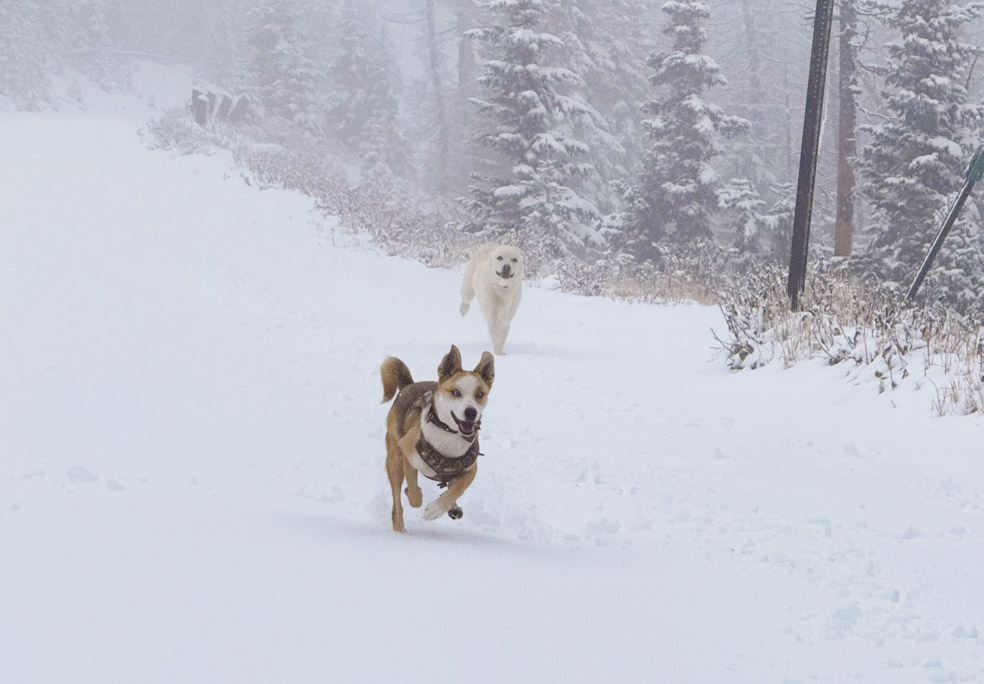
The pups love the snow! This at 11,400ft, above Wolf Creek Pass. There was 4-6” of snow to play in. Roads were slick! – Pic taken 10/14/2026
Wednesday – 14 Oct 2026 – 3:45pm
The past…
Stevens Field Observations
Monday: High: 59, Low: 45, Peak wind: 9mph
Tuesday: High: 54, Low: 43, Peak wind: 32mph
| Average High | Record High / Year | Average Low | Record Low / Year |
| 66 | 85 / 1940 | 26 | 13 / 1975 |
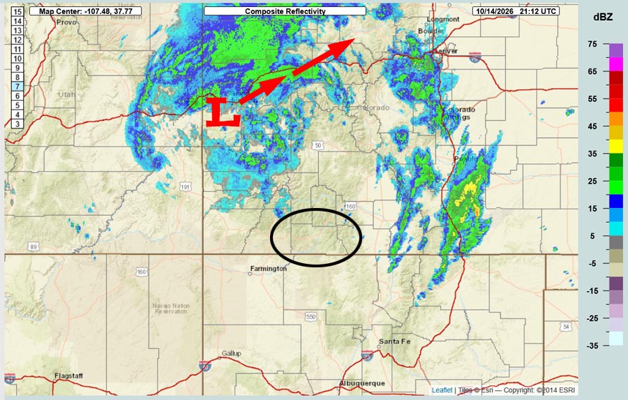
Precipitation summary… It’s been an impressive few days. Bands of heavy showers, hail, gusty winds, poor visibility, and lightning repeatedly moved through the county and gave us a good soaking.
CoCoRaHS 24-hour rain amounts reported Tuesday morning range from 0.21” to 0.52”.
CoCoRaHS 24-hour rain amounts reported Wednesday morning range from 0.64” to 1.50”.
Totals over the last 7 days range from 1.28” to 2.77”.
Current satellite, radar, and river levels…


Forecast highlights…
*** The storm is about over! ***
*** Patchy fog and poor visibility is possible tonight. ***
*** A HARD FREEZE is likely Wednesday night and Thursday night. Temps will be below freezing each morning the rest of the week. ***
*** Lots of sun and mostly dry Thursday through Monday. ***
*** Another round of valley rain and mountain snow is possible late next Tuesday into Friday (20-23 Oct). ***
Rest of Wednesday… The low will slide farther to our north. A few scattered snowshowers will fall over the mountains. Another inch of snow is possible in the mountains, but it will be spotty.
Clouds will clear out overnight and patchy fog will develop.
Thursday through Monday… We will be between a ridge to our north and a cutoff low spinning over the Baja Peninsula. Most of this period will be dry and sunny, but there is a slight chance for a spotty afternoon shower, late Sunday afternoon and again Monday afternoon.
Snow levels will bounce between 9,000ft and 10,500ft. Wolf Creek Pass could get a few fast-moving snowshowers, but accumulations will be minimal.
Tuesday through next Friday… I’m tracking the next storm. There is still a lot of uncertainty.
Snow levels start 11,000ft to 11,500ft and then drop to 9,500ft on Thursday.
*** I don’t trust the models enough to forecast snow amounts. I will make adjustments and get more specific as the data gets better. ***
Temps…
Wednesday night lows will be in the *** mid 20s to the low 30s ***.
Thursday highs will be in the mid 50s to near 60 and *** lows will be in the mid 20s to the low 30s. ***
Friday through Monday highs will be in the high 50s to the mid 60s and lows will be in the high 20s to the high 30s.
Tuesday and next Wednesday highs will be in the mid 50s to the low 60s and lows will be in the low to high 40s.
Winds…
Thursday late afternoon and evening, gusts will be around 30mph.
Friday through next Wednesday, each afternoon gusts will be 15-20mph.
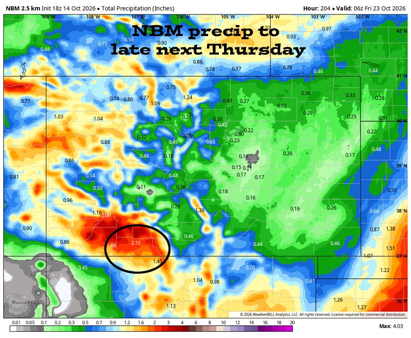
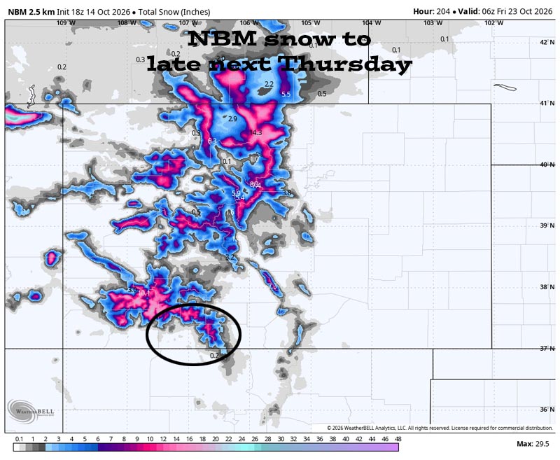
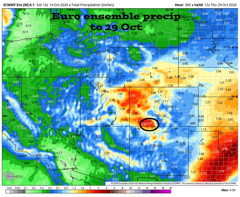
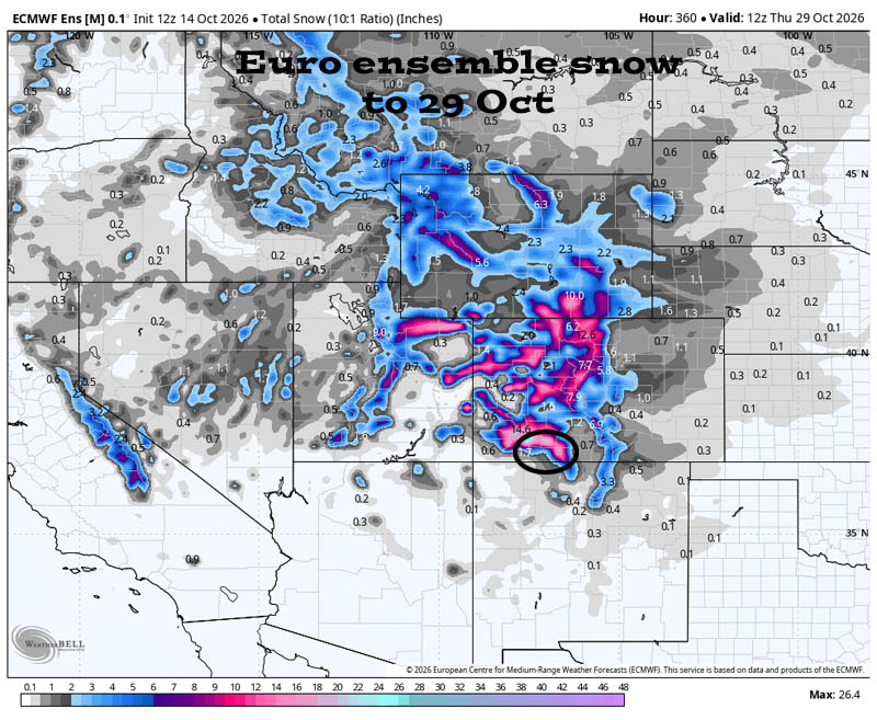
21 Oct to 29 Oct… Another storm is taking shape 20-23 Oct. And then some models keep the pattern active while other models show a ridge over the west US and an inactive pattern. I’m cheering for active!
The next post will be on Friday.
– Shawn


