
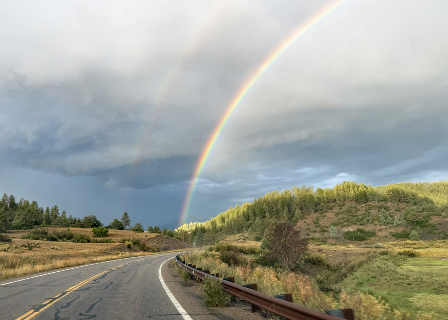
We were treated to some beautiful rainbows along Highway 84 Sunday evening. – pic taken 9/13/2026 by Arleen
Monday – 14 Sep 2026 – 5:30pm
The past…
Stevens Field Observations
Saturday: High: 83, Low: 45, Peak wind: 25mph, Afternoon humidity: 22-27%
Sunday: High: 83, Low: 46, Peak wind: 31mph, Afternoon humidity: 20-25%
| Average High | Record High / Year | Average Low | Record Low / Year |
| 74 | 92 / 1990 | 37 | 24 / 1950 |
Precipitation summary… We are finally getting rain! On Sunday, much of the county got 0.20” to 0.35” and a few lucky spots got nearly a half inch.


Current satellite and radar…
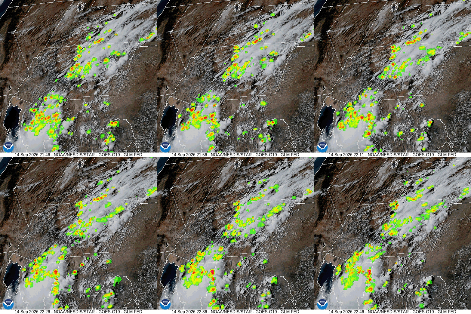
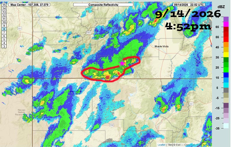
The Swiss Roll Fire area had a burst of heavy rain Monday afternoon.
There was a FUNNEL CLOUD reported out of a cell south of Bayfield around 3pm.
Forecast highlights…
*** We haven’t received enough rain yet to lift fire restrictions. The San Juan National Forest and Archuleta County are under stage 1 fire restrictions. ***
*** The Swiss Roll Fire, burning about 14 miles northwest of Pagosa Springs, is 777 acres. The fire has received rain over the last couple of days. ***
*** An active weather pattern through Friday. Hit and miss storms will be capable of short periods of heavy rain, small hail, gusty winds, and lightning. ***
*** Things line up best Wednesday and Thursday. Total precip amounts for this period could approach 2”. Minor flooding along small streams and low-lying areas is possible. I do not expect the San Juan or Piedra rivers to get anywhere near flood stage. ***
*** How about mountain snow? Snow levels will be 13,000 to 14,000ft for most of this event. Strong showers or thunderstorms could temporarily drop it down to 12,000ft so a brief dusting is possible above timberline. We are more likely to see hail than snow on our mountains. ***
*** Saturday through next Monday will be less active but there’s still a chance for a few scattered storms each day. ***
Rest of Monday through Friday… We will be in the sweet spot between a trough impacting the Pacific NW and the high wobbling between the southern plains and the southeast US.
Upper-level flow out of the southwest will draw monsoon moisture back into the Four Corners area. Precipitable water, the amount of moisture available for precip, will be around 200% for much of this period.
Abundant moisture plus an unstable atmosphere plus orographic lift will result in a wet weather pattern.
*** Things line up best Wednesday and Thursday. Total precip amounts for this period could approach 2”. Minor flooding along small streams and low-lying areas is possible. I do not expect the San Juan or Piedra rivers to get anywhere near flood stage. ***
*** Each morning fog and low clouds are possible. ***
Summary:
Tuesday will be less active but there will still be hit and miss showers and thunderstorms.
Wednesday and Thursday will be soakers with potential for minor flooding.
Friday will be less active but there will still be hit and miss showers and thunderstorms.
Saturday through next weekend… Upper-level flow will turn more westerly and push much of the moisture to our east. It will be marginally unstable so there’s a chance for a few scattered afternoon and evening storms.
Temps…
Monday night lows will in the mid 40s to the mid 50s.
Tuesday highs will be near 70 to the mid 70s and lows will be in the mid 40s to the mid 50s.
Wednesday through Friday, each day highs will be in the mid 60s to the low 70s. Wednesday and Thursday lows will be in the mid 40s to the low 50s. Friday lows will be in the high 30s to the mid 40s.
Saturday through next Monday, each day highs will be near 70 to the mid 70s and lows will be in the high 30s to the mid 40s.
Winds…
Each afternoon gusts will be around 20mph.
*** As always, isolated stronger gusts are likely near showers and thunderstorms. ***
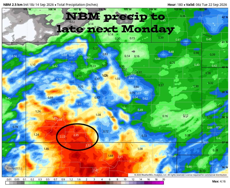
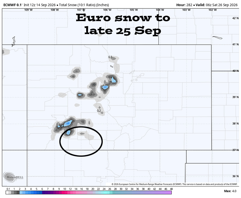
21 Sep to 29 Sep… The forecast models agree it will remain active. The question is how active? I don’t see anything significant on the horizon, but there will be a chance for a few rounds of scattered showers and thunderstorms.
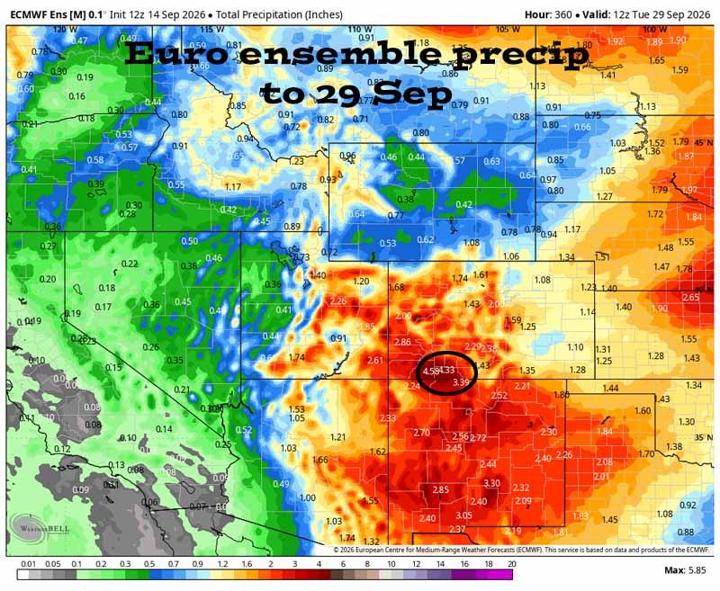

It’s wet late through Friday. There’s a lull with less activity and more hit and miss storms Saturday through next Monday. It gets more active again next Tuesday into the following weekend, and then it wants to dry out.
The next post will be on Wednesday. Keep an eye on Facebook for quick posts.
– Shawn


