
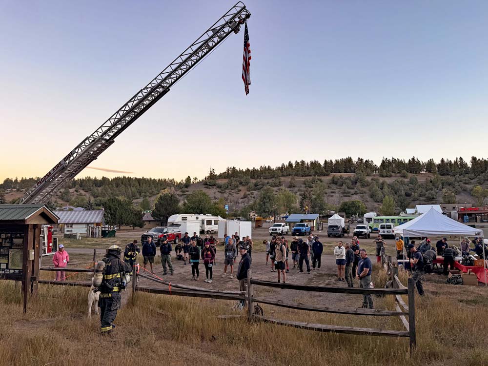
Thanks to the Pagosa Fire Department for sponsoring the Res Hill Ruck March in remembrance of 911 – pic taken 9/11/2026
Saturday – 12 Sep 2026 – 4:45pm
The past…
Stevens Field Observations
Wednesday: High: 85, Low: 45, Peak wind: 26mph, Afternoon humidity: 11-16%
Thursday: High: 83, Low: 42, Peak wind: 20mph, Afternoon humidity: 7-12%
Friday: High: 83, Low: 38, Peak wind: 29mph, Afternoon humidity: 9-14%
| Average High | Record High / Year | Average Low | Record Low / Year |
| 74 | 90 / 1945 | 39 | 28 / 1957 |
Precipitation summary… It has been dry until Saturday afternoon. A few lucky folks will have something to report tomorrow morning!
Current satellite, radar, and the Swiss Roll Fire…
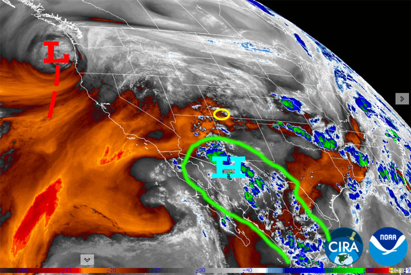
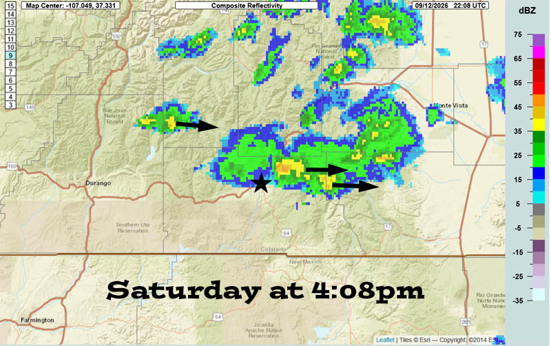
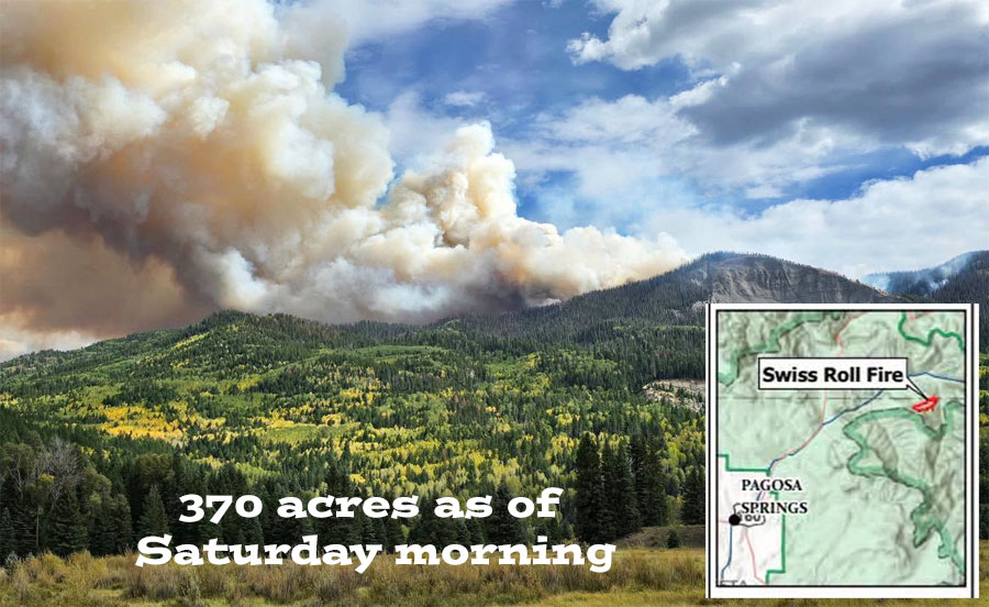
After hardly any growth for 3 weeks, yesterday the ingredients came together for the fire to grow to 370 acres. The fire is in a rugged area and not threatening personal property.
A wet weather pattern Sunday night through Thursday should prevent much additional growth.
Forecast highlights…
*** It has been dry and warm with breezy afternoons. The San Juan National Forest and Archuleta County are under stage 1 fire restrictions. ***
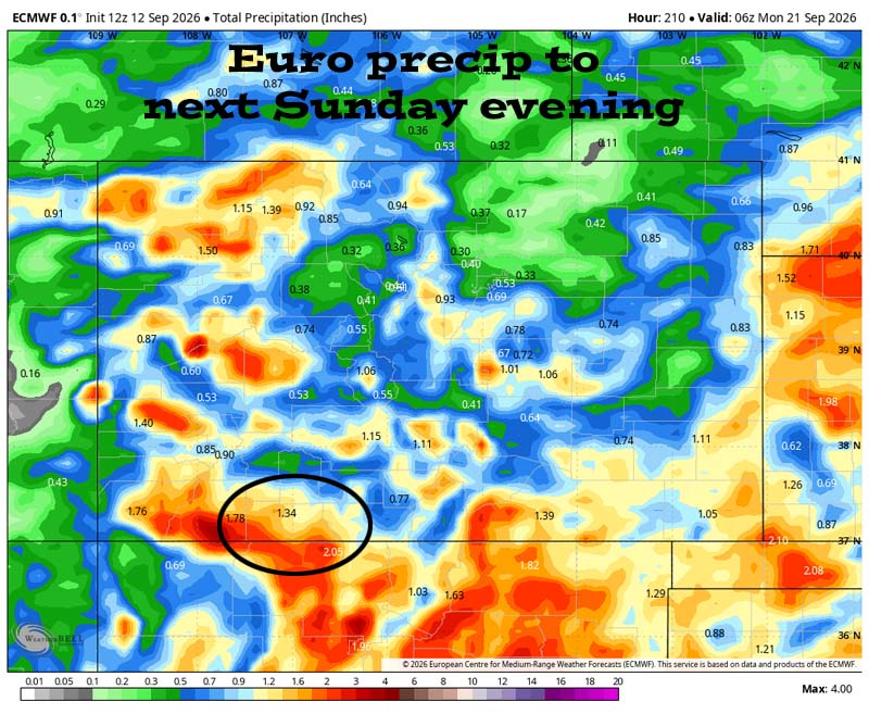
*** Late Sunday through Thursday will be wet with scattered storms each day. Storms will be capable of short periods of heavy rain, small hail, gusty winds, and lightning. ***
*** Friday through next weekend will be less active but there’s still a chance for a few scattered storms each day. ***
Rest of Saturday moisture and instability are gradually increasing. There will be a spotty storm or two. Storms will move west to east.
Sunday through Thursday… We will be in the sweet spot between a trough impacting the Pacific NW and the high wobbling between the southern plains and the southeast US.
Upper-level flow out of the southwest will draw monsoon moisture back into the Four Corners area. Precipitable water, the amount of moisture available for precip, will be around 200% for much of this period.
Abundant moisture plus an unstable atmosphere plus orographic lift will result in a wet weather pattern.
Albuquerque NWS summed it up nicely:
“PWATs will continue to climb from Monday through Thursday, challenging daily record values as the upper high sets up over TN/AL/MS and troughing along the west coast allows for a Monsoon moisture plume to stand up over the region. This will be an increasingly wet period, with daytime temps trending down, PoPs trending up and an increasing threat for locally heavy rainfall and localized flash flooding.”
PoPs = probability of precip
PWATs = precipitable water
Friday through next weekend… Upper-level flow will turn more westerly and push of the moisture to our east. It will be marginally unstable so there’s a chance for a few spotty afternoon and evening storms.
Temps…
Saturday night lows will be near 40 to the high 40s.
Sunday highs will be in the mid 70s to the low 80s and lows will be in the low to high 40s.
Monday through Thursday, each day highs will be near 70 to the high 70s and lows will be in the mid 40s to the low 50s.
Friday through next weekend, each day highs will be in the low to high 70s and lows will be near 40 to the high 40s.
Winds…
Sunday and Monday, each afternoon gusts will be around 25mph.
Tuesday through next weekend, each afternoon gusts will be around 20mph.
*** As always, isolated stronger gusts are likely near showers and thunderstorms. ***
19 Sep to 27 Sep… The forecast models are all over the place, so I don’t trust them. I see potential for the pattern to stay active, but there is nothing significant on the horizon.
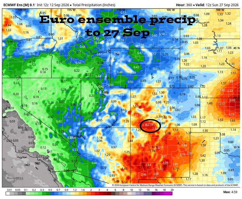
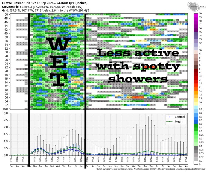
It’s wet late Sunday through Thursday. There’s a lot of uncertainty the rest of the period. I don’t see anything significant but spotty showers are possible.
The next post will be on Monday.
– Shawn


