
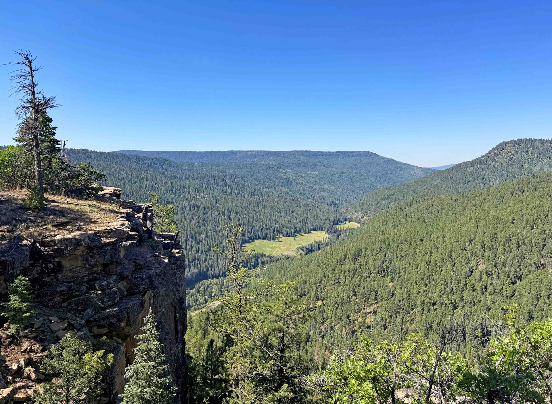
Wonderful views of Piedra River Trail from Ice Cave Ridge & Sally’s Overlook – pic taken 6/23/2026
Wednesday – 24 Jun 2026 – 9:00pm
With lightning from thunderstorms, wild fires are possible.
The past…
Stevens Field Observations
Tuesday: High: 87, Low: 39, Peak wind: 29mph, Afternoon humidity: 9-16%
Wednesday: High: 81, Low: 43, Peak wind: 38mph, Afternoon humidity: 16-30%
| Average High | Record High / Year | Average Low | Record Low / Year |
| 82 | 92 / 1990 | 38 | 26 / 1951 |
Precipitation summary… A few sprinkles this afternoon. .01″ was reported near the Piedra River Bridge. Intermittent lightning in the mountains between us and Creede. A reliable report from Southwest Hinsdale county said they had rain for about an hour and a half.
Current satellite and radar…

Water vapor satellite Wednesday afternoon – Green arrows indicate moisture flow. The gradient is getting “pinched” between the low to our north and the high to our south and causing gusty winds. An upper level trough is bringing instability and upper level cold temps. We’ve had thunderstorms north of us all afternoon. The big green and blue blobs are large thunderstorms.

Forecast highlights…
*** Wednesday, Thursday, and Friday afternoons: chance for showers and thunderstorms. Low rain amounts. Potential for lightning fires. ***
***Saturday & Sunday: Very Strong afternoon gusts! Gusts to 60mph in the high country on Saturday!***
***Fire Weather Watch for gusty winds, low relative humidity and dry fuels, which is in effect from Saturday morning through Saturday evening.***
Wednesday afternoon through Friday evening… An area of low pressure has sunk off the west coast setting up southwest flow advecting moisture and energy into our area with a few upper level disturbances. We’ll be Partly Cloudy becoming Mostly Cloudy each afternoon.
A little moisture and instability will kick up a few scattered showers and thunderstorms each afternoon. Precip amounts will be low and spotty on Wednesday & Thursday. Some areas will only see Virga which combined with dry air at the surface will result in erratic gusty winds at the surface. All models have shown an upward tick for Friday as the trough kicks through.
*** Fire danger will remain high and lightning fires are possible. ***
Temps… Wednesday High: Highs will be in the Lo 80s. Thursday & Friday: “Cooler” Mid 70s to the Lo 80s. Lows: Lo 40s to upper 40s.
Winds…Afternoon gusts will be 25-30mph. Expect erratic higher potential gusts near thunderstorms.
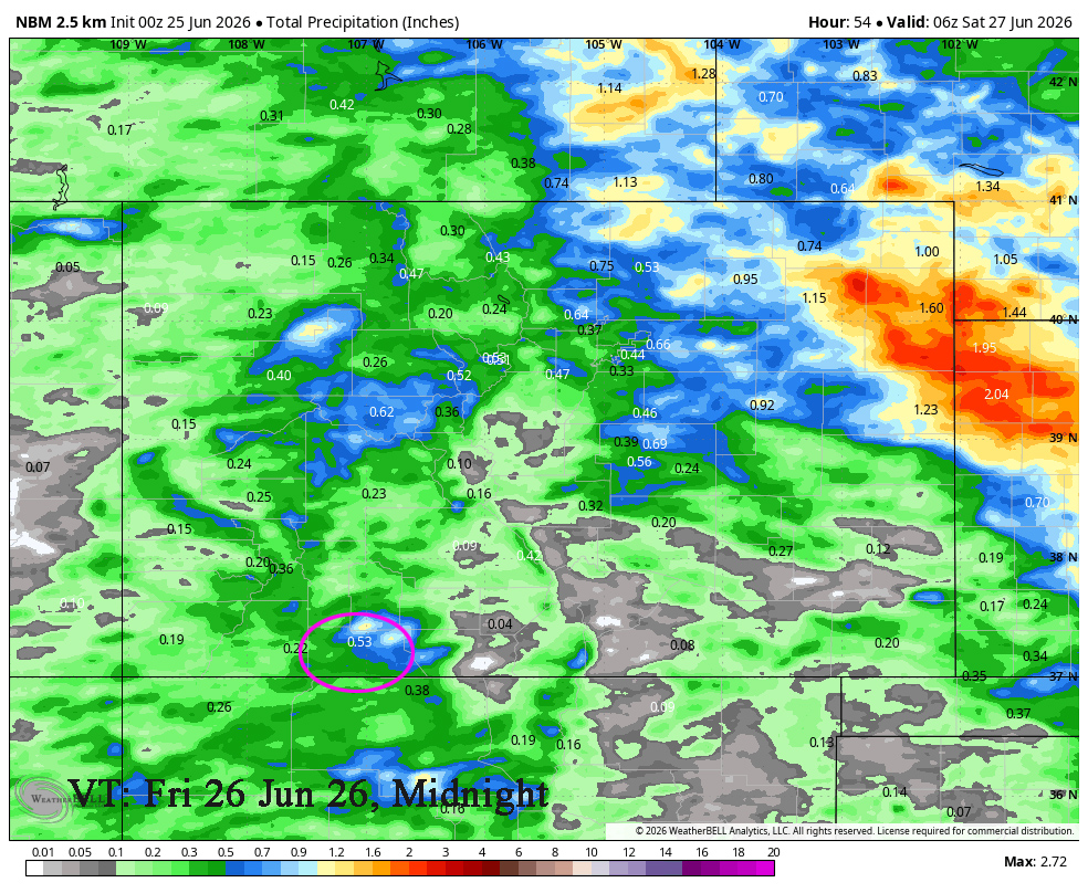
Saturday & Sunday… Squeeze play… As the area low-pressure system exits into Montana and then Canada, it will deepen as the area of high pressure to the southeast builds bring us a tightening gradient and strong, dry flow out of the southwest. Clear to Partly Cloudy. Humidity in the low to mid teens and wind gusting 35-45mph will lead to CRITICAL FIRE CONDITIONS.
Temps… Highs: Mid 70s to Mid-80s. Lows: Low 40s to upper 40s.
Winds… Very Strong afternoon gusts! Winds on Saturday from late morning till late evening will gust to 45mph! Winds on Sunday could gust to 40mph. Note: Gusts to 60mph in the high country on Saturday and 50mph on Sunday.
Monday and Tuesday … We’ll be clear to partly cloudy. We’ll still be under the squeeze play though the gradient will be looser. High pressure will be to our southeast and the long-wave trough will be set up over the Great Basin. Upper-level flow will be out of the southwest though it will be dry. It will remain sunny, dry, and warm with gusty afternoon winds.
Temps… Highs will be in the mid 70s to the lo 80s and lows will be near 40 to the upper 40s.
Winds… Afternoon gusts will be 25-30mph.
01 Jul to 9 Jul… The subtropical high will start over the southern plains (ideal monsoon position) on the July 1st and then slowly shift towards eastern Colorado. We’ll be dry till 2nd or 3rd of July and then see a slow increase of moisture and instability as the monsoon tries to set up.

Monsoon Update for Monsoon Appearance date – How is it setting up?
- Intense Heating
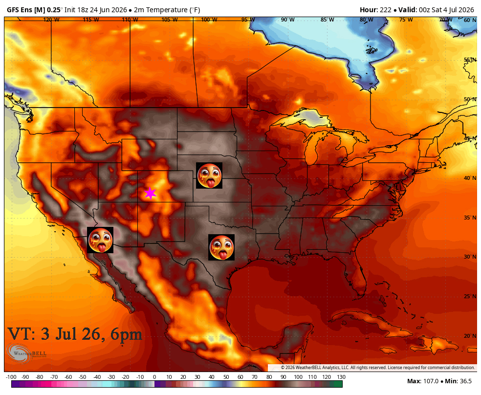
- Strong 500 millibar (mb) ridge

- Position of the Ridge
The ridge will be to our east. We want it to our east to set up southwest flow as opposed to northwest flow if it should slip to our west.
- High Surface Dew Points

This all looks good. I’ll continue to monitor the models closely. We have been forecasting a decent monsoon and it looks to be setting up.
My next post will be on Friday.
– Arleen


