

Watching the clouds build over Toner mountain this morning. They grew from fair weather cumulus at 10am to black bottomed beauties by noon – sign of an unstable environment. (select title of post to see picture)
Friday – 26 Jun 2026 – 7:15pm
Red Flag Warning is out for tomorrow from 10am to midnight.
The past…
Stevens Field Observations
Thursday: High: 80, Low: 46, Peak wind: 30mph, Afternoon humidity: 18-30%
Friday: High: 79, Low: 43, Peak wind: 28mph, Afternoon humidity: 27-60%
| Average High | Record High / Year | Average Low | Record Low / Year |
| 81 | 94 / 1990 | 39 | 22 / 1951 |
Precipitation summary… We had a few thunderstorms with just light showers Wednesday afternoon.
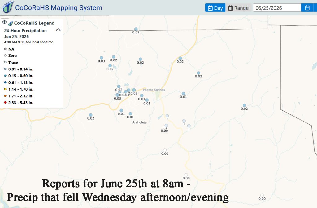
There was only one report this morning for .03″ from San Juan River Village for precip from yesterday, Thursday evening.
I am looking forward to tomorrow’s CoCoRaHS reports. We have had a number of thunderstorms with moderate rainshowers at times, small hail, and gusty winds moving through the area. As of 5:00pm we had .43″. I saw a report in Hatcher of .55″.
Current satellite and radar…


Thunderstorms & Rainshowers are moving from the southwest to the northeast. Most showers have exited the area. Expect a round 2 from 11pm to 2 am.

Forecast highlights…
*** Friday afternoon: Thunderstorms with moderate rain at times, frequent lightning, small hail, gusty winds. Potential for lightning fires. Second Round 11pm-2am. ***
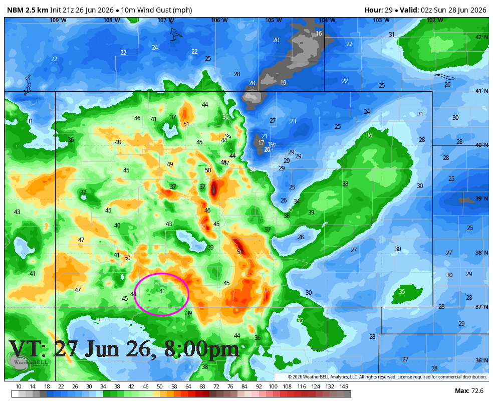
***Saturday & Sunday: Very Strong afternoon gusts! Gusts to 55mph in the high country on Saturday!***
***Red Flag Warning for gusty winds, low relative humidity and dry fuels, which is in effect from Saturday morning through Saturday evening.***
Friday evening… Long wave trough with a prefrontal trough and frontal system is set up over Great Basin area. The prefrontal trough pushed into our area this afternoon resulting in southwest flow and advected moisture and energy into our area. We’ll be mostly cloudy occasionally partly cloudy, between the prefrontal trough and the front, for the rest of the day.
In the afternoon we had Thunderstorms with moderate rain at times, frequent lightning, small hail, gusty winds. Potential for lightning fires. We’ll see a break after 7pm and then a second round will move in from ~ 11pm to 2am ahead of the front. It will be mostly thunderstorms with light rain.
Temps… Highs: Upper 70s. Lows: Lo 40s to upper 40s. Our temperature dropped from 78 to 55 with the first round of showers. Cool!
Winds…Afternoon gusts will be 25-30mph. Expect erratic higher potential gusts near thunderstorms.

Saturday & Sunday… Squeeze play… As the area low-pressure system exits into Montana and then Canada, it will deepen as the area of high pressure to the southeast builds resulting in a tightening gradient and strong, dry flow out of the southwest.
Clear to Partly Cloudy. Dry air will move in behind the front. Humidity in the mid teens and wind gusting 30-40mph will lead to CRITICAL FIRE CONDITIONS.
***RED FLAG WARNING 10am to midnight!!! It has already been issued for low humidities, gusty winds, and dry fuels. Fires will catch and spread quickly. ***
Temps… Highs: Mid 70s to Lo-80s. Lows: Low 40s to upper 40s.
Winds… Very Strong afternoon gusts! Winds on both Saturday and Sunday from late morning till late evening will gust to 40mph! Note: Gusts to 55mph in the high country on Saturday and 50mph on Sunday.
Monday through Thursday (Jun 29 – Jul 2)… We’ll be clear to partly cloudy. We’ll still be under the squeeze play though the gradient will be looser. High pressure will be to our southeast and the long-wave trough will be set up over the Great Basin. Upper-level flow will be out of the southwest though it will be dry. It will remain sunny, dry, and warm with gusty afternoon winds.
Temps… Highs Monday though Wednesday will be Lo 70s to lo 80s Thursday will be the warm day of the week with a high of mid 70s to mid 80s. This front will let a little cool air spill into the area. Lows will be near 40 to the upper 40s.
Winds… Monday will be the breeziest with afternoon gusts to 30mph. Tuesday through Thursday will breezy with afternoon gusts to 25mph.
03 Jul to 11 Jul… The subtropical high will start over the southern plains (ideal monsoon position) on the July 1st and then slowly shift towards eastern Colorado. We’ll be dry till 4th or 5th of July and then see a slow increase of moisture and instability as the monsoon tries to set up.

- My next post will be Sunday unless there is an urgent update tomorrow.
– Arleen


